Once known primarily for its powerful Automated Mapping and Facilities Mapping software, Intergraph provides geospatial solutions primarily in security, government, and infrastructure industries:
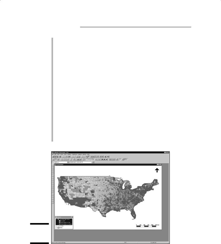
Product line: Intergraph’s premier GIS software package is called GeoMedia Professional, a vector-based GIS product (see Figure 21-4). Many special-purpose modules include GeoMedia Terrain for working with surfaces, Grid for raster modeling, Image for working with scanned imagery or satellite data, and WebMap Professional for presenting maps online, in addition to data server and other products.
Major capabilities of the software include
•Queries
•Buffer zones
•Thematic mapping
•Spatial and arithmetic functions
322 Part VI: The Part of Tens
•What-if scenario building
•Web-based map visualization
•On-the-fly map projections
Training opportunities: Intergraph offers hands-on training at its facilities, at your facility, and at its annual conference. The company has
a Registered Research Laboratory program that universities can use, and Intergraph increasingly encourages academic use of its software by providing it free for use in classes. A 52-week license of GeoMedia Professional is available for students to use at home.
Other services: Intergraph has a long tradition of fitting its product line to your particular solution. Even the Web site (at www.intergraph. com) is solution-driven, rather than product-driven. You can find consulting, design, and implementation services on Intergraph’s Web site, as well as technical support for its product line.
Platform: Intergraph’s software works on a Microsoft Windows operating system (XP or Vista).
Contact information: Intergraph Corporation, P.O. Box 240000, Huntsville, AL 35813; or 170 Graphics Dr., Madison, AL 35758. Phone: 256-730-2000 or 800-345-4856. Fax: 256-730-2048. Web: www.intergraph. com (you can find an e-mail contact form on the Web site).
Figure 21-4:
GeoMedia
Professional.
Chapter 21: Ten GIS Software Vendors 323
Clark Laboratories
The laboratories of Clark University have a powerful but inexpensive package called IDRISI that performs both GIS and remote sensing image processing tasks. Its current incarnation is called IDRISI Andes.
Product line: IDRISI is the core product available from Clark Laboratories, but a recent parallel product called Land Change Modeler provides additional functionality and works in tandem with the ESRI ArcGIS product. Some of these Clark Laboratories products’ prominent features include
•Land-change modeling
•Time series analysis
•Image processing
•Image classification
•Neural networks
•Decision support
•2D and 3D visualization
•Surface analysis
•Spatial statistics
Training opportunities: Comprehensive tutorials are included with the software. University faculty often use IDRISI tutorials as a teaching tool for both GIS and remote sensing courses because of ease of use and price. Clark Laboratories offers academic pricing at 50 percent of retail cost, as well as $95 student licenses.
Other services: Clark Laboratories provides technical assistance for software installation, operation, data compatibility, and selection of solution-specific modules. Although it interacts with agencies to perform analyses with its products, it is not focused on consulting.
Platforms: IDRISI employs the Microsoft Windows platform.
Contact information: Clark Labs, Clark University, 950 Main St., Worcester, MA 01610-1477. Phone: 508-793-7526. Fax: 508-793-8842. E-mail: idrisi@clark.edu. Web: www.clarklabs.org.
324 Part VI: The Part of Tens
Autodesk, Inc.
Best known for its computer-aided drafting (CAD) software, AutoCAD, Autodesk now sells a line of geospatial products that are designed to act as a bridge between CAD and GIS:
Product line: Autodesk’s primary geospatial product line is called, not surprisingly, Autodesk Geospatial. It consists of a number of component products. AutoCAD Map3D is designed to streamline the geospatial data input and management tasks. Other component products assist in online data sharing and team collaboration, incorporation of scanned imagery, data conversion, coordinate geometry, and other management tasks.
Training opportunities: Autodesk has several authorized training centers that deliver instructor-led software training. You can also find a line of training manuals available from the company. These manuals come in three types: Autodesk official training courseware (AOTC) used in the training centers, Autodesk official certification courseware for those who want to become certified to teach Autodesk’s software, and Autodesk authorized training courseware produced by Autodesk partners. The courses come in four levels: essentials, transition, advanced, and solutions.
Other services: Autodesk provides technical support and offers consulting services. Consulting mostly focuses on the use of the existing products, rather than one-of-a-kind application development.
Platforms: AutoCAD Map 3D and associated products require the Microsoft Windows operating system. Autodesk offers Web-based tools for UNIX, Windows, and Mac operating systems.
Contact information: Autodesk, Inc., 111 McInnis Pkwy., San Rafael, CA 94903. Phone: 415-507-5000. Fax: 415-507-5100. Web: http://usa. autodesk.com (you can find an e-mail contact form on the Web site).
GE Smallworld
Smallworld, once its own company, is now part of General Electric Energy Corporation and provides a suite of geospatial tools to support communications, utility, and public systems organizations:
Product line: The core product for GE Smallworld is called the Core Spatial Technology product suite. It enables encapsulated, reusable components for rapid development and reduced custom code generation. Strong features of the software are its scalable architecture and seamless open data access.
Chapter 21: Ten GIS Software Vendors 325
Smallworld’s software capabilities include
•Data access and integration
•Thematic mapping and visualization
•Sketching and measurement
•Querying
•A complete set of spatial analysis tools (network, buffering, polygon, cluster, and proximity analysis)
Training opportunities: GE Energy offers courses for engineers, developers, and administrators who use GE’s suite of products at its corporate sites. You can schedule additional locations, times, and courses if sufficient demand exists; you can even hold these classes at your own organization’s location.
Other services: As part of a larger corporation, Smallworld provides consulting, installation, and customization of its product line, as well as product technical support.
Platform: UNIX and Microsoft Windows.
Contact information: GE Energy, 2000 S. Colorado Blvd., Ste. 2-1100, Denver, CO 80222. Phone: 303-779-6980. Fax 303-779-1051. Web: www.gepower.com (use the e-mail contact form on the Web site to send a message).
PCI Geomatics
A full-service geospatial company, PCI Geomatics incorporates remote sensing, GIS, photogrammetry (the science of exact measurement of features
on aerial photography), and cartography. Originally focused on analyzing remotely sensed images, its new product line offers many opportunities for geospatial analysis and display:
Product line: PCI’s core product, Geomatica, now at version 10, is a desktop product that has both raster and vector capabilities, and boasts support for more than 100 spatial data formats:
•Geometric correction of imagery
•Projection and re-projection
•Data visualization
•Image classification
•Robust geospatial analytics
•Photogrammetric functions
•Cartographic production
326 Part VI: The Part of Tens
Training opportunities: Besides an included set of tutorials, PCI offers on-site or customized training sessions. These sessions can be tailored to meet specific needs.
Other services: PCI provides on-call technical support by phone or e-mail, software updates, data resources (including a line of data-han- dling tools), and a discussion forum. It also has an extensive list of white papers and articles that describe various applications of its software.
Platform: A desktop Microsoft Windows environment.
The motto at Leica is “Powering Geospatial Imaging.” This motto reflects its original focus on digital image processing software. Over the years, Leica has grown to incorporate a robust raster-based GIS suite, as well as a suite of photogrammetry tools:
Product line: The primary product, ERDAS IMAGINE, provides a wide array of tools for geospatial analysis:
•Import/export
•Data preparation
•Map composition
•Image enhancement
•Image classification, including sub-pixel classification
•Raster GIS modeling
•Stereo analysis
•Batch processing
Training opportunities: Leica offers a full suite of training opportunities, including corporate classroom training at its corporate headquarters, on-site training, and Webinars. Leica also offers a free demo version of its software for potential clients.
Other services: Primarily a software vendor, Leica provides technical support via e-mail and the Internet.
Platform: A desktop Microsoft Windows environment.
Bentley Systems is a leading provider of solutions to assist engineers, architects, contractors, governments, institutions, utilities, and private owners with designing, building, and operating infrastructures (including buildings, bridges, and utilities). One major tool for mapping, planning, and designing these solutions is its GIS software.
Product line: Microstation GeoOutlook is a spatial decision support system for mapping and GIS analysis. It has tools that can provide data visualization, map measurement, dimensioning, database access, and plotting. Other major features include
•Data collection
•Data editing
•Cleanup and analysis tools
•Integrated engineering and mapping on a single platform
Training opportunities: Bentley offers online educational materials and classroom training at its locations worldwide. Bentley also offers account-specific training at your location.
Other services: The Bentley Institute provides consulting services. The company also offers services for integration and software implementation. The Managed Solutions branch provides software-plus-services packages for clients.
Platform: A desktop Microsoft Windows environment.
Contact information: Bentley Corporation, 685 Stockton Dr., Exton, PA 19341. Phone: 800-236-8539. Outside the U.S.: 610-458-5000. Web: www. bentley.com.
GRASS GIS
Originally developed by U.S. Army Construction Engineering Research Laboratories, GRASS (Geographic Resource Analysis Support System) remains the most powerful and possibly the most common open source GIS package on the market. Reflecting its natural-resources–analysis roots, this package contains both GIS and remote sensing image processing capabilities:
Product line: GRASS is a single product, with many modules. It is has both raster and vector data models. Its major capabilities and features include
•2D raster analysis and 3D volume management
•2D and 3D vector models with SQL DBMS capabilities
328 Part VI: The Part of Tens
•Image processing
•Network analysis and referencing
•Visualization in both two and three dimensions
•Batch processing
•Standard raster and vector data format interoperability
Training opportunities: Because GRASS is open source software, no one offers formal training — but you can access a large user community that can readily provide help.
Other services: The Open Source Geospatial Foundation’s own mission statement says it all — its purpose is to “support the development of open source geospatial software, and promote its widespread use.” It doesn’t provide consulting services or technical support.
Platform: GRASS is a multi-platform software solution. It operates on computers running Unix, Microsoft Windows, or Mac OS X.
Contact information: Open Source Geospatial Foundation, 14525 S.W. Millikan, #42523, Beaverton, OR 97005-2343. Phone: 250-277-1621. E-mail: tmitchell@osgeo.org. Web: www.osgeo.org.
Chapter 22
Ten Questions to Ask
Potential Vendors
In This Chapter
Identifying the right vendor for your needs
Understanding the products and services that vendors provide
Finding a vendor that meets — and even exceeds — your needs is critical to ensuring your success when working with GIS. In order to find that
vendor, you need to know what questions to ask. This chapter provides a good starting point for your decision-making process. Whatever you do, don’t rush your decision.
What Services Do You Offer?
Your first questions for a vendor should be based on your needs. Figure out what you require for output (called Spatial Information Products). Your
output requirements give you an idea of the software capabilities, data structures (for example, raster or vector), and analytical capabilities that you need. Also, determine what, beyond the software, you’ll need from the company. Do you need consulting, implementation and setup, training, complete solutions, individualized services, or data?
Ask yourself what you currently use the GIS for in your organization so you can be sure the software meets those immediate needs.
330 Part VI: The Part of Tens
Can You Show How Your Product
Will Meet My Needs?
Among the most powerful methods of evaluating the utility, quality, and reliability of a vendor is to view examples of products and services that it provided to other clients. Reputable companies provide examples from their own portfolios, as well as the names and contact information of past clients.
You might want to ask the potential vendor to provide several names of satisfied and dissatisfied clients. A large amount of resistance to supplying this information tells you something about the vendor’s lack of confidence in its products and services.
What Data Formats Does
Your Product Support?
Of the many different spatial data formats, some are standard and readily available, but others are proprietary. If you know your data format needs, include them in any request for proposals. Of course, you probably know some — but not all — necessary data formats, so ask the vendor for a complete list of data formats that it can either provide or can convert to and from. You don’t necessarily want to go with the largest list because that list may not include important formats. Ask the vendor to provide not just a list of formats, but some descriptive information regarding what those formats are and who created them.
How Do You Handle Communications
and Change Requests?
Projects aren’t static. While your needs and expectations change, you want a vendor who can adapt to your changing needs. So, make sure that you can have constant communication with the vendor. Ask who will communicate with you, how he or she will communicate, and how often.
The more dynamic your operation, the more you need the assurance of communication. Establish this communication protocol right from the start to avoid any misunderstandings.