


|
Site selection and characterisation |
87 |
|
Table 4.2 |
|
|
|
Summary of useful lessons to be learned regarding selection of disposal sites |
|
||
|
|
|
|
Main factors |
Subject areas |
Comments |
|
|
|
|
|
General |
Methodology |
Important (wherever possible) not to have rigid criteria, |
|
points |
|
guidelines are preferable |
|
|
|
Methodology must not be prescriptive, but flexible and pragmatic |
|
|
Social factors |
Openness by the waste disposal organisation is one of the most |
|
|
|
important issues |
|
|
|
Public acceptance related to previous experience of nuclear |
|
|
|
industry |
|
|
|
An advocacy led approach or some form of volunteerism is likely |
|
|
|
to be most successful |
|
|
|
Difficult concept to put across is that acceptable/adequate site, |
|
|
|
rather than best, is being selected |
|
|
|
Solutions for waste disposal need to be similar to those in other |
|
|
|
countries (cf. the US SF programme) |
|
|
|
Waste transport to repository can generate adverse public reaction |
|
|
|
NIMBY effect varies greatly within and between countries in its |
|
|
|
significance and effect |
|
Geological |
Applicable to all geological |
General consensus on requirements for suitable geological |
|
factors |
environments |
environments for disposal |
|
|
|
Often little to choose geologically between many sites up to their |
|
short-listing for investigation
The most important geological factor is the geological predictability/complexity (linked to explorability)
characterisation was considered in the scoring of sites during the final stages of site selection by Nirex (e.g., Chapman and McEwen, 1991) and is discussed by Nagra in their selection of areas for further study in northern Switzerland (Nagra, 1994). It has been termed the site’s explorability and is discussed below as part of the characterisation of a site. This aspect of the site selection process is very dependent on the particular country’s geological history (Table 4.2).
4.2. Site characterisation
Having selected a site or perhaps several sites, it will be necessary to characterise them to find out whether they show potential for the disposal of radioactive waste. As was discussed in Chapter 3, the rock mass at depth needs to provide a suitable environment in which the engineered barriers can operate as planned over a considerable period of time and where the rates of change of the chemical and physical conditions are slow. Important questions to ask regarding site characterisation are therefore: can we define this natural environment sufficiently thoroughly and, in addition, how much do we need to know about the rock mass and the groundwater system to supply sufficient and suitable information for a performance assessment, to design a repository and to convince ourselves and other stakeholders that we understand the natural system sufficiently well? These two questions are obviously inter-related.
88 |
T. McEwen |
4.2.1. Can we define the natural environment sufficiently thoroughly?
Site characterisation programmes have been carried out at potential deep disposal sites and at URL sites over the past three decades and have become ever more detailed and comprehensive. There have been considerable advances in investigation techniques over this period, especially in the areas of wireline logging and seismics, where advances in computing power and electronics have had a major influence on the capabilities of such techniques to provide the properties of the rock mass in 3D.
The ability of software to model the rock mass and the groundwater and geochemical systems, and to display the results in user-friendly formats, has also shown great advances. Many of these improvements have been as a result of increased interest in the use of such techniques by the oil and mining industries and other parts of the energy sector, such as geothermal power, have also played a role here. Advances in understanding the flow of groundwater and the transport of solutes through low-permeability rocks, especially clays, have, however, been mainly as a result of considerable research by the radioactive waste sector, as such formations are generally of little economic interest.
4.2.2. Sedimentary environments
There are several differences between the type of site characterisation programme carried out in crystalline rocks (this term is being used in a broad sense to refer to all fractured, hard rocks, e.g., granite, schist, gneiss, etc.) and that carried out in sediments and evaporites (e.g., rock salt). The sedimentary formations of interest for hosting a repository are generally those with low permeabilities, most notably clays, and these clays can vary in strength to a considerable extent, from plastic clays to clays which are highly indurated, i.e., strong and with low natural moisture content. It should be noted, however, that the proposed LLW site at Rokkasho (Aomori Prefecture, Japan) is in highly permeable rock (mainly tuffaceous sandstone).
Otherwise, in sediments, the following general comments can be made regarding their characterisation (although, it needs to be emphasised that these comments are, of necessity, general in nature and there will be exceptions to the rule). The considerable range in strengths that are shown by sedimentary rocks, and the association of increased strength with an increase in the likelihood of their being fractured, has obvious implications for the type of investigation programme that is appropriate and, in particular, the type of drilling that is required.
1.The investigation areas tend to be larger.
This is due, in part, to the fact that groundwater flow systems can be considerably larger in these environments as the distance over which hydraulic heads can be transported is dependent on the bulk hydraulic anisotropy of the hydrogeological system. Sedimentary sequences, which commonly consist of alternating highand low-permeability formations, tend to have considerably greater hydraulic anisotropies than crystalline rocks, whose bulk hydraulic anisotropies are often close to unity. The result is that groundwater flow cells can be considerably larger in sedimentary sequences, although, of course, their size can be affected by the presence of faults (both those that are more permeable and those that provide
Site selection and characterisation |
89 |
barriers to flow) and by lateral lithological changes, which can be associated with considerable changes in hydraulic conductivity.
2.Boreholes will tend to be more complex and are more likely to be vertical.
This is because the sedimentary sequences of greatest interest for radioactive waste disposal are likely to have low dips and be relatively simple structurally, although some boreholes at later stages in a characterisation programme may be deviated (such as is the case at the Meuse/Haute Marne URL site in France). More complex sedimentary sequences, such as that at Wellenberg, Switzerland, are more likely to have inclined boreholes as, in common with crystalline rocks, the transmissive parts of the rock mass will need to be specifically targeted.
Borehole completions will tend to be more complex and boreholes may require complete casing.
Boreholes will tend to be more like oil field exploration boreholes. This is due to the need to support the borehole through what might be complex sedimentary sequences, i.e., repeated changes in lithology that might require several reductions in casing, and the likelihood of there being fewer, but more complex, borehole testing programmes.
They are likely to allow greater use to be made of wireline geophysics.
3.There is a greater experience in the use of geophysical techniques in these types of rocks.
More experience in the use of seismics, and in particular 3D seismics (although 3D seismics is expensive on land).
4.Sedimentary rocks with low hydraulic conductivities will be difficult to test and obtaining good quality groundwater samples will not be easy.
The better the host rock (for the disposal of radioactive waste), the more difficult it will be to carry out hydraulic tests and to sample groundwater. Hydraulic testing in such rocks is difficult, as is explained below, and obtaining high-quality groundwater samples can also prove difficult, although such samples are likely to provide very useful data.
The guidelines or criteria developed as part of the site selection programme will have determined what attributes of a geological environment are required for it to be potentially suitable for deep disposal. As part of the site selection programme, some geological and hydrogeological evidence will have been collected to define the areas that are of interest and one of first things that is done in investigating any environment in more detail is to continue this process and to collect all the available evidence.
What is of interest in a sedimentary environment is its depositional history and the burial and compaction that the sediments have undergone since their deposition. Burial/ compaction curves are of interest here and by using data on parameters such as clay content, porosity, organic maturity, etc., basin modelling software can be employed to provide a burial and temperature history over time. There are problems in such modelling, related to the various assumptions that are built into the modelling algorithms, but useful information can be obtained on the maximum temperature and burial depth that the sediments have undergone. This can then be used to explain differences that might exist across the area of interest, such as variations in porosity and thermal maturity that can be of use later when extrapolating or interpolating data between boreholes or in deciding to what extent data from one part of the area are applicable in another part.

90 |
T. McEwen |
A study of this nature will increase the level of knowledge of the geological evolution of the area and generate increased confidence in providing estimates of a site’s future evolution. This subject is discussed further below.
In sedimentary environments, at least in those that display a simple structure and could be of interest for the disposal of radioactive waste, it is now possible using seismic techniques to determine the structure of the sedimentary formations, i.e., their bedding and any faulting and folding, in 3D to depths of several hundred metres. It is, for example, possible to detect small displacements on faults of perhaps less than a few metres at depths in excess of 500 m, as shown in the Opalinus Clay formation of northern Switzerland (Fig. 4.1).
Such seismic surveys are costly and time-consuming when they take place on land and it can be difficult in some areas to obtain access for the closely spaced seismic lines, or built-up areas may preclude their use. In some geological environments, especially those where thick glacial sediments mantle the solid geology or where the topography is too marked, it can be difficult to obtain a sufficient seismic signal at depth or to carry out a
Fig. 4.1. Displacements of only a few metres on faults cutting the Opalinus Clay in northern Switzerland at depths of greater than 500 m detected using 3D seismics (Birkha¨user et al., 2000).
Site selection and characterisation |
91 |
Fig. 4.2. The uniformly banded nature of the Boom Clay in northern Belgium. Specific horizons in the Clay can be traced over distances of 50 km using information from boreholes (ONDRAF, 2001a,b).
survey for practical reasons. In the majority of sedimentary environments, however, the 3D seismic technique provides the best method of obtaining a reliable and detailed 3D image of the rock mass, and one that is useful not only for the site characterisation programme itself but also for demonstrating to other interested parties, such as the public, the level of understanding that has been obtained on the rock mass. Where the geological structure is simple, there is also likely to be less uncertainty associated with the interpretation of the seismic data and, therefore, a smaller difference between alternative models of the site that might be developed and greater confidence in the interpretation(s) used. Figure 4.2 illustrates the situation of the Boom Clay in northern Belgium, where a simple structure and a well developed stratigraphy allow specific horizons in the Clay to be traced over distances of more than 50 km.
Seismic surveys can only be interpreted in terms of time, i.e., the time for the seismic signal to travel from the surface to depth and back to the receiver, unless information is available on the velocity properties of the rocks, and this requires a borehole. Velocity data obtained from wireline logging of the borehole, a technique known as Vertical Seismic Profiling (VSP), is then used to develop the geological structure in terms of depth (Fig. 4.3). A good agreement between the results of the VSP data and the seismic survey allows the results from the borehole to be transferred with a greater degree of confidence to the whole of the area covered by the survey – again this high level of transferability is only likely to be possible where the geological environment is relatively simple and the sedimentary host formation, in particular, is relatively homogeneous. If sufficient homogeneity is not present, more than one borehole may be required to supply the velocity data.
Although it is more common to drill vertical boreholes when investigating sedimentary environments, inclined or deviated boreholes are also drilled. This type of borehole was drilled at an angle of 20L to a depth of 757.6 m in the fractured sediments (marls) of

92 |
T. McEwen |
Fig. 4.3. Correlation of borehole geophysical and lithostratigraphic data for the Benken borehole with data from 3D seismics, Switzerland (Nagra, 2002a).
the Wellenberg site in central Switzerland (Fig. 4.4), where it penetrated the planned repository horizon (details in Macek, 1991 and Nagra, 1996). More recently, a deviated borehole (with a maximum dip of 40L) has been drilled at Bure, France, as part of the geological investigations associated with the URL, and was accompanied by a VSP survey to supply not only velocity data but also to provide a very detailed image of the rock in a longitudinal direction of several hundred metres – something that would not have been possible with a vertical borehole.
There are fewer benefits to be obtained from the use of other surface and aerial geophysical techniques in sedimentary environments, although they are still of use in helping to define the structure, especially on the regional scale. The main way of determining the structure of a rock mass in more detail, defining the distribution of lithologies and providing opportunities for hydraulic testing and groundwater sampling is by drilling boreholes. Correlations between these boreholes can be obtained using the results of core and wireline logging. In many countries, there will be existing boreholes, drilled perhaps for groundwater or mineral or oil exploration, which can be used to build up a 3D picture of the geological environment (e.g., see SAFIR 2; ONDRAF, 2001a,b), and these may be associated with existing seismic surveys, as is
Site selection and characterisation |
93 |
Fig. 4.4. The inclined borehole at the Wellenberg site in Switzerland. In 1990, the borehole was drilled at an angle of 20L to a (inclined) depth of 757.6 m, directly into the repository horizon (Macek, 1991).
the situation in northern Switzerland. The amount and quality of information from these existing boreholes will depend on when they were drilled and for what purpose. In some cases it will be possible to re-enter these boreholes and carry out wireline geophysical surveys, and perhaps carry out hydraulic testing or install monitoring equipment.
In areas of simple structure, where bedding dips are small and where formations are continuous and display only small lateral lithological changes over large areas, e.g., as in the Boom Clay in Fig. 4.2 (ONDRAF, 2001a,b) and in the Opalinus Clay in northern Switzerland in Figs 4.1 and 4.3 (Nagra, 2002a), only a small number of deep boreholes is likely to be required to determine the geology of the site. Examination of the surface exposures of the sedimentary rock and data from existing boreholes will allow, via an integrated analysis of the data, a regional geological synthesis to be developed which will indicate the extent to which formations can be traced laterally. The geological history of the region is also of interest here, as links needs to be developed between the geological history of the site and the region, the present geological environment and tectonic activity and its future evolution over perhaps the next million years or more.

94 |
T. McEwen |
As explained above, the explorability of an area is enhanced by selecting one in which the geological structure is simple and where tectonic activity is subdued. Geological simplicity can be translated via ease of investigations to an increased likelihood of developing a good understanding of the geological conditions, to being able to develop a robust safety case for disposal (see Chapter 6).
When investigating evaporite formations (as in the US, UK, Switzerland and Germany), it has often been a requirement from regulatory bodies that the integrity of the rock salt formation itself, whether it be in the form of a salt dome or bedded salt, is preserved so that the majority of the investigation activity is in the formations surrounding the evaporites.
Additional boreholes may be required outside the area in which the geology is of prime interest, as groundwater flow systems in sedimentary environments can be extensive. An example of such a situation is shown by the research site at Mol in northern Belgium, where detailed geological investigations have taken place over a relatively restricted area around the URL, whereas groundwater pressure data for use in groundwater flow modelling have been collected over an area of 7000 km2 (Fig. 4.5). The boreholes covering the broader region were either existing boreholes or were new, the latter being drilled and completed with piezometers to measure groundwater pressures in several phases of the investigation programme to investigate specific characteristics of the regional groundwater flow system.
Fig. 4.5. Location of piezometers in boreholes whose data have been used in the regional groundwater model around Mol, Belgium (ONDRAF, 2001a,b).

Site selection and characterisation |
95 |
Fig. 4.6. Rapid change in physical properties of Opalinus Clay in the uppermost few tens of metres at outcrop in southern Germany (Hekel, 1994).
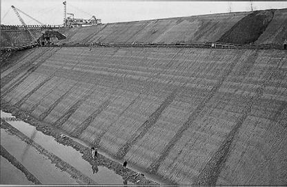
The properties of many sediments, in particular clays, change considerably with depth and this is an important factor to be investigated as it has implications in many areas, from the maximum depth of repository development to the way in which the clays might react to future uplift and erosion. Figure 4.6 shows the rapid decrease in hydraulic conductivity in the Opalinus Clay in the upper few tens of metres, which is combined with an increase in the chloride content of the porewater, indicating a parallel decrease in the effects of oxidation and weathering over the same interval. The Opalinus Clay at outcrop is shown in Fig. 4.7, where well developed planar jointing can be seen – this jointing is associated with oxidation and the deposition of fibrous minerals. Extensive research on the Opalinus Clay has demonstrated that the clay is self-sealing and that below a depth of approximately 200 m there is no evidence that faults in the clay are any more transmissive than the intact rock (Nagra, 2002a). This has been shown by Nagra from an examination of inflows of groundwater into 5.5 km of tunnels (road, railway, URL) through the Opalinus Clay, where they were able to provide evidence that this formation, even when deformed, faulted and tilted, still retains its low hydraulic conductivity – as very few inflows of groundwater into any of these tunnels had been experienced. More detailed and recent investigations in the Mont Terri URL also come to the same conclusion (Buehler et al., 2003), as does work on other clays at depth (for additional examples, see NEA, 2001).
The extent of surface mapping is dependent on the level of exposure. Large areas of northern Europe, for example, are covered with thick glacial or recent deposits, which limit the opportunities for detailed surface mapping, but any such mapping is useful as it