

Плавание по срд, одобренным имо, регламентируется правилом 10 мппсс-72.
В таблице 1.5 перечислены системы разделения и их описание.
Таблица 1.5 – Системы разделения по маршруту перехода
|
№ п/п |
Система разделения движения |
Позывной СУДС |
Канал связи |
|
1 |
Kilindini Traffic Separation Line |
Iquique Pilot |
12, 16 |
|
2 |
Chennai to Colombo Traffic Separation Line |
Iquique Pilot |
12, 16 |
|
3 |
Koaum Traffic Separation Line |
Iquique Pilot |
12, 16 |
В таблице 1.6 указана радиостанция факсимильных гидрометеорологических передач.
Таблица 1.6 – Радиостанции факсимильных гидрометеорологических передач.
|
№ |
Радиостанция |
Обозначение и граница карты |
Содержание передачи |
Время передачи |
|
1 |
Rio de Janeiro A |
1: 53,000,000 20°N 90°W20°N 20 ° E 70°N 90°W 70°N 20°E |
Surface analysis |
0750(00) 1635(12) |
|
B |
Significant wave height(m) & direction prognosis 12Z+36 hour |
1810(00) 1655(12) | ||
|
C |
Wind at 10 kts prognosis 12Z + 36 hour |
0830(00) 1715(12) | ||
|
4 |
Rio de Janeiro D |
15°N 72°W15°N 18 ° W 50°S 72°W 50°S 18°W |
Sea surface temperature (C) |
0850(12) 1735(00) |
В таблице 1.7 представлены станции NAVTEX соответсвенно переходу. Таблица 1.7 – Районы NAVAREA, станции NAVTEX на переходе
|
№ |
Участок перехода |
Район NAVAREA |
Станции NAVTEX |
Координатор NAVAREA |
|
1 |
South America – Atlantic Ocean |
VI |
Mar del Plata[Q] |
Argentina
|
|
VI |
Comodoro Rivadavia(O) | |||
|
VI |
Rio Gallegos(N) | |||
|
2
|
South America – Pacific Ocean |
XV |
Magellanos(E) |
Chile
|
|
XV |
Puerto Montt [D] | |||
|
XV |
Valparaiso Playa Ancha [B] | |||
|
XV |
Antofagasta [H] | |||
|
II |
Ribeira de Vinha[U] |
USA |
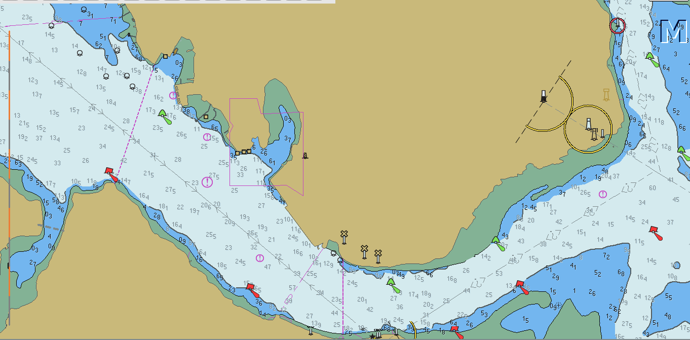
В данном рейсе, при подходе к Зоне Разделения Движения ( Traffic Separation Scheme), мы обязаны провести обмен информацией с местными управляющими органами по форме, которая изложена в табл. 1.8.
Таблица 1.8 – Форма доклада (Report)
1.5. Сведения о портах
Момбаса (Кения)

MOMBASA
General information
Charts 616, 666
Position
10.10
1 The modern port of Mombasa lies on the W side of Mombasa Island (404S 3940E) and comprises the fine natural sheltered harbour of Port Kilindini and Port Reitz. The old port, now known as Mombasa Harbour, lies E of Mombasa Island.
Function
10.11
The port of Mombasa is the principal port of Kenya and port for Uganda; it also acts as a main port for several other countries in central Africa including, Rwanda, Burundi, Democratic Republic of Congo and Sudan. Exports are primarily agricultural products and bulk cement; imports are primarily manufactured goods and bulk oil products.
The town of Mombasa, which extends over the greater part of Mombasa Island, as well as parts of the adjacent mainland, is the most important town on the E coast of Africa between Durban and Port Said. In 2004 the population was about 800 000.
Topography
10.12
Mombasa Island lies close within the entrance to the port of Mombasa, but it is not readily visible from seaward. The island is from 12 to 21 m high and, although much built−over, is well covered with trees, chiefly mangoes and baobabs.
The banks of the channels either side of Mombasa Island are cliff−like and, except for the developed part of the island, are covered with trees and bushes.
The coast immediately S of Mombasa Island, S of Ras Mwa Kisenge, is described at 10.9.
NE of Mombasa Island, between Mackenzie Point
(4037S 39412E) and George Rock 3¼ miles ESE, the coast is of low cliffs. From George Rock a sandy beach
continues 8 cables ENE to Ras Mkuungombe a bluff cliff−like point.
Port limits
10.13
1 The port of Mombasa includes Kilindini Harbour, Port Reitz, the Old Port, Port Tudor and all the tidal waters surrounding Mombasa Island; the seaward limit is reported (1997) to be formed by a line drawn between Ras Mkuungombe (Ras Kungwongbe) and a point on the shore 5 cables S of Ras Mwa Kisenge. The port authority should be approached for more precise details.
Approach and entry
10.14
1 Approach is direct from the open sea, and entry is through a buoyed channel on the alignment of leading lights.
1 In 2005, the port was used by 1083 vessels with a total of 20 735 510 dwt.
Port Authority
10.16
1 Kenya Ports Authority, PO Box 95009, Mombasa 80104, Kenya.
Website, www.kpa.co.ke.
The Port Office is at Ras Mchangamwe (4025S 39384E), at the head of Port Kilindini.
Limiting conditions Controlling depth
10.17
1 Although depths of 130 m are charted along the entrance channel leading line, it is reported (1994) that the channel has been dredged to 150 m. The port authorities should be contacted for the latest information.
In the approach to Port Kilindini and Port Reitz there is a least charted depth of 145 m on the Mtongwe Leading Line 7 cables SE of the front leading light (4037S 39385E).
Under−keel clearance
10.18
1 In the approach channel, an under−keel clearance of 24 m is required during the SW Monsoon, and of 18 m during the NE Monsoon. Tankers drawing up to 128 m may enter harbour at HW; deeper draught vessels drawing up to 134 m can only be taken in during ideal conditions. Within the inner harbour, an under−keel clearance of 10 m is required for all vessels, and 15% of draught for laden tankers.
Vertical clearance
10.19
1 Nyali Bridge, a concrete structure with a vertical clearance of 11 m, spans the channel joining Mombasa Harbour with Port Tudor, at Ras Kisauni (4026S 39404E).
Deepest and longest berth
10.20
1 Deepest. Berth 9 at Port Kilindini (10.45).
Longest. Berths 16 to 18 of the container terminal at Port Reitz (10.46).
Tidal levels
10.21
1 Mean spring range about 32 m; mean neap range about 11 m. For further details see Admiralty Tide Tables.
Density of water
10.22
1 The density of the water at the berths is 1025 g/cm3.
Maximum size of vessel handled
10.23
1 Vessels up to 250 m in length can enter by day. Entry at night is normally limited to vessels up to 198 m in length, although in certain circumstances vessels up to 250 m may be permitted to enter.
Local weather and sea state
10.24
1 During the SW Monsoon, from May to September, sea and swell conditions in the approaches to the port
frequently make it impracticable for pilots to embark, and entry of vessels at night is therefore very limited during this period. Also, due to the strength of the tidal streams, vessels do not usually enter the port during darkness at springs. As a general rule, therefore, vessels making the port late at night are advised to stand off until daylight.
limited to daylight hours only: Tankers.
Vessels carrying dangerous cargoes. Those longer than 200 m.
Vessels constrained in any way.
Vessels are normally berthed stemming the tidal stream. At Shimanzi Oil Terminal and at Berths 8, 9 and 10, vessels are berthed port side−to on the in−going tidal stream when the tidal range is 25 m or more during the day, or 19 m or more at night.
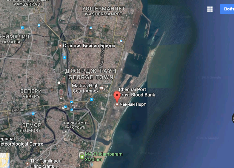
2) Ченнаи (Индия)


General information
Position
1 The modern Chennai (Madras) port (E India) lies in position 1308N 8029E).
Chennai Port, formerly known as Madras Port, is the second largest port
of India, behind the Mumbai Port, and the largest port in the Bay of
Bengal and the principal harbor of Coromandel coast. It is an artificial and all-weather port with wet docks that front s the center of the city. It was a major travel port before becoming a major container port.
The port with 3 docks, 24 berths and draft ranging from 12 to 16.5 m has become a hub port for containers, cars and project cargo in the east coast of India.
Depths? Limitations
The approach channel, marked by the IALA Maritime Buoyage System (Region A), is dredged and maintained at a depth of 19.2m. Vessels are to keep at least 0.5 mile off the channel entry unless a pilot is on board.
The harbor entrance is maintained to a depth of 18.6m, and there is a swinging
basin, 0.3 mile in diameter, lying immediately inside the harbor entrance with a
maintained depth of 18m. In 1986, it was reported the port could accommodate
vesels up to 274m length, with a draft of 16.2m.
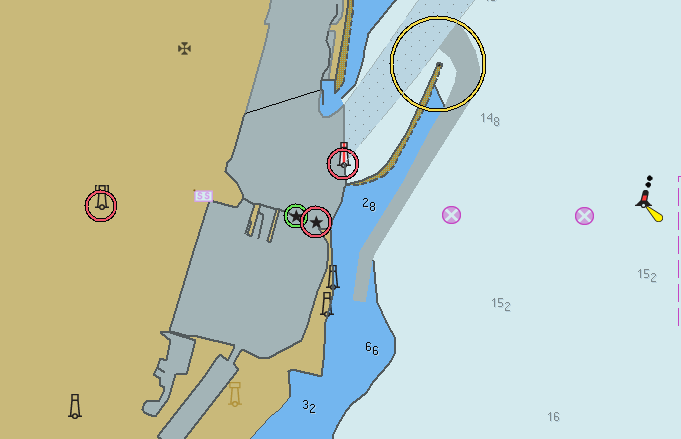
Bharathi Dock, the N part of the harbor, is protected by the North Breakwater and East Breakwater; a light stands near the head of East Breakwater. Dock 1 and
Dock 3, on the E side of Barathi Dock, are oil berths. Dock 2, located in the NW corner of the dock, is an iron ore berth.
A fully mechanized container terminal, with alongside charted depths of 11.5 to 12.5m, is located on the W side of Bharathi Dock close NW of North Pier.
The S part of the harbor, forming the Inner Harbor is protected by East Quay. The entrance lies between North Pier and a spur projecting from East Quay; it is
122m wide with a depth of 9.4m and marked by lighted beacons at each side of
the entrance.
The protecting breakwater N of the spur is known as the sheltering arm; a light
stands at the head of the arm. Dr. Ambedkar Dock (Inner Harbor) contains 12
berths alongside the quays and one fixed mooring.
It has been reported (2006) that the alongside depths are being increased to
15m.
Jawahar Dock, entered along the mid-section of South Quay of the inner harbor, has an overall length of 655m. The S end of the dock is used by LASH barges. It has been reported (2006) that the depth in the dock has been increased to
11.5m.
Chennai Fishing Harbor is located 1 mile N of Bharathi Dock and is sheltered by two extensive breakwaters which provides berths for up to 500 fishing vessels.
Depths off the harbor shoal gradually from the 20m curve, about 1.5 to 2 miles
offshore, to a depth of 11m less than 0.3 mile E of the breakwaters.
The surf N and S of the harbor generally breaks about 122m from the beach in
fine weather and about 183m in squally weather. During gales from the E,
breakers were observed about 244m offshore; with an offshore wind, the surf is
often very high and in the form of a heavy roller. During normal weather the surf wave is about 0.9 to 1.8m high, and during a gale from 3 to 3.7m high.
Pilotage
Pilotage is compulsory for vessels over 200 grt.
Signals
The Port Signal Station is located on the Harbor Office on the seaward end of the Transit Shed and Passenger Terminal on North Pier. International Code of
Signals Flags and Morse code are employed.
Contact Information
The port can be contacted, as follows:
1. Call sign: Port Control
2. VHF channels 10 and 16
3. Tel: 91-44-25360833
4. Fax: 91-44-25384012
5. Mail: dc@chennaiport.gov.in
Anchorage
Chennai Roadstead is open to all except offshore winds. There is usually a swell from seaward which causes vessels to labor or roll considerably.
Vessels which are not awaiting berth on arrival are not to anchor N of latitude
13°06'N, and within Pilot Boarding Area No. 1 or Pilot Boarding Area No. 2,
without prior approval from Port Control.
A dangerous wreck, with masts exposed, lies about 0.8 mile SE of the harbor
entrance. It is marked by a lighted buoy lying 0.2 mile E.
An Examination Anchorage area is shown on the chart.
Caution.?Vessels are advised to be on the lookout for pirates attempting to board at night.
The roadstead fronting the harbor area is subject to a heavy surf