NP 286(1) United Kingdom and Europe
.pdf


Contents Index
UNITED KINGDOM
MCADistrict
Falmouth
Forth
HoIyhead
Humber
Liverpool
Milford
Portland
Shetland
SoIent
Stomoway
Swansea
Thames
Yarmouth
" |
|
Base Station |
MMSI |
Lands End |
002320721 |
Lizard Poinl |
002320720 |
Scillies |
002320;23 |
Inverbervie |
002320nO |
MRSe Forth |
002320734 |
S. Abb's,Crosslaw |
002320710 |
South Slack |
002320771 |
Cullercoats |
002320708 |
Flamborough Head |
002320709 |
Whitby |
002320780 |
MRSC Uverpool |
00232On2 |
Snaefell |
002320718 |
Dinas |
002320742 |
S. Ann'sHead |
002320719 |
The Grove |
002320722 |
CoIlafirth Hill |
002320737 |
Compass Head |
002320714 |
Saxa Vord |
002320774 |
WidefordHiII |
002320781 |
Needles |
00232On5 |
Newhaven |
oo2320n6 |
Selsey |
002320744 |
Bull of Lewis |
002320715 |
Forsnaval |
002320738 |
Melvaig |
0023207t7 |
Rodel |
002320716 |
HarUand Point |
002320nB |
Mumbles Hili |
002320743 |
Sevem Bridge |
002320777 |
MRSC Thames |
002320779 |
Langham |
002320773 |
MRCC Yarmouth |
002320733 |
Mablethorpe |
002320732 |
;
!
--
I
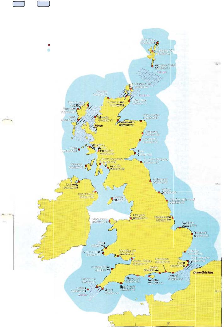
(2)The AIS network operates wilhil 100 guidelines and is capable of receiving all message types and in particular AIS message type 5: Ship'sstatic and voyage related data, provided at6 minute intervals in accordance with ITU·RM.1371·!.
(3)11 is anticipated this will provide the following data sets in support of the Directive:
(a)Position
(b)Vessel and cargo type (e.g. tanker or cargo and whether the cargo is hazardous)
(c)Length
(d)Draught
(e)Next port of call
(f)Course
(g)Speed
(4)This automated procedure will enable idenlification and tracking of suitably equipped vessels without further intervention from either the vessel'screw or Coasfguard personnel.
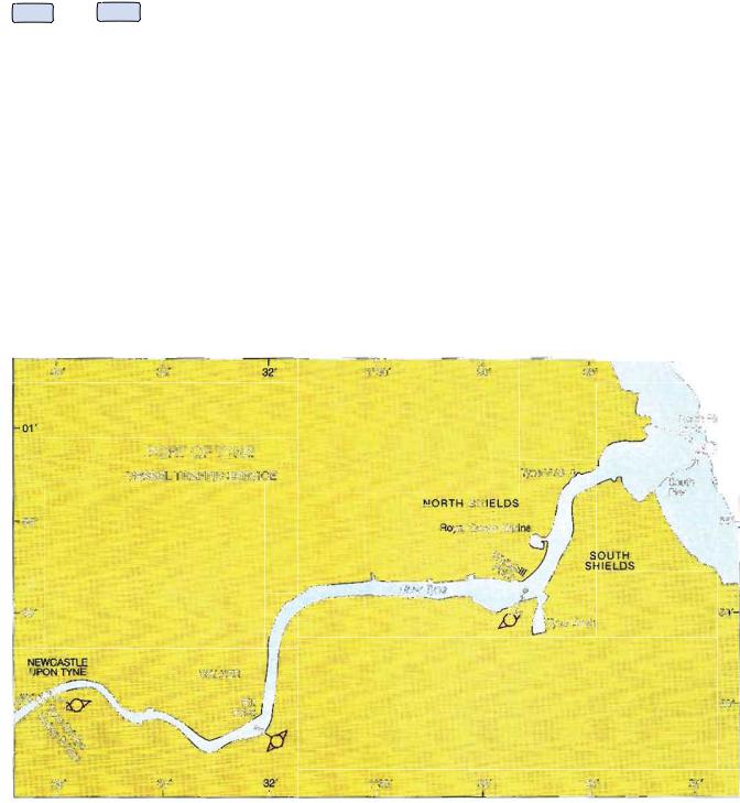
AREAS COVERED:
See diagram UNITED KfNGDOM AUTOMATIC IDENTIFICATION SYSTEM (AIS) NETWORK.
ADVICE TO USERS OF AIS ON BOARD VESSELS:
(1) Mariners on vessels fl\ted with AIS should be aware that the AIS will be transmitting own-ship data 10 other vessels and shore stations. To this end they are advised 10:
(a)Initiale action 10 correct improper installation.
(b)Ensure the correct information on the vessel'sidentity, position and movements
(including voyage-specific) is transmitted.
(e)Ensure thallhe AIS is turned on, at least within 100 n miles of the coastline of the United Kingdom
428