

CHAPTER TWENTY-THREE
TRADE IN THE SUMERIAN WORLD
Harriet Crawford
The importance of trade as a ‘prime mover’ in the development of human society has been acknowledged by archaeologists for many years (see, for example, Ucko et al. 1972). In the 1960s and 1970s, it was seen as one of the major forces driving society
towards urbanism, and more recently, Wallerstein’s World Systems theory enjoyed a vogue as an explanatory model for understanding the rise of so-called secondary states (Renfrew 1969; Trigger 1972; Algaze 1986). This latter view has now been heavily modified (Stein 1999). On the other hand, it is generally agreed that the presence of complex trading networks has important implications for the organisation of society, encouraging the development of craft specialisation, mass production, new modes of transport, (Algaze 2004) and the emergence of what might loosely be called information technologies, such as the writing and sealing practices used to track the flow of goods.
It is therefore surprising that it is not always easy to identify the presence of trade in the archaeological record. In the absence of written evidence the presence of nonlocal goods or raw materials in the material culture of any group could be thought to indicate trade with the areas of origin of such goods, but it must not be forgotten that there are many mechanisms other than trade, in the strict sense, by which objects can be moved over long distances and these are frequently ignored.
Context, quantity and the type of goods concerned are important in attempting to decide which of the many potential mechanisms was employed. Foraging for widely available raw materials such as timber, or building stone, was a timeless method of acquisition which became less useful as populations expanded, forests shrank and people became more possessive of their local resources. At the other end of the spectrum, high-value prestige items such as ornaments and precious stones have always been exchanged as gifts by the elite, by travellers, by nomads seeking safe passage or carried by women as dowries. Such items may have passed through many hands before they arrive in the archaeological context in which they are found. Equally, both goods and women can arrive as the result of pillage or the taking of booty (Lafont 2008: 27), another timeless and effective method of moving goods around the world.
The picture is further complicated by the well-established practice of craftsmen moving from town to town whether voluntarily or at the behest of their masters. For example, in the mid-third millennium nine sculptors from Mari worked at Ebla, while blacksmiths from Ebla went to Kish (Quenet 2008: 203/4, 226); itinerant groups of potters or metal workers may travel over long distances and the emulation of an
447
–– Harriet Crawford ––
attractive or superior product by local craftsmen is also well attested in pottery manufacture. These factors make the attribution of a place of origin to a manufactured item on stylistic grounds alone unreliable.
Between the two poles of foraging and gift-giving is what might be called standard trade – trade that is the commercial exchange of goods which takes place on a regular basis and where each party sees themselves as satisfied with the outcome. It is on that mechanism that this chapter will concentrate.
Mesopotamia provides an excellent example to illustrate Finlay’s dictum that “Imports alone motivated trade, never exports” (Finlay 1954: 65). In south Mesopotamia, true trade was focused on the importation of the raw materials which the region lacked, notably metals, high-quality timber and both building and semi-precious stones. Metals were probably carried in semi-processed form, partly to reduce weight, and partly no doubt because of the lack of high-quality fuel necessary for smelting in Mesopotamia; semiprecious stones also travelled in the same way. A few finished luxury goods such as etched carnelian beads or chlorite and calcite vessels were also traded, though many other highvalue items were made of imported exotic materials in workshops in Sumer itself to suit local tastes.
Such materials were acquired in exchange for manufactured goods, mainly textiles, foodstuffs and oils. Cereals do not seem to have played a major role, probably because of the difficulty of transporting such bulky items by land over long distances (Potts 1997: chapter V for the carrying capacity of early boats in Mesopotamia). Where possible, transport by boat was preferred as land transport was slow and cumbersome. The waterways of Mesopotamia are well known and, in addition, the head of the Gulf was considerably further inland during the Sumerian period. The Karun River, which today runs into the Shatt al-Arab, may have been navigable making transport to and from Elam possible by boat, while in north Mesopotamia the Balikh, the Habur and the Jaghjagh were probably navigable for much of the year (Quenet 2008: 17). The Euphrates was the major north–south artery of communication as the current powered downstream movement while, at least by the Ur III period, conscripts could be used to haul boats upstream (Lafont 2008: 32–33). The domestication of the donkey by the later Uruk period at latest made bulk transport by land somewhat easier (Payne 1988: 100), but much of the terrain was difficult and sleds and carts with solid wheels made progress slow. Valuable goods were no doubt still carried by men in packs on their backs.
As well as material goods, technologies and ideas also crossed borders. The most significant of these was arguably the cuneiform script and the associated scribal methods of record keeping. Together they paved the way for the easier storage and transmission of knowledge, as well as goods, across time and space thus linking people regardless of distance. By the middle of the third millennium, the cuneiform script was to be found over a swathe of territory which included Turkey and Iran.
Sometimes it is only from the presence of textual evidence that we can identify with certainty the methods used to acquire goods, though the texts are not infallible either. Rulers may record trade goods as tribute, or disguise them as royal gifts from neighbouring kings, when trade would be a more accurate description. The nature and quantity of goods may also provide an insight. A sprinkling of exotic stones in highstatus graves may not have arrived by the same mechanism as large quantities of lead or copper for utilitarian tools. It is also recognised that several mechanisms were
448
–– Trade in the Sumerian world ––
probably in use at any one time and that their relative importance changed as society developed and goods that had been luxuries, like copper and bronze, became essentials.
Change can be seen in the goods imported, the routes by which they travelled, and the status of the people carrying the goods. For example, merchants became increasingly professional as the goods they carried became utterly essential to the social and economic systems of Mesopotamia and the volume of goods increased exponentially. The Sumerian word for merchant, damgar, is found on some of the earliest tablets when it already seems to have been an established profession. It has been suggested that damgar is rather more all-encompassing than the translation ‘merchant’ would suggest. Foster has proposed that it should more accurately be translated as ‘man of business’ or ‘business agent’ (Foster 1977: 35) as they also seem to have lent money and carried out commissions for the state institutions and for individuals. Their status in relation to the state institutions is often difficult to determine, but by the Agade period there seem to have been ‘private sector’ merchants who were organised into groups, often of family members, and who were led by an ‘overseer’. It is also important to remember that the bulk of the merchants’ business was conducted within southern Mesopotamia and was not concerned with international trade (see below). This chapter will attempt to track changes in all these areas through the late fourth millennium and the succeeding Early Dynastic, Agade, and Ur III periods.
Foreign trade is not of course the whole story. It is also recognised that intraregional exchange within south Mesopotamia was important and made up the bulk of a merchant’s business. Different cities on the southern plain developed manufacturing specialities, or acted as entrepots for the forwarding on of foreign goods (Foster 1977: 36). It seems that Isin was well known for its leather goods, while Adab may have been a forwarding agent for decorated steatite/chlorite vessels from Iran and the Gulf which were in vogue in the middle of the third millennium (Kohl 1975). Under the Third Ur dynasty very large amounts of bitumen were forwarded by Girsu to Ur, five shiploads are mentioned in one text (Forbes 1964: 18). This transaction also illustrates well the difficulty of interpreting the texts as it is not clear whether this is really trade, or was tribute or taxes to the centre. An emphasis on foreign goods and raw materials alone certainly underestimates the total volume of goods exchanged as too does the fact that many of the items concerned in a whole range of transactions are now generally accepted to have been perishable or invisible (Crawford 1973). Textiles and food stuffs, both major exports, leave little trace in the archaeological record, while knowledge and technical skills leave only indirect evidence.
South Mesopotamia has never been a self-contained unit. Almost from the time of the first permanent settlements in the Ubaid period there is evidence for contacts with the outside world. Some of the earliest of these demonstrate contacts southwards down the Gulf, where Ubaid 2/3 pottery occurs, thus predating Ubaid dealings with north Mesopotamia which belong to the later Ubaid 3/4 period (Carter 2010). Ubaid 3/4 pottery has been found over much of north Mesopotamia and southeast Anatolia, while at Deg˘irmentepe there appears to be an Ubaid village (Yener 2000: 30). There are also stylistic similarities with the pottery of southwest Iran. The nature of the relationship between the southern plain and these adjacent areas is far from clear. It certainly differed from region to region and the desire for foreign goods may not have been the sole motivation. Indeed, there is little evidence from southern Ubaid sites such as Ouelli for the use of imported materials. Some of the contacts may reflect the search
449
–– Harriet Crawford ––
for knowledge or resources, some the emigration of people from the south, and some emulation by local people of a desirable commodity, rather than close encounters with the originators of the goods.
By the middle of the Uruk period, it is possible to identify a radical change in these varied relationships with the founding of the first so-called colony site at Sheikh Hassan on the Middle Euphrates (Boese 1995). Much has been written about the elaborate system of so-called colonies which was in place by the late Uruk period (Algaze 1986: passim), of which Habuba Kabira and Jebel Aruda are perhaps the best known examples. These sites were apparently intended to ensure a constant flow of goods, especially metals and timber, southwards from the highlands of Anatolia into the southern plain. Here, in the colonies, the material culture is identical with that on the southern plain and seems to owe little to the area in which the settlements were planted. In addition to the colony sites, there were also smaller way stations where presumably caravans could rest and recuperate. Such sites have all the conveniences of home, but show more evidence for local interaction. At Hassek Huyuk these facilities include a small public building decorated with splendid mosaics. In the pottery corpus there is also a ‘substantial component of indigenous late Chalcolithic chaff-tempered forms’, suggesting a closer relationship with local people than at the colonies (Algaze 1993: 86). Furthest from home there were small groups of people from the plain living in enclaves in local settlements, presumably to facilitate the flow of goods to their homeland. The best known of these enclaves is found at Hacinebi, while another almost certainly existed at Brak in North-East Syria (Stein 2002: 149–172).
Further north, where there is no evidence for enclaves, stylistic contacts with the south can be recognised, sometimes in the glyptic and sometimes in the pottery. The magnificent urban site of Arslantepe in eastern Turkey with its public buildings, wallpaintings, sophisticated metalwork and elaborate accounting system has also produced a limited amount of late Uruk pottery (e.g., Frangipane 2004: fig. 37), and Uruk style seals, suggesting a limited contact with the south, but the architecture and the metalwork owe nothing to their southern counterparts and are equally sophisticated. Even further north on the coast of the Caspian sea, recent studies have detected traces of Uruk influence on the pottery (Munchaev and Amirov forthcoming).
Looking eastwards, there were also close ties between Susa and the south in the Uruk period. By the late Uruk much of the material culture, perhaps most striking in the iconography of the seals, is almost identical, but the exact nature of the relationship is unclear and much debated. Differences in the shape of the proto-cuneiform tablets from Susa and in the way signs are arranged both argue against the presence of Sumerian bureaucrats (Potts D. 1999: 52ff.) and so of the actual conquest of southwest Iran by south Mesopotamia. On the other hand, the pottery is Uruk in style. It also seems unlikely that Uruk could maintain a full-blown military occupation of another polity at this early time, but relations were undoubtedly close. The end of the Uruk period, which coincides with the end of Susa II, saw a complete change in the material culture of that city, marking an abrupt change in the relationship.
By contrast, relations with the Gulf seem to have declined later in the Ubaid period and this region does not seem to have had a significant relationship with Uruk Mesopotamia. A few pieces of Uruk-related pottery have been found in the Eastern province of Arabia (Potts D. 1986). There are also scattered references in the texts to Dilmun, which also appears as an element in a few personal names (Potts D. 1990:
450
–– Trade in the Sumerian world ––
85–87). It seems that whatever the motive for the Ubaid travellers had been, the thrust of the contacts turned north and southeast in the Uruk period. Regular contact with the Gulf is only resumed after the collapse of the Euphrates route northwards.
There has been speculation about the reasons for the collapse of this wide-ranging Uruk network and it is still unclear what factors brought it about. Some of the colonies such as Habuba seem to have been deserted, while Hassek Huyuk was destroyed (Algaze 1993: 107). We can suggest that many of the traders who had manned the colonies and outposts of the Uruk system were forced to relocate.
Dramatic changes at much the same time are visible in the north at Arslantepe and as we have just noted at Susa, and at Godin Tepe in the Zagros. At both Arslantepe and at Godin, the post-Uruk levels are marked by a new type of pottery, Kura-Araxes ware, which originated north of the Causcasus (Frangipane 2002; Badler 2002: 83). The appearance of this pottery appears to be related to movements of new people southwards into Anatolia and northwestern Iran (Kohl 2007). Can we suggest that part of the reason for the end of the colony system was that the production of ore was disrupted at the Anatolian mines as a result of these incursions? The disruption of supplies would have made the late Uruk colonies unnecessary and must have had a major economic impact on the cities of the plain. It is noticeable that there was a sharp contraction in the urban population at this time and at Uruk there is a break in the Eanna sequence at the same moment, which we can perhaps attribute to a period of recession. There is no evidence of an attack or an invasion at Uruk itself and the recession, if such it was, was followed by another flowering in the third millennium when the old public buildings were carefully cleared out and a massive terrace built over them. The so-called Sammelfund, a cache of precious objects probably buried at the end of the Uruk period, has been used to suggest an attack, but we know that later, in the mid-third millennium, superfluous items of religious significance were disposed of by carefully burying them1 so we can suggest that this, rather than imminent danger, may be the explanation for the Sammelfund.
In north Mesopotamia, the collapse of the Uruk network had even greater repercussions with urban centres disappearing from the archaeological record for several centuries. This did not mean that trade ceased completely. In both north and south there is evidence for some foreign goods, but the scale is hugely reduced and in some cases the routes too seem to have changed (Quenet 2008: 36, 97ff.). In the north the distribution of one particular type of seal, the Piedmont, suggests the use of a route from Elam to Western Syria (Collon 1987) that hugged the flanks of the Zagros and Taurus mountains. The Piedmont seal is typically made of glazed softstone, it is long and thin, and is decorated with simple geometric motifs and crude animal files. These seals are relatively rare on the southern plain which does not seem to have been a major player in this network. The route mapped by these seals is also marked by a string of circular fortified sites in the Hamrin valley, east of the middle Tigris, which seem to have acted as staging posts on the route. Some continued in use into the succeeding Early Dynastic I period but after this the valley is more or less deserted, pointing to another shift in the direction of the trade.
In spite of the very limited evidence, it seems clear that the supply of foreign goods in the southern plain was drastically curtailed after the collapse of the Uruk colonies. For example, the amount of metal brought into the south was apparently sharply reduced, although as few sites of the period have been excavated, it is difficult to make
451
–– Harriet Crawford ––
an accurate comparison. There is not a total famine, as lead bowls appear in some of the Jemdat Nasr or ED 1 graves at Ur, and a few simple copper tools are known from Jemdat Nasr itself (Matthews 1999: 43). The limited evidence from the Jemdat Nasr period may point to foreign, Arabian merchants as the carriers of what little copper there was (see below). It is only in the later Early Dynastic period that we can again be certain that professional merchants were operating out of Sumer.
The evidence from the Arabian peninsula suggests that, post-Uruk, the search for metals was now concentrated here rather than up the Euphrates or eastwards onto the Iranian plateau. Susa no longer had such close ties with the south either. The mountains of the United Arab Emirates and Oman are rich in copper and also produce carnelian and decorative hard stones such as black diorite. Finds of typical painted Jemdat Nasr pottery, a type of pot found on the southern plain after the Uruk collapse (cf. Crawford 1998: 35 for refs.), mark the route travelled by these goods from the Arabian mines to the coast, where they could be trans-shipped to Mesopotamia. We do not know who the merchants were. The fact that much of this pottery is associated with small free-standing conical graves built of rough stone in a local style may suggest that many of those who carried the goods were natives of Arabia who had acquired the attractive vessels and their contents from Sumer in exchange for their metals. On the other hand, it is possible that the exchanges took place on the coast of the Arabian peninsula.
New evidence from the beginning of the third millennium provides clear evidence from the southern plain for the movement of goods within the Sumerian plain. No doubt this had taken place earlier, but is not recorded. The exact nature of this movement is unclear, but it appears that a number of cities may have joined together to supply the central religious site of Nippur with small amounts of foodstuffs and textiles (Matthews 1999: 51). Their activities are documented on thirteen tablets from the southern site of Jemdat Nasr and by a very specific type of cylinder seal impression found on them which is decorated with pictograms representing the names of the cities involved. Similar impressions are also found at Uruk and in the Seal Impression Strata at Ur, which is probably a little later in date (Matthews 1993: 40). The group’s activities do not seem to have been restricted to the plain as a number of possible examples of city sealings are known from Susa (Matthews 1993) and one such impression has recently been found on a door sealing at Konor Sandal in the region of Jiroft in the Halil basin of Iran (Pittman in Madjidzadeh with Pittman 2008: 100). This suggests that external ventures could also be organised on a co-ordinated basis and that merchants from Sumer were present here. It is perhaps relevant in this context to note that plain steatite/chlorite vessels, many of which appear to have originated in this part of Iran, are found in graves at Ur from the Jemdat Nasr period onwards (Kolbus 1983).
The Early Dynastic period, conventionally dated from c.2,800 to 2,350 and subdivided into four parts,2 saw sharply rising levels of prosperity and a huge increase in demand for imported goods. Over this time, we see a growing market in the raw materials for luxuries such as jewellery and precious metal to meet the requirements of a newly affluent sector of society. There is also a marked expansion in the use of base metals for tools and weapons and an increasing demand for high-quality building timbers to roof the new public buildings. The imported goods came from different areas and a number of routes seem to have been in use simultaneously. As the evidence is greater than for previous periods, we will deal with it by geographical location as well as chronologically to try to clarify the position.
452
–– Trade in the Sumerian world ––
THE EUPHRATES ROUTE
The ‘Uruk’ route up the Euphrates is reopened in ED I/II and the newly founded city of Mari has provided many examples of the ties between this region and the Sumerian plain, especially in the stylistic characteristics of statuary and seals and, above all, in its use of the cuneiform script. We may guess that by ED III relations between the states were generally friendly, Mes-anne-padda of Ur even dedicated a fine lapis bead inscribed with his name which was found in the courtyard of the Mari palace temple (Frayne 2008: E1.13.5, 391). Mari’s geographical situation allowed it to play a major role as a forwarding agent for goods and materials originating in Anatolia and the Levant. These included copper and high-quality building timber and enabled Mari to establish a close relationship with the Sumerian plain. It was not alone in this as other sites in north Mesopotamia such as Ebla and Chuera also demonstrate similar influences, although the links do not seem to have been so close (Quenet 2008: 214).
THE SOUTHEAST AND IRAN
At about the same time, in ED I/II, direct contact seems to have been re-established with Susa, although contacts with highland Iran were much more tenuous, in spite of the famous literary composition (the story of Enmerkar and the Lord of Aratta) which tells of the Sumerian ruler’s search for lapis and carnelian to decorate his temple for Inanna (Potts T. 1994: 281). Susa shows a similar range of Sumerian influences as those seen at Mari, but sadly the evidence for this period of time is poor owing to later building activity on the site (Potts D.T. 1999: 93). Susa may have been the transit point for material from further north and east such as the lapis lazuli, which is found in large quantities in the royal graves at Ur, precious metals, the ‘chlorite’3 containers referred to above, and finished calcite vessels.
The trade in one type of chlorite vessels, decorated in what is known as the Intercultural style, illustrates, clearly the complexity of the trading networks in the third millennium and the variety of ways in which the same prestige materials could arrive in Sumer. It is possible to group the material broadly known as chlorite by geophysical analysis, at least in general terms, and it is clear that vessels from at least three different sources were brought in. Two of these sources were in southwest Iran and at least one in the Arabian peninsula (Kohl 1975). There are also several known manufacturing centres in Iran: one at Tepe Yahya, one recently discovered at Jiroft, and one at Tarut in the Eastern province of Arabia. These centres are not necessarily exactly contemporary. It is remarkable that the iconography is similar on products of all the known centres and that its roots seem to lie in Iran rather than Mesopotamia. (There are other groups of chlorite vessels which apparently originate in Eastern Iran and central Asia. These include square boxes, other compartmented vessels and flasks.) The highly decorated Intercultural style vessels show magnificent scenes of writhing snakes, mythical animals, kilted humans and architectural decoration. Some figures are enhanced with inlays of brightly coloured semi-precious stones. They were apparently specially prized in Sumer as dedicatory offerings and are frequently found in temples (Potts T. 1994: 250ff.).
How they were acquired is not precisely known, they seem to have arrived by at least two different routes: up the Gulf and from Susa. The recent findings of Early Dynastic
453
–– Harriet Crawford ––
sealings at Jiroft, as well as the single City seal impression mentioned above, suggest that merchants from the south may have journeyed there themselves to source these desirable goods (Pittman 2008: 99 and fig. 32). Adab may have been a centre for their reception in Mesopotamia as vessels of several different origins were found here and it may also have been part of the route by which such vessels were forwarded on to Mari (Kohl 1975: 30, 2001: 228ff.). Not all the examples from Sumer were necessarily trade goods, some, which were found in temples, may have originated as gifts from rulers or merchants, or as royal booty, but if they were booty, the Sumerian rulers, who are not known for their modesty, would surely have inscribed such prestige offerings as they did less valuable vessels and as their successors did in the Agade period.
Susa does not appear to have been a major purveyor of copper and tin, although copper was certainly entering the south from Iran – for example, from the Anarak mines – but it probably arrived from the northeast, where Tepe Gawra seems to have re-established itself as a market town, or down the Diyala, which might explain the prosperity of this valley in the Early Dynastic period (Potts T. 1994: 147, 152–153). There are also recent reports of an important tin/copper mine at Deh Hosein, approximately 45 km southwest of Arak on the borders of Luristan. The new mine is polymetallic and was apparently in use from the third to the first millennium BC. Lead isotope analyses of the metal match those of third millennium bronzes from Luristan, the Gulf and Mesopotamia and raise the possibility that the area may have been a major supplier of tin and copper from the third millennium onwards (Weeks 2008: 336). It has long been thought that tin may also have arrived from Afghanistan, possibly overland or else through the Indus valley and up the Gulf (see below and Moorey 1994: 298).
THE GULF ROUTE AND THE INDUS
Another major source of metals was the trade up the Gulf which also increased in importance during the third millennium. Tablets document the trade between preSargonic Lagash, Fara, Umma and Dilmun to purchase copper and tin in return for wool (Foster 1997; Prentice 2010)4. It should be noted that Dilmun at this period almost certainly refers to the east coast of the Arabian peninsula and not specifically to Bahrain as it did by the end of the millennium.5 The merchants probably travelled to sites such as Tell Abraq on the coast of Umm al Gawain Emirate, a site which has an amazing range of overseas contacts reaching as far as Central Asia. Recent work on the metal remains from this site strongly suggest that copper arrived here from a variety of sources which included both local ones and others from much further afield which were apparently channelled through the Indus alley. The tin was probably from Afghanistan and arrived by the same route (Weeks 1999). Other goods forwarded on to Mesopotamia included carnelian both in its unworked state and as beads, lapis lazuli, shells from the Indian Ocean, more decorated chlorite vessels, and perhaps exotic animals and birds (Ratnagar 2004). A similar but smaller and poorer transhipment site lay slightly nearer Mesopotamia on Umm-an-Nar island (Frifelt 1991, 1995). Somewhat unexpectedly Ur-Nanshe claims to have brought timber by ship from Dilmun to build various temples (Frayne 2008: E1.9.1.2, 84). This too must have originated further afield as no suitable timber is found in Eastern Arabia.
454
–– Trade in the Sumerian world ––
THE AGADE PERIOD: THE EUPHRATES ROUTE
Looking now to the traditional route northwards up the Euphrates, Sargon claimed to have washed his weapons in the Upper Sea and to have conquered Mari and Ebla (Frayne: E1.9.1.2, 84) which suggests at least fleeting control of the Euphrates route thus making the acquisition of copper and timber from Anatolia and the Levant easier and more reliable. It also marks a change from the apparently peaceful contacts of the Early Dynastic period with these cities. The destruction of Palace G at Ebla has been attributed to Sargon, or to Naram-Sin, as has a destruction level at the Mari palace P1. He does not seem to have been active in the northeast, which seems to have become one of the main points of entry for lapis lazuli which was trans-shipped perhaps via Ebla and the Levantine ports as far as Egypt (Quenet 2008: 268).
SUSA AND IRAN
Sargon also campaigned in the southeast and in the same inscription claims to have conquered Elam and Parahsˇum. Susa seems to have become an Akkadian colony governed by southern bureaucrats. Some of the other so-called conquests may have been more in the nature of successful raids as his successors seem to have had to rely on more and repeated military expeditions to maintain control and to keep the trade routes open. Although Highland Iran may have suffered occasional incursions, it seems to have remained largely independent (Potts D.T 1999: 128–129). T. Potts has suggested that booty rather than tribute or taxes became an important source of goods from Highland Iran during the Agade period. Occasionally, ‘chlorite’ bowls belonging to both the série ancienne, with elaborate decoration, and the série récente, with a simple dot and circle design, and vessels of banded calcite, all probably of eastern origin, bear dedicatory inscriptions of Rimush and Naram-Sin some of which specifically identify the vessels as from the booty of Elam or Parahsˇum. Rimush also claims to have brought back 30 minas of gold, 3,600 minas of copper and a number of slaves from Elam (Potts T. 1989: 285).
Unlike Sargon, Naram-Sin campaigned actively in the northeast as the rock reliefs, such as that at Pir Hosseini bear witness. It can be suggested that these campaigns were aimed at keeping the metal trade routes to the Iranian plateau open, in the face of threats from tribesman such as the Lullubi who were eventually to help bring down the dynasty. There are indications of shortages of some metals in Mesopotamia. The few examples of Agade metalwork which have survived, such as the Bassetki statue, are of superb quality, all the more so as they seem to be made of pure copper rather than bronze, which is of course easier to cast. It is also interesting that, by contrast, Agade weapons and tools from Ur, one of the largest collections we have, seem to be of poorer quality than those of the Early Dynastic period, often made of copper rather than bronze and with hammered tangs rather than cast sockets. Do these facts perhaps reflect a shortage of raw materials and especially of tin? (Alternatively the weapons from Ur, all from graves, may be inferior examples manufactured specifically as burial goods which would not have to be used.)
On the other hand, Tepe Gawra, close to one such route onto the plateau, sees a period of prosperity in level VI which, at least in part, dates to the Agade period. This level has yielded evidence for copper working, weights and seals, both suggesting
455
–– Harriet Crawford ––
commercial activity, and a range of exotic goods from further east. These include lapis, turquoise and a piece of stepped inlay of possible Central Asian origin. There is also a model of a covered wagon similar to those used by the Transcauscasian people who moved into Northern Iran early in the third millennium (Speiser 1935). Looking southwards there is a dice said to be identical with those from the Indus. There is at least one tantalising glimpse of possible (indirect?) contacts between Central Asia and the Agade kingdom, which might well have been mediated by sites such as Gawra. A typical Agade combat scene was found at Gonur Depe in southeastern Turkmenistan inscribed with the name of ‘Lucaks, the cupbearer and a servant. . .’. The name of his boss is unfortunately missing. There are a number of other cylinder seal impressions and bullae from this site and from Togolok, but from the murky photographs it is difficult to say if they are Elamite or Mesopotamian (Sarianidi 2002: esp. 326 and
334–335).
The great store at Brak, known as the Naram-Sin palace, demonstrates the importance of the northeast as a source of grain and perhaps raw materials, until its destruction late in the Agade period, but we cannot tell if these commodities were acquired as tribute, booty, trade or a combination of the three. It is not clear if the Agade kings controlled Brak before this building was erected, but the city was strategically placed, commanding the gap in the hills leading to the south, and was known as a breeder of a sought after equid cross called a kungu, both of which made it a desirable acquisition (Oates et al. 2001: esp. ch. 16).
THE SOUTHERN GULF ROUTE AND THE INDUS
The famous inscription of Sargon of Agade stating that ships of Dilmun, Magan and Meluhha moored at the quays of Agade indicates that the Gulf route remained extremely active during his reign at the beginning of the Agade period (Frayne 1993: E2.1.1.11, 28–29). Contacts were also maintained with the Indus valley, weights, seals and etched carnelian beads continue to be found in small numbers and may have arrived via the Gulf, as too did lapis, copper and perhaps gold and tin, forwarded on from Afghanistan or Central Asia (Ratnagar 2004). A well-known seal of the period shows a Meluhhan interpreter sitting on the knee of an Agade ruler (LambergKarlovsky 1981), which may suggest that there were people from Meluhha resident in Sumer itself (Parpola et al. 1977). It is also from this period that we begin to see the Indian zebu or humped cattle depicted on cylinder seals (Collon 1987). Relations with the Gulf were not purely commercial and Manishtsu claimed to have actually crossed the Lower sea and defeated thirty-two towns before quarrying black stone there for a statue (Frayne 1993: E2.1.3.1, 76). Naram-Sin was more specific and records that he conquered Magan, captured its ruler, quarried diorite and dedicated several items of booty from this campaign to his gods (Frayne 1993: E2.1.4.13, 117).
UR III: THE EUPHRATES ROUTE
There is surprisingly little direct evidence for trade up and down the Euphrates under the Ur III kings. The great site of Mari has not provided much evidence for the period either, though both the Zimri-Lim palace and the palace of the shakkanakus were probably founded at this time. It seems that a son of Ur-nammu of Ur was married to
456
–– Trade in the Sumerian world ––
a princess of Mari, which underlines the continuing importance of the ties between the two areas (Hallo and Simpson 1998: 74) and we may suppose that some copper and timber continued to flow into the south by this route. Both Gudea and Shu-Sin state that they obtained high-quality wood from Ebla, which in addition, sent messengers or ambassadors to the Ur III court (Dolce 2001: 24–25). This would indicate that Ebla was rebuilt fairly quickly after the destruction by Naram-Sin. Elsewhere, It seems that there was once again, a period of de-urbanisation in north Mesopotamia with disruption to some trade routes, although major sites such as Brak continue on a somewhat reduced scale.
SUSA AND IRAN
It is interesting to speculate how far the need to ensure reliable sources of raw materials informed the foreign policy of south Mesopotamia. There was apparently no shortage of metals, although the use of traditional luxuries such as semi-precious stones declined, so we can assume that some of the trade routes remained open. The Ur III kings seem to have focused their military expeditions to the north and northeast, controlling a swathe of territory as far as a line which ran roughly from the bend in the Euphrates to the Diyala (Steinkeller 1991: esp. fig. 6). Beyond this and east of the Tigris were the satellite kingdoms which they sometimes struggled to control and who in turn controlled the routes through the Zagros on to the Iranian plateau. These routes probably continued to supply raw materials to the south as in Agade times. On the Tigris, there is evidence for direct southern control at Asˇsˇur where a southern governor was in place and Susa, too, was under southern rule until the reign of Ibbi-Sin. In addition, we have evidence for settlements of Elamites in south Mesopotamia itself, as well as for southerners resident in Susa (Potts T. 1994: 36). Many of the resources of the Iranian plateau could be channelled into Sumer down the Zagros passes or via Susa and the Karun.
THE GULF ROUTE
Although we have suggested that essential raw materials were still coming into south Mesopotamia down the Euphrates and also perhaps through the passes in the Zagros mountains, this period sees an increase in the importance of the Gulf route. Contacts with both Dilmun and Magan are mentioned regularly in the texts, but direct contact with Meluhha seems to have ceased, even though there is again evidence for a Meluhhan village, as well as a Magan one, both in the Lagash/Girsu region. As the inhabitants of the Meluhhan village had good Sumerian names, it is suggested that they had been thoroughly assimilated into Mesopotamian society (Potts T. 1994: 36).
We may speculate that the power of Mari increased under the shakkanaku rulers, and with the developing might of the Amorites, may have threatened trade on the Euphrates. The hill people were also a constant threat in the mountains to the east making a third supply route desirable. Ur-Nammu boasts in the law code formerly attributed to him, (and in various dedicatory inscriptions) that he returned the Magan ship to Nannar and a little further on that he had established freedom ‘from the chief sea captain’ for those conducting trading ventures, presumably in the Gulf (Frayne 1997: 47–48) – an early reference to piracy perhaps? Inscriptions of other kings of the
457
–– Harriet Crawford ––
dynasty refer to goods sent to Magan in exchange for copper, and for rations issued to Magan shipbuilders. We also have part of the archive of a merchant called Lu-Enlilla based in Ur which details the goods given to him to purchase copper and other items from Magan. The evidence suggests that goods originating in Meluhha such as ivory were still coming to Mesopotamia via Magan even if direct contact had ceased (Ratnagar 2004). The evidence of the texts suggests that Lu-Enlilla operated on behalf of both temple and private investors (Potts D.T. 1990: 143–148). This commerce seems to have ceased in the middle of the reign of Ibbi-Sin when the dynasty began to unravel. When there is again evidence for Gulf trade, it is focused on Dilmun rather than Magan.
SUMMARY
It is possible to chart some important changes over the course of the late fourth and third millennia in trade routes and the way in which trade was conducted. We have already noted that water transport was preferred to land, especially for the transport of heavy goods, and this is reinforced by the use of the Euphrates route from Anatolia southwards over long periods of time. Broadly speaking, the Gulf only became the major route when the Euphrates was unreliable as a source of supply, for reasons of unrest in north Mesopotamia or aggrandisement by local kings there wishing to control the flow of goods on the river. We can see this shift clearly at the end of the Uruk period, a ‘Dark Age’ in the north, when the network of ‘colonies’ goes out of use. Jemdat Nasr pottery then occurs in graves on the routes to the copper of Oman, the first time since the middle of the Ubaid period that Mesopotamian pottery is found in some quantity in Arabia pointing to a renewed importance for the Gulf route. At other times, in the second half of the third millennium for instance, both routes were in use together and their relative importance fluctuated depending, among other things no doubt, on the strength of cities like Mari which controlled the middle Euphrates, and the incursions of the Amorites, who, potentially, had the power to disrupt routes across north Mesopotamia.
Relations with Susa varied too as it moved several times from being an independent state to a colony of the south. Susa was important not so much for its own resources but as a ‘port of trade’ for goods from the interior of Iran. Of less significance were other routes to the Iranian plateau through the Zagros. These channelled resources such as copper, and perhaps tin from Iran, and luxuries like lapis lazuli from further east. (Some of these goods were also received via the Gulf.) We can speculate that Agade campaigning in the northeast may have been aimed at keeping these routes open in the face of the hostile hill tribes whose advances into Mesopotamia also had to be stopped.
The main imported goods remain unchanged throughout the Sumerian period, but their quantity increased as former luxuries such as base metals for tools and weapons became essentials. Copper and lead predominate in the earlier part of the third millennium, later augmented by tin and perhaps ready-made ingots of bronze. Quality timbers for the massive building programmes undertaken by any successful ruler were also in constant demand and arrived from both north and south. The nature of the luxuries imported is more varied and changes over time. Precious metals and semiprecious stones are a constant. By the later third millennium, silver must have been readily available from Anatolia as we begin to see it used regularly as a medium of
458
–– Trade in the Sumerian world ––
exchange. Semi-precious stones were usually imported unworked, but sometimes exotica like the magnificent long carnelian beads of the later third millennium, or the etched carnelian ones, both typical of the Indus valley, were brought in. Vessels of calcite and of steatite were also imported ready made by a number of different routes, especially in the second half of the third millennium. Other imports could include ivory, shells, spices, and more mundane goods such as bamboo and red ochre, a favourite pigment.
These goods were carried by victorious armies, by nomads and increasingly by professional merchants. These were both southern Mesopotamian and foreign. The first tentative evidence for foreign merchants comes from the people who carried the copper from the mines of Oman in the early third millennium. By the middle of the millennium there is circumstantial evidence for people from Magan, Meluhha and Elam living within Mesopotamia and by the Ur III period that evidence is undeniable. The indigenous merchants apparently worked for both the state institutions and in the private sector. They were family firms organised by a senior member known as an overseer and the bulk of their business was within the plain itself (Snell 1977). The seal and the tablet were the most important tools of their trade and merchants began to keep their own business archives by the Ur III period. They also increasingly used silver as a medium of exchange, ‘pricing’ other goods against it. In the Ur III period, one shekel of gold cost ten of silver (Garfinkle 2008: 68). Silver had the advantage that it was imperishable, easier to store than barley and less cumbersome than copper.
No doubt the professional merchants also took gifts to their partners overseas and brought home trinkets and souvenirs, while nomadic herders offered small luxuries to the farmers in the settled villages on their cycle of movement. The importance of booty and tribute has also been recognised. These methods of moving goods across long and short distances are not mutually exclusive and many of them no doubt co-existed. The importance of trade proper to south Mesopotamia is hard to overestimate. It provided essential raw materials and the luxuries demanded by an increasingly stratified and prosperous society. It was also a powerful engine of social and economic change, shaping many aspects of Sumerian society, notably methods of production and the development of a diverse and sophisticated world.
NOTES
1The cache of statues in the Square temple at Tell Asmar for example.
2Early Dynastic (ED) I, II, IIIa and IIIb.
3The term is used here to cover a group of geologically related stones which includes chlorite, steatite and softstone.
4I am grateful to Rita Wright for this reference.
5There is no substantial settlement on Bahrain until the late Agade period.
REFERENCES
Algaze, G. 1986. The Uruk World System. Chicago: University of Chicago Press.
——1993. The Uruk World System. Chicago: Chicago University Press
——2004. Trade and the origins of Mesopotamian civilization. Biblioteca Orientalis LXI: 5–19. Badler, V. 2002. A chronology of Uruk artefacts from Godin Tepe. In Artefacts of Complexity: tracking
the Uruk in the Near East, ed. Postgate, J.N, pp. 79–110. London: British School of Archaeology in Iraq.
459
–– Harriet Crawford ––
Boese, J. 1995. Ausgrabungen in Tell Sheikh Hassan I. Saarbru˝cken: Saarbru˝cken Druckerie u Verlag. Carter, R. 2010. Appendix 4. In Maritime interactions in the Arabian Neolithic, ed. Carter, R. and
H. Crawford. Leiden: Brill, pp. 291–295.
Collon, D. 1987. First Impressions. London: British Museum Press.
Crawford, H.E.W. 1973. Mesopotamia’s invisible exports. World Archaeology 5: 231–41. —— 1998. Dilmun and Its Gulf Neighbours. Cambridge: Cambridge University Press.
Dolce, Rita. 2001. Ebla after the ‘Fall’: some preliminary considerations on the EB IVB city.
Damaszener Mitteilungen 13: 11–28.
Finlay, M.I. 1954. The World of Odysseus. New York: Viking Press. Forbes, R.J. 1964. Studies in Ancient Technology, vol.1. Leiden: Brill.
Foster, B.R. 1977. Commercial activity in Sargonic Mesopotamia. Iraq XXXIX.i: 31–44.
——1997. A Sumerian merchant’s account of the Dilmun trade. Acta Sumerologica 19: 53–60. Frangipane, M. 2002. ‘Non-Uruk’ developments and Uruk-related features on the northern borders
of Greater Mesopotamia. In Artefacts of Complexity: tracking the Uruk in the Near East, ed. Postgate, J.N, pp. 123–149. London: British School of Archaeology in Iraq.
——2004 (ed.) Arslantepe. Milan: Electa.
Frayne, D. 2008. Royal Inscriptions of Mesopotamia. Vol. 1. The Early Periods. Toronto: University of Toronto Press.
——1993. Vol. 2. Sargonic and Gutian Periods. Toronto: University of Toronto Press.
——1997. Vol. III.2. The Ur III Period. Toronto: University of Toronto Press. Frifelt, K. 1991. The island of Umm an-Nar. Third millennium graves. JASP XXVI: i.
——1995. The island of Umm an-Nar. The third millennium settlement. JASP XXVI: ii. Garfinkle, S. 2008. Silver and gold: merchants and the economy of the Ur III state. In On the Third
Dynasty of Ur: studies in honour of Marcel Sigrist, ed. Michalowski, P., pp. 63–70. Journal of Cuneiform Studies Supplemental Studies vol. 1. New Haven: American School of Oriental Research.
Hallo, W.W and W.K. Simpson. 1998. The Ancient Near East: a history (second edition). Oxford: Harcourt Brace.
Kohl, Philip. L. 1975. Carved chlorite vessels: a trade in finished commodities in the mid-third millennium. Expedition 18.i: 18–31.
——2001. Reflections on the production of chlorite at Tepe Yahya: 25 years later. In Excavations at Tepe Yahya Iran: The third millennium, ed. D.T. Potts. Cambridge, MA: Harvard University Press.
——2007. The Making of Bronze Age Eurasia. Cambridge: Cambridge University Press.
˘
Kolbus, S. 1983. Zur Chronologie des sog. Gamdat Nasr-Friedhofs in Ur. Iraq XLV.1: 7–17. Lafont, B. 2008. L’armée des rois d’Ur: ce qu’en dissent les texts. In Les armées du Proche-Orient
ancient, ed. Abrahimi, Ph. and L. Battini, Oxford: John and Evica Hedge, pp. 23–48. Lamberg-Karlovsky, C.C. 1981. Afterword. In Bronze Age Civilization of Central Asia, ed. Philip Kohl,
pp. 386–97. New York: M.E. Sharpe.
Matthews, R.J. 1993. Cities, Seals and Writing: archaic seal impressions from Jemdet Nasr and Ur. Berlin: Gebr. Mann Verlag.
—— 1999. Secrets of the Dark Mound, Jemdat Nasr 1926–1928. Iraq Archaeological Reports 15. London: British School of Archaeology in Iraq.
Madjidzadeh, Y. with H. Pittman 2008. Excavations at Konor Sandal (2002–2008). Iran XLVI:
69–104.
Moorey, P.R.S. 1994. Ancient Mesopotamian Materials and Industries. Oxford: Clarendon Press. Munchaev, R.M. and Sh.N. Amirov. Forthcoming. Contacts between Mesopotamia and the
Caucasus from the IVth – the first half of the third millennium. In Preludes to Urbanism (Studies in honour of Dr Joan Oates), ed. A. MacMahon and H. Crawford. Cambridge: McDonald Institute.
Oates, D., J. Oates and H. McDonald. 2001. Excavations at Tell Brak. Vol. 2. Nagar in the third millennium. Cambridge: McDonald Institute Monographs.
460
–– Trade in the Sumerian world ––
Parpola, S., A. Parpola and R. H. Brunswig Jr 1977. The Meluhhan village. Journal of Economic and Social History of the Orient 20: 129–165.
Payne, S. 1988. Animal bones from Tell Rubeidheh. In Excavations at Tell Rubeidheh, ed. Killick, R.K., pp. 98–135 Iraq Archaeological Reports 2. London: British School of Archaeology in Iraq.
Potts, D.T. 1986. Eastern Arabia and the Oman peninsula during the late 4th and early third millennia BC. In Gamdat Nasr: period or regional style? ed. Uwe Finkbeiner, pp. 121–170. Weisbaden: L. Reichert.
——1990. The Arabian Gulf in Antiquity. vol.1. Oxford: Clarendon Press.
——1997. Mesopotamian Civilization. The material foundations. London: Athlone Press.
——1999. The Archaeology of Elam. Cambridge: Cambridge University Press.
Potts, Timothy. 1994. Mesopotamia and the East. Monograph 37. Oxford: Oxford University Committee for Archaeology.
—— 1989. Foreign stone vessels of the late third millennium BC from southern Mesopotamia. Iraq
LI: 123–164.
Prentice, Rosemary. 2010. The Exchange of Goods and Services in Pre-Sargonic Lagash. Mu˝nster: Ugarit Verlag.
Quenet, Philippe. 2008. Les échanges du nord de la Mésopotamie. Subartu XXII. Turnhout: Brepols. Ratnagar, S. 2004. Trading encounters: from the Euphrates to the Indus in the Bronze Age (revised
edition). Oxford: Oxford University Press.
Renfrew, C. 1969. Trade and culture process in European prehistory. Current Anthropology 10, (2/3):
151–170.
Sarianidi, V. 2002. Margush: ancient oriental kingdom in the old delta of the Murghat river. Ashgabad Snell, D. 1977. The activivities of some merchants of Umma. Iraq XXXIX: 45–50.
Speiser, E.A. 1935. Excavations at Tepe Gawra. Vol.1. Philadelphia: University of Pennsylvania Press. Stein, G. 1999. Rethinking World systems. Tucson: University of Arizona Press.
—— 2002.The Uruk expansion in Anatolia: a Mesopotamian colony and its indigenous host community at Hacinebi, Turkey. In Artefacts of complexity, ed. Postgate, J.N, pp. 149–172. London: British School of Archaeology in Iraq.
Steinkeller, Piotr. 1991. The administrative and economic organisation of the Ur III state: the core and the periphery. In The Organisation of Power: aspects of bureaucracy in the ancient Near East, ed. Gibson, McG. and Robert. D. Biggs (second edition), pp. 15–34. Chicago: Oriental Institute Press.
Trigger, B. 1972. The determinants of urban growth in pre-industrial societies. In Man, Settlement and Urbanism, ed. Ucko, P.J, R. Tringham, and G.W. Dimbleby, pp. 575–600. London: Duckworth.
Ucko, P.J.R. Tringham, and G.W. Dimbleby (eds) 1972. Man, Settlement and Urbanism. London: Duckworth.
Weeks, L. 1999. Lead isotope analyses from Tell Abraq, United Arab Emirates: new data regarding the ‘tin problem’ in Western Asia. Antiquity 73 (279): 49–64.
—— 2008. The 2007 Iranian metallurgy workshop at the University of Nottingham. Iran XLVI:
335–345.
Yener, K.A. 2000. The Domestication of Metals. Leiden: Brill.
461
CHAPTER TWENTY-FOUR
NORTH MESOPOTAMIA IN
THE THIRD MILLENNIUM B C
Augusta McMahon
INTRODUCTION
What lies to the north of the Sumerian World? How and why did the north and Sumer interact?
Sumer’s northern neighbour in the third millennium BC remains enigmatic and under-discussed; this chapter aims to shed light on this region and on the nature of the north–south relationship. Was northern Mesopotamia a periphery to Sumer’s core, merely replicating its cultural and economic developments? Was it a less-complex but resource-rich area targeted by more powerful and resource-hungry political units of the south? Or did its varied environment and mixed population generate strong and dynamic independent systems, processes and ideologies?
NORTH OF SUMER
In general and even in specialist literature, ‘Mesopotamia’ is often used to discuss Sumer/Babylonia, the alluvial plains of southern Iraq with their irrigation agriculture and long-lived city-states. Northern Mesopotamia, or northern Iraq and northeast Syria, is a vague adjunct or entirely omitted. Despite recent decades in which archaeological work in the north has outstripped that in Sumer, the culture–history of the region rarely appears in modern texts, and north-based research projects are not widely visible. Northern Mesopotamia is awkward, with idiosyncratic sites and material culture, particularly in the third millennium BC. It includes Tigrisand Euphrates-based settlements and cultures; it comprises foothills, rain-fed agricultural plains, river valleys and steppe. How can we bring together western Kranzhügeln, Middle Khabur grain distribution sites, Upper Khabur hollow ways and much-debated Ninevite 5 ceramics into a coherent narrative of the region? We even lack a comfortable label designation: terms such as ‘une civilisation “syro-mésopotamienne” (Rouault and Wäfler 2000: 1) have not been comprehensively embraced, while the commonly used ‘Upper Mesopotamia/Haute Mésopotamie’ (e.g., Kuzucuoglu and Marro 2007; Lebeau 2000) implies a ‘Lower Mesopotamia’, which, however, appears rarely.
Northern Mesopotamia saw very early explorations in Neo-Assyrian and NeoHittite capital cities (Nimrud, Khorsabad, Nineveh, Carchemish and Tell Halaf). And once archaeology replaced exploration, prehistoric investigations also treated northern
462

–– North Mesopotamia ––
Mesopotamia as a crucial, well-defined locus of research; for example, early farming at Tell Hassuna, the cultural sequence at Nineveh. But it was not until the 1970s, with excavations at Tell Leilan and Tell Brak, that the third millennium BC occupation came into sharper focus. Even then, that focus remained on the large mounds of the Upper Khabur. By then, the history of Mesopotamia had been written, with a southern and textual emphasis. The independent fourth millennium BC urbanism of northern Mesopotamia is beginning to emerge from the long shadow thrown by Uruk, but its third millennium BC descendant remains underappreciated.
The best-known ancient Mesopotamian term for the north, Subartu (Sumerian Shubir), was first recorded in the mid-third millennium BC in a literary text from Ebla and a historical inscription of Eanatum of Lagash (Michalowski 1999; Sallaberger 2007). And the boundaries of Subartu were diffuse and changeable. Subartu may begin as the geographic equivalent of later Assyria or the Upper Tigris and expanded to encompass the Upper Khabur only under the Akkadian kings (Steinkeller 1998). Its southern frontier presumably lay somewhere between Babylon and Ashur. But was this frontier a thin line or a wide band, was it porous and flexible or impermeable and fixed? Traditionally Subartu’s western edge is the Euphrates, but ceramic and other cultural assemblages imply it should perhaps lie on the Balikh.
CHRONOLOGY AND CULTURAL LABELS
The history-derived labels of Sumer are inappropriate for northern Mesopotamia, but there is not yet consensus on an alternate system. Early excavators developed a hybrid that used some northern developments but borrowed from the south at points of influence. Since the 1990s, the ‘Early Jezirah’ sequence, based in ceramic assemblages from key sites, has undergone several iterations and amendments. As with most chronological sequences, transitions are problematic and correlation of levels at specific sites is debated. (See Table 24.1 and Kolinski 2007; Lebeau 2000; Pfälzner 1998; and Pruβ 2004 for versions of this scheme.)
Table 24.1 Current approximate chronological label equivalencies, Sumer and North
South |
Traditional |
N Mesopotamian |
N Mesopotamian |
Traditional |
Mesopotamian labels |
Dates BC |
traditional labels |
new labels |
Dates BC |
|
|
|
|
|
Jemdet Nasr |
3000–2900 |
Ninevite 5 |
Early Jezirah 0 |
3000–2900 |
Early Dynastic I |
2900–2600 |
Ninevite 5 |
Early Jezirah I |
2900–2600 |
Early Dynastic II |
2600–2500 |
Ninevite 5 |
Early Jezirah II |
2600–2500 |
Early Dynastic III |
2500–2334 |
Ninevite 5/late |
Early Jezirah IIIa |
|
(including A and B) |
|
Early Dynastic |
Early Jezirah IIIb |
2500–2300 |
Akkadian |
2334–2154 |
Northern |
Early Jezirah IV |
2300–2150 |
|
|
Akkadian |
|
|
Gutian |
2192–2101 |
Post-Akkadian |
Early Jezirah IV–V |
|
Ur III |
2112–2004 |
Post-Akkadian/ |
Early Jezirah V |
2150–2000 |
|
|
Ur III |
|
|
Isin-Larsa |
2017–1763 |
Post-Akkadian/ |
Old Jezirah I |
2000–1850 |
|
|
Old Assyrian |
|
|
|
|
|
|
|
463
–– Augusta McMahon ––
SURVEYS AND SETTLEMENT
Survey coverage in parts of northern Mesopotamia is now more comprehensive and detailed than that in Sumer (Wilkinson 2000b). Early selective tell-focused surveys of Lloyd (1938; N Iraq) and Mallowan (1936, 1937; NE Syria) have been supplanted by other methods: extensive cross-regional surveys of Lyonnet (2000) and Meijer (1986) in Syria, and Wilkinson and Tucker (1995) in Iraq; wadi- or river-based surveys of Eidem and Warburton (1996) and Montchambert (1984) in Syria; intensive site-centred surveys around Beydar, Brak, Hamoukar and Leilan (Wilkinson 2000a; Ur 2002; Ristvet and Weiss 2005; Stein and Wattenmaker 2003; Weiss 1986). As in Sumer, remote sensing data (LANDSAT, SPOT, SRTM, CORONA) have been used to good effect (Menze et al. 2007). The combination of methods gives a picture of settlement pattern dynamics and has been crucial for elaborating third millennium BC reurbanisation.
Problems that hamper surveys in Sumer appear in northern Mesopotamia also. Small, single-period sites are under-represented, less often due to the alluviation of Sumer (although this can occur) but due to landscape deflation or site destruction by modern agricultural practices. Transition definitions and the continuity of artifactual types across the Early Jezirah sub-divisions are also problematic (Ur 2010). For instance, the Sumerian problems of separating Early Dynastic from Akkadian and Akkadian from Ur III also exist in northern Mesopotamia. Surveys in the Upper Khabur struggled to subdivide the later third millennium BC (Lyonnet 2000; Meijer 1986). To the east, the Northern Jazirah survey subsumed the complexity of Ninevite 5/late Early Dynastic into a single category (Wilkinson and Tucker 1995).
Nonetheless, northern Mesopotamian third millennium BC settlement can be summarised. Generally, the number of known small sites is low, while the number of urban sites reached its maximum by c.2500 BC. Particularly in the Upper Khabur, tells with extended lower towns were common, implying continuity of occupation from late prehistory, accompanied by immigration and–conscious or natural–expansion of settled space. The majority of sites of all sizes in the third millennium BC were multiperiod tells; it was rare that a third millennium BC settlement was founded on virgin soil. The maximum size is approximately 100 hectares, a limit set by the agro-pastoral economy and transportation parameters (Wilkinson 1994).
This general picture should be broken down into smaller trends. After an urban beginning in the fourth millennium BC which rivals that of southern Mesopotamia, the early third millennium saw a reduction in urbanism, contemporary with Sumer’s ED I–II. Sites that had reached over 100 hectares in the Late Chalcolithic fourth millennium BC (e.g. Tell Brak) were reduced to 15–20 hectares. Cities grew again in the second half of the third millennium: Tell Leilan regained its maximum size of 90 hectares, Hamoukar re-grew to 105 hectares (Ur 2002), while Beydar (25 hectares) and Brak (60 hectares) also re-expand. This urbanisation has long been attributed to influence from the complex urban Early Dynastic south. But there is potential for debate over this influence. The general picture of Sumer’s third millennium BC thriving city-states is based almost solely on ED III evidence. ED I–II cities of Sumer are not well known, and in fact both south and north experienced related undulating trends, with limited urbanism in the early third and coincident resurgence in the mid-third millennium BC.
464
–– North Mesopotamia ––
Northern urbanisation then saw a discontinuity towards the end of the third millennium (EJ IV–V); site size was reduced and site numbers decreased. This disruption began in the early Akkadian period but was at least partially contemporary with significant climate change (see below) in the Late Akkadian and Post-Akkadian periods. However, the severity of that change and human reaction to it are debated, and the north was not entirely abandoned in the Post-Akkadian period. Although settlement size was reduced, occupation persisted at Brak, Mozan, Hamoukar, Tell alHawa and Tell Taya, while construction of single large buildings atop relatively small sites (Chagar Bazar, Arbid) implies the presence of a local political authority.
One of the most important aspects of northern Mesopotamian surveys has been identification of ‘hollow ways’, linear features that are the remains of past paths of traffic and goods transport. They connect settlements to agricultural hinterlands or to other settlements (Ur 2003; Wilkinson 1993, 2000a, 2003); they originate in the third millennium BC urban uplift. Hollow ways may appear as dark lines on satellite imagery and, more rarely and seasonally dependent, as visible depressions with standing water and/or denser vegetation from ground level. The identification of hollow ways has led to development of a more nuanced treatment of Mesopotamian landscapes, shifting from a model of a tell-dotted agricultural base to one brimming with lived experience of resource clusters, quarries for flint or clay, work spaces and prominent natural or man-made places. Studies of field manuring and other ‘off-site’ sites provide vital balance to tell-focused reconstructions of space use; and these land-use aspects are almost absent from our knowledge of Sumer’s landscape.
SITE-SIZE HIERARCHY AND CITY-STATES
Third millennium BC occupation in the north exhibits a classic tiered pattern similar to that of Sumer. It is centred on urban settlements of 50 to 155 hectares; for example, Beydar, Brak, Chuera, Hamoukar, al-Hawa, Khoshi, Leilan, Mozan and Taya. There is also an important story of mid-range settlements (10–40 ha) told by sites such as Chagar Bazar, Tell Arbid, Tell Barri and Tell Billa. Smaller settlements (5 to less than 1 hectare), including Mohammed Arab, Tell Atij, Tell Bderi, Tell Raqa’i, Telul ethThalathat V and Ziyadeh, add depth and detail to that story. However, there remain sites that are difficult to classify; Ashur, for instance, has a major temple to an important deity, but its third millennium BC size and political importance are unclear.
The scarcity of texts in the north means that our reconstruction of these sites’ interaction is in some ways less detailed than our history of Sumer. We lack, for instance, Sumer’s richly illustrated chapters on warfare and local dynasties. However, from archaeology and settlement patterns alone, the political systems were similar: a network of independent city-states comprising a central city and linked hierarchy of smaller sites (Sallaberger and Ur 2004). Agricultural land was the primary local resource, but the nomadic population was also a significant factor. Names of some city-states are known from the few local and contemporary southern texts: Brak = Nagar, Beydar = Nabada, Leilan = Shehna, Mozan = Urkesh.
465
–– Augusta McMahon ––
SITE MORPHOLOGY AND ARCHITECTURE
Three main site types provide a cross-section of third millennium BC northern Mesopotamian settlements: small tells, large complex tells, and tells comprising a distinct Upper Town and Lower Town.
Small tells are the most variable and unpredictable in function and yet the most useful for reconstruction of economic dynamics. Tell Raqa’i on the Middle Khabur, for instance, was not a simple village despite its size of less than 1 hectare; it had grain storage facilities, a shrine and a tight group of houses (Curvers and Schwartz 1990; Schwartz 2000; Schwartz and Curvers 1992). The associated cluster of similar sites of EJ I–II date (Tell Atij, Tell Gudeda, Kerma, Kneidig, Ziyadeh) presents a model of directed agricultural production, surplus management and processing. Questions remain about the grain’s source (small-scale irrigated fields along the Middle Khabur or larger fields further north), its intended destination (north to Brak, south to Mari, or storage by and for a local nomadic population), and its mode of management, whether corporate or elite (Hole 1999; Riehl 2006). In the better-watered upper Tigris, excavation at Telul eth-Thalathat V also revealed a contemporary grain storage facility (Fukai et al. 1974), perhaps connected to Tell al-Hawa or another urban centre nearby. This northern agricultural management picture is almost completely missing from the archaeological record of contemporary Sumer, where administration is assumed from texts but is inadequately represented in architecture.
Tell Brak provides a stark contrast to Raqa’i: it is a multi-period massive mound with complex morphology that has close Sumerian cousins, such as Nippur. Mozan, Tell alHawa and Nineveh’s Kuyunjik are parallels in the north. In EJ I–II, with Brak only approximately 15–20 hectares, known public buildings are limited to a small singleroom shrine (Area HS; Matthews 2003) with thick walls, benches and a niche. Its small scale and relatively easy accessibility match shrines at Raqa’i, Arbid and Kashkashok and argue against full-time specialised priests or significant power over people or resources. The oneto two-room rectangular plans of these shrines are at odds with the large temple complexes of Sumer. Other EJ I–II architecture at Brak is irregular and incompletely excavated (a similar situation pertains at many sites; Roaf 2003). By EJ IIIB, the centre of the then 50–60 hectare site housed a massive institutional building (Area TC; Emberling et al. 1999; Emberling and McDonald 2001, 2003). The excavated portion of this structure may be a provisioning area, with ovens, storage and facilities for grinding grain and possibly brewing beer (Emberling and McDonald 2001). The building’s main function may be secular or religious; the core rooms have not been revealed. Nagar is known to be the primary Upper Khabur kingdom in the mid-third millennium BC, with power over Nabada/Beydar (see below); this seems to be secular and economic control, rather than religious.
In EJ IV, Brak was taken over by Akkadian kings, who built two extensive religious–administrative complexes at the south and north city edges (Areas SS and FS; Oates et al. 2001) and a ‘palace’, also at the south (Mallowan 1947). Mud-bricks stamped with Naram-Sin’s name in the latter leave no doubt it was a southern-imposed and commissioned construction. Its large courtyards and narrow rooms suggest a storehouse or barracks rather than a palace. Contemporary houses and a scribal school were exposed to its east (Area ER; Oates et al. 2001). The highly visible placement of these public buildings made a power statement both within the urban landscape and
466
–– North Mesopotamia ––
to the surrounding area. A similar Akkadian administrative centre at Tell Leilan, including palace and scribal school, dominated the central acropolis and replaced EJ III public buildings (de Lillis Forrest et al. 2007; Weiss et al. 2002). The oftensimplistic equation of large sites with institutions and power does seem valid in these instances.
In contrast to these organic tell sites, an alternative site morphology developed in the western Upper Khabur-Balikh region from EJ I: a central mound surrounded by a regular ring of fortifications, the Kranzhügel (Meyer 2006). Beydar and Chuera are classic examples of this form. At both, institutional buildings clustered in the centre: separate palace and massive oneto two-room temples at Chuera and integrated palace–temple complex at Beydar. The Beydar palace is a multi-room structure more than 20 x 30 m, arranged over two storeys. It may precede Palace A at Kish–usually identified as the earliest known Mesopotamian palace – since its initial construction is dated to c.2500 BC. Beydar’s palace has a set of adjacent temples with storage and kitchens (Lebeau 2006; Lebeau and Suleiman 2003, 2007); the entire complex was terraced into an acropolis that surely made a power statement within the urban landscape, as well as from the site’s exterior. Despite the scale of this palace, Beydar is a mid-range site, holding economic power over its own region but falling under the control of Nagar/Brak (Archi 1998). Gateways at the inner and outer walls continue the material statement of power, and regular streets connect Outer Town to centre; houses in the Outer Town are tightly packed and grouped in blocks delineated and linked by these streets. A granary and ‘sheepfold’ reflect urban management of the economy. Tell Taya and Tell Leilan are close cousins to Kranzhügels, although they are less regularly concentric. Each has an imposing Upper Town with institutional buildings and a Lower Town of houses, spacious, well-built and served by streets. There is no parallel for this settlement form in third millennium Sumer; although some sites were expanded in politically inspired programmes (e.g. Ur III Nippur), they are less regular and artificial.
It has been argued that the agricultural base and network of linked smaller sites were insufficient to support the probable populations of Beydar and other large sites and that intensive exchange with a pastoral population was a necessary supplement (Kouchoukos 1998; Sallaberger 2007). Hollow ways would have enabled cross-regional movement of staple goods (Wilkinson 2000c). And the artificial development of Beydar’s urban skyline may have been intended to create a visible power statement in a pastoralised landscape. This statement persists, in a different form, in EJ IV–V, when only one temple was in use at Beydar, at the highest point within a settlement that had shrunk to less than one hectare. This conscious use of high-visibility points for public buildings during the decentralised Post-Akkadian period is also seen at Chagar Bazar and Tell Khoshi (Lloyd 1940).
MATERIAL CULTURE
The mostly undecorated, mass-produced pottery of ED I–III Sumer contrasts to contemporary ceramics of the north: Ninevite 5 ware (Thompson and Mallowan 1933). The densely painted, incised and excised variants of this ware give the impression of focused effort on each piece and thus of high value and aesthetic standards. Changes over time include reduction in painted motifs in favour of incised and excised designs
467
–– Augusta McMahon ––
(Rova 2003; Schwartz 1985). Differences between assemblages in the Upper Tigris and Upper Khabur have also been noted (Akkermans and Schwartz 2003: 214; Rova 2000); painted decoration is more common in the Upper Tigris and eastern Khabur than in the central and western Khabur. Painted examples are chaff-tempered, while incised and excised versions have fine grit or no visible temper, rarely chaff. The meaning of these variations remains unclear: fashion trends, technological innovation, or response to shifts in political affiliation.
Metallic Ware from the western Upper Khabur-Balikh and Stoneware, a central Khabur product, overlap in complex temporal and geographic ways with late Ninevite 5 ceramics. ‘True’ Metallic Ware has non-calcareous clay, but calcareous ‘imitations’ appear in significant numbers (Broekmans et al. 2006). Both reflect directed clay acquisition and a high degree of craft specialisation and technological knowledge, particularly high firing. Forms are distinctively angular, and the surface of Metallic Ware vessels is usually dark red, implying that they may have been copper skeuomorphs (Pruβ
2000).
During EJ IV, northern ceramic assemblages include decorated fine-wares and standardised angular jars and bowls (Oates et al. 2001). Occasional southern Akkadian forms appear, but they are unusual pieces within a strongly northern idiom. EJ V ceramic assemblages remain elusive and debated but include features also seen in the Ur III south–comb-incised decoration and complex articulation of vessel rims–while remaining distinct.
Seals and sealings of EJ I–II, contemporary with Ninevite 5 ceramics, were either geometric or figurative (Marchetti 1998; Matthews 1997; Parayre 2003). The geometric examples are ‘Piedmont Style’, ‘glazed steatite’ seals, tall narrow cylinders with crosshatching, herringbones, ladders, circles and undulating lines. These seals (and sealings) skirt the edge of Sumer, from Susa along the Zagros foothills, including the effectively Sumerian Diyala sites (Frankfort 1955), and across northern Mesopotamia. This wide geographic spread has been identified as evidence for trade (Collon 2003; Parayre 2003) or cultural connectivity. Figurative seal designs overlap in time with the geometric and persist into the second half of the third millennium BC. This style is more strongly connected to ED II–III glyptic of Sumer: the most common scenes match those in the south, animal–hero combats or banquets. However, the northern examples’ abbreviated engraving, composition and filling elements betray their local manufacture. Sealings from Beydar are particularly distinctive, with local wagons, chariots and equids within southern-inspired banquets and combats. The north may have borrowed the scenes, but the style is descended from the rich, expressive northern stamp seals of the fifth to fourth millennium BC (e.g., from Brak and Gawra).
Sealings are better represented from the north than are seals, the inverse of the situation in Sumer. The Beydar and Mozan glyptic assemblages include many door locks, while Brak’s and Nineveh’s are mostly from containers (Charvat 2005; Emberling and McDonald 2001; Matthews 2003). Both sides of the redistribution system are thus represented: container sealings reflecting incoming goods, broken door locks reflecting controlled outflow of goods (Charvat 2005).
Everything changes with the arrival of the Akkadian imperial project. Seals and sealings, as official objects, respond more quickly to political change than does quotidian material culture. Seals and sealings from administrative complexes at Leilan and Brak are dominated by heraldic combats in distinctive Late Akkadian style (Oates
468
–– North Mesopotamia ––
et al. 2001; Matthews 1997). However, a local variant of seal style and praxis persists in strung clay bullae from Brak’s Area SS, impressed with seals bearing rows of frontal bull and lion heads (Oates et al. 2001); other motifs, such as equid chariots, are ‘Brak’ style rather than southern and may be the heirs of the equid sealings of EJ III Beydar. And beyond the reach of the Akkadian imperial arm, at Mozan, local style persists, with unusual figures in adapted southern introduction scenes.
While the pottery of northern Mesopotamia reflects local idiom and seals betray a complex north–south relationship, other elite material culture is more clearly influenced by the south. Shell inlay in southern style was recovered from Tell Atij (Fortin 2000). Votive statues in Sumerian style appear at Ashur’s Ishtar Temple and Tell Chuera’s shrines. But are these instances of borrowing or acculturation?
TABLETS AND ADMINISTRATION
Early third millennium northern Mesopotamia is sometimes referred to as ‘prehistoric’, although ‘atextual’ might be preferred. A few numerical tablets were found at the EJ I–II Middle Khabur grain redistribution sites (Raqa’i, Atij; Curvers and Schwartz 1990; Fortin 1990a, 2000) and an ED IIIB tablet at Tell Bderi (Maul 1992). Ebla’s and Mari’s EJ III archives are supplemented by significant tablet numbers from Beydar (c.230) and a few finds from Brak. The writing is cuneiform taken from Sumer, although the language is a local dialect of Akkadian, with a sprinkling of Sumerian logograms; it is distinct from but related to Eblaite and closest to the language used at Mari (Ismail et al. 1996). Tablet language and contents point to a northern Mesopotamian tradition distinct from that of Sumer but still tightly linked. For instance, a literary text in Sumerian comes from Beydar and texts from Brak include a version of the southern Standard Professions List (Sallaberger 2004).
The EJ III Beydar archives record palace administration, mainly economic. Texts include ration lists for agricultural workers and artisans and records of animal exploitation (sheep for plucking, oxen for ploughing); together with sealings, these texts reflect sophisticated control over the movement of and access to goods and raw materials within a linked hinterland. In scope and details, the Beydar texts closely match their southern contemporaries from, for example, Lagash. But the administration and control of goods is hardly a southern borrowing; the system is a more complex and well-articulated version of arrangements present in the north from the late fifth millennium BC (evidenced by sealings from Brak and Gawra).
Beydar and Ebla texts indicate that late EJ III Nagar (Brak) had expanded beyond the scale of city-state to a provincial state, with other cities, such as Beydar, as subcapitals (Sallaberger 1999) and linked smaller sites of lesser importance. Nagar was engaged in international trade and diplomatic relations with Ebla and Kish (Archi 1998; Archi and Biga 2003; Emberling and McDonald 2001; Sallaberger 1999). The scale of this state and attempt at regional hegemony are similar to the expanding powers of Uruk and Kish in terminal Early Dynastic III. It is out of this context in both south and north that the Akkadian kings’ territorial state was born.
And what was the textual or administrative legacy of the Akkadian adventure in the north? Sargon’s conquest is not represented by local texts (nor archaeology). Inscribed bowls of Rimush from Brak may have migrated there after his reign. Manishtushu’s building at Nineveh is only reported in a text of the early second millennium BC
469
–– Augusta McMahon ––
(Grayson 1987: 53). It is not until Naram-Sin’s reign that southern presence is reflected in texts from Brak and Leilan. And in the Post-Akkadian period, Subartu returns to atextual status.
AGRO-PASTORAL ECONOMY
The clearest economic difference between the rolling landscapes of northern Mesopotamia and the alluvial plains of Sumer is the viability of rainfall agriculture in the north. This is a high-risk strategy with lower yields than irrigation but fewer restrictions and investment. Studies of hollow ways and sherd scatters have led to a model of intensive use of fields in concentric rings extending 3–5 km from most midthird millennium sites. But the growth of large sites that could not be sustained by agriculture in their immediate surroundings may have compelled or enabled the development of an integrated agro-pastoral economy (Zeder 1995), further upheld by trade (Wilkinson 2000c).
Plants farmed were dominated by barley and wheat, but their relative importance varied temporally and sub-regionally. Botanic remains from EJ III Tell Brak indicate a concentration on (droughtand salinity-resistant) two-row barley over emmer and einkorn wheat and pulses such as lentil and pea (Emberling and McDonald 2001; Matthews 2003). Similar crop ratios are seen at EJ I–II sites on the Middle Khabur (Bderi, Raqa’i; van Zeist 1999/2000) and from EJ III–IV Tell Mozan (Deckers and Riehl 2007). Some animals, particularly those destined for meat rather than dairy, may have been fed on barley, thus figuring into its frequency (McCorriston 2002; Riehl 2006). However, botanical remains from EJ I–II contexts at Leilan show a reliance on wheat over barley (Wetterstrom 2003). Only in EJ III contexts was there a shift to barley, together with an increase in weeds associated with drier poorer soils. This may imply a shift in practices and/or an expansion of agricultural lands, as the site grew in size. The climate change in EJ IV–V creates an unsurprising increase in the relative percentage of barley, but the effect at Subartu’s northern edge is curious: Tell Mozan’s reliance on barley in EJ III–IV shifted to free-threshing wheat in EJ V (Deckers and Riehl 2007).
Context is crucial in understanding this variability: EJ III institutional contexts at Brak are overwhelmingly supplied with barley, but contemporary domestic contexts are more variable (Emberling and McDonald 2001). There may have been a dual economy: mixed household versus specialised institutional. This variability makes the north’s agricultural economy appear more flexible and less regulated than Sumer’s. However, we have unequal data: botanical remains are poorly preserved in Sumer due to salinisation, and there we rely heavily on texts, with their strong administrative focus, for reconstruction of the agricultural system. Sumer may have had equal flexibility, risk-spreading and crop choice below the administrative radar.
Despite the region’s potential for farming and the visible intensity of land use adjacent to settlements, surveys indicate that in some periods large areas were ‘empty’ of permanent settlement, although probably occupied by semi-nomadic people and flocks (Wilkinson 2000a).
There is a trend towards higher proportions of domesticates and fewer wild animals from the fourth through third millennia (Emberling et al. 1999; Zeder 1995). Wild fauna (onager and gazelle) were present in most assemblages, but in small numbers,
470
–– North Mesopotamia ––
while sheep/goat, cattle and pigs were the main species consumed. A few ‘hold-out’ sites such as Tell Bderi (Becker 1988) and Tell Beydar (Pruβ and Sallaberger 2003/04) maintained a higher degree of hunting in EJ I through III that may be related to their locations near basalt desert or migration routes. Within domesticates, there was also a shift from a wide range of species to greater specialisation on sheep and goats across the third millennium BC. But there was, as in botanical material, sub-regional variation. Pigs made up a fifth to a quarter of the faunal assemblage at EJ III–IV Brak and Leilan but 1 per cent or less at contemporary Beydar and Chuera (Emberling et al. 1999; Pruβ and Sallaberger 2003/04; Zeder 1998). At Raqa’i and Atij, pigs were 20–25% of the assemblage in the earlier third but declined to 1–2% by the mid-third millennium (Zeder 1998). Other animals varied accordingly: Brak had a relatively high percentage of equids, Beydar had more frequent cattle, Chuera had more sheep/goats (Pruβ and Sallaberger 2003/04). These variations and temporal shifts may be related to different contexts (pigs are particularly suited to households) or adaptation to micro-environ- ments. Texts from Ebla indicate that specially bred equids from the Upper Khabur were a valuable commodity (Sallaberger 1999). The frequency of equid bones at Brak may reflect breeding there, while the Beydar glyptic’s images of equids and carts offers oblique support, as does the more concrete evidence from administrative texts, which record fodder for donkeys and rations for cart makers.
CLIMATE CHANGE
Past Mesopotamian climate changes are currently a topic of intense debate. Some climatic and geomorphological data indicate an aridity increase in the terminal third millennium BC (Courty and Weiss 1997; Cullen et al. 2000; De Menocal 2001; Weiss 1997, 2000a, 2000b), but the data are not straightforward (Bottema 1997). The dating of this aridity increase and its chronological relationship to archaeological levels and political history remain blurred. The lake or deep water cores, ice cores and cave speleothems in which this climate change registered come from a distance; climatic data currently known from within northern Mesopotamia are minimal.
Human reaction to climate change is also debated, and particularly the degree of political collapse and settlement pattern reorganisation in Subartu in EJ V is not clear. Some sites’ occupation persisted while other sites shrank and some were abandoned; strategies such as nomadism are not collapse but instead are successful adaptations; the concept of collapse itself and its political, economic and social implications can be deconstructed (see papers in Kuzucuoglu and Marro 2007). Indeed, close analyses of data reveal that there were earlier strong fluctuations of aridity and temperature within the third millennium, that is, 2600–2400 BC (Kuzucuoglu 2007), and that the Upper Khabur in the third millennium BC was already drier than in the fourth and undergoing changes in vegetation and river regimes (Courty 1994). The Upper Khabur’s original ‘oak park woodland’ was already thinning and receding at the beginning of the third millennium, perhaps linked to herd animal grazing and human over-exploitation of timber for construction and fuel. Settlement patterns around Beydar and Tell alHawa were disrupted in the early Akkadian period (EJ IV; Ball and Wilkinson 2003; Wilkinson 2000a), rather than the post-Akkadian EJ V. The impacts of human occupation, agriculture, ever-expanding animal herds and urbanism are difficult to disentangle from larger-scale climate change.
471
–– Augusta McMahon ––
SUBARTU–SUMER RELATIONSHIP
After intensive interaction in the Late Uruk period, the Sumer–Subartu relationship cooled in the early third millennium (EJ I–II). No cultural flow is visible between the two regions until EJ III, when southern influence is evidenced by Sumerian style in statuary from Ashur and Chuera and in hoard objects from Tell Brak (Area HS5; Matthews 2003). Contemporary seals and writing betray mixed south and north styles. But monumental and private architecture, ceramic assemblages and economic arrangements remained unaffected. Southern influence is thus seen purely in prestige goods and is generally proposed as a symptom of elite–elite interaction. In support, the Ebla archive reveals a network of diplomatic and economic connections among Ebla, Mari, Brak/Nagar and Kish. Were Sumerian items in Subartu part of a two-way flow of goods and information or the one-way emulation of an exotic vocabulary by an underdeveloped power? Despite the absence of Subartian objects and influence in Sumer that might imply the latter, comparison of Beydar’s palace with Kish’s royal palace indicates the north was hardly a backwater.
The question is complicated by the strong cultural similarity across all of Mesopotamia. Funerary practices are illustrative. Burial locations (cemeteries, open areas or below house floors) were similar in both sub-regions. Single intact burials in simple pits were the norm in both; pottery vessels and jewelry usually accompanied the dead. Any graves with elaborate structures, such as mud-brick vaults, contained larger sets of ceramics and tools, weapons and richer ornaments. The social messaging potential of burial, and the messages’ meaning for status, wealth and power, is wellmatched in the two regions, as were the practices. So when ‘Sumerian’ statues appeared at Ashur, were they ‘Mesopotamian’ rather than ‘Sumerian’? Both emulation and acculturation assume greater social distance between cultures.
The Akkadian period saw unification of Sumer and military expansion that included northern Mesopotamia. Sargon is said to have controlled from the Upper to Lower Sea, but it is only under Naram-Sin that we see direct intervention. Destructions at Ebla, Brak and Mari may be attributed to Sargon or to Naram-Sin; our temporal accuracy is not fine-grained enough to separate their claims. In fact, it is possible that Ebla, and even Brak, were destroyed by Mari (Archi and Biga 2003; Sallaberger 2007) in an earlier local conflict.
The buildings, sealings and texts at Brak and Leilan prove that these were Akkadian outposts during the reign of Naram-Sin. The Leilan project argues for impact beyond the urban settlements, an intensive exploitation of the region’s agricultural system, with reorganisation of settlement. In support, at least one state-organised grain shipment went from Subartu via Brak to Sippar (Ristvet et al. 2004). Yet evidence for Akkadian presence is limited to large sites, and a vast gap exists between these, particularly on the east between Leilan and the ambiguous and minimal Akkadian materials from the upper Tigris (Nineveh, Bassetki). There is no evidence for Akkadian presence in the western Upper Khabur. In addition, at the northern Hurrian edge of the Khabur, Akkadian control was minimal, as represented by the equal marriage of Naram-Sin’s daughter Taram-Agade to the leader of an independent Urkesh/Mozan (Buccellati and Kelly-Buccellati 2002). Our knowledge of the Akkadian relationship with nomadic tribes within its territory is also unknown, and these tribes’ autonomy may have been significant. And if the political impact of the Akkadian ‘empire’ outside of major cities was minimal, its cultural impact was even less.
472
–– North Mesopotamia ––
Further contact between Sumer and Subartu was cut off sharply in the reign of Shar-lkali-sharri (Sallaberger 2007), and the EJ V occupation and material culture of Subartu describes an independent trajectory. Diplomatic marriages and exchange between the regions, and occasional military conflicts, in Ur III period texts have left no traces in the archaeological record.
In conclusion, the traditional reconstruction of an asymmetrical relationship between Subartu and Sumer is an exaggeration. Borrowed Sumerian material culture was selective and often mixed with local material and adapted to local uses. True acculturation did not occur; Subartu did not become more like Sumer. The strong economy bolstered political independence, probably aided by further connections to the northern Levant and Anatolia. Even the Akkadian episode of colonisation did not have a strong or lasting material effect.
BIBLIOGRAPHY
Akkermans, P. and G. Schwartz. 2003. The Archaeology of Syria, From Complex Hunter-Gatherers to Early Urban Societies (c.16,000–300 BC). Cambridge: Cambridge University Press.
Archi, A. 1998. The Regional State of Nagar According to the Texts of Ebla. In Ismail et al., pp. 119–122.
Archi, A. and M. Biga. 2003. A Victory over Mari and the Fall of Ebla. Journal of Cuneiform Studies
55: 1–44.
Ball, W. and T.J. Wilkinson. 2003. Ninevite 5 Town and Country in Northwestern Iraq. In Rova and Weiss, pp. 335–359.
Becker, C. 1988. Die Tierknochenfunde vom Tell Bderi. Damaszener Mitteilungen 3: 379–386. Bottema, S. 1997. Third Millennium Climate in the Near East Based upon Pollen Evidence. In
Dalfes, Kukla and Weiss, pp. 489–515.
Broekmans, T., A. Adriaens and E. Pantos. 2006. Insights into North Mesopotamian ‘Metallic Ware’.
Archaeometery 48: 219–227.
Buccellati, G. and M. Kelly-Buccellati. 2002. Tar’am Agade, daughter of Naram-Sin, at Urkesh. In L. al-Gailani Werr, J. Curtis, H. Martin, A. McMahon, J. Oates and J. Reade, eds., Of Pots and Plans, pp. 11–31. London: Nabu Publications.
Butterlin, P., M. Lebeau, J.-Y. Monchambert, J.L. Montero Fennolos, B. Muller, eds. 2006. Les espaces syro-mésopotamiens: Dimensions de l’expérience humaine au Proche-Orient ancien: volume d’hommage offert à Jean-Claude Margueron. Subartu XVII. Brepols: Turnhout.
Charvat, P. 2005. The Backs of Some Sealings from Nineveh 5. Iraq 67(1): 391–397.
Collon, D. 2003. The Ninevite 5 Seal Impressions from Nineveh. In Rova and Weiss, pp. 249–269. Courty, M.-A. 1994. Le cadre paleogéographique des occupations humaines dans le basin du Haut-
Khabour, Syrie du Nord-Est. Paléorient 20: 21–59.
Courty, M.-A. and H. Weiss. 1997. The Scenario of Environmental Degradation in the Tell Leilan Region, NE Syria, During the Late Third Millennium Abrupt Climate Change. In Dalfes, Kukla and Weiss, pp. 107–147.
Cullen, H.M., P.B. deMenocal, S. Hemming, G. Hemming, F.H. Brown, T. Guilderson and F. Sirocko. 2000. Climate Change and the collapse of the Akkadian Empire: Evidence from the deep sea. Geology 28/4: 379–382.
Curvers, H. and G. Schwartz. 1990. Excavations at Tell al-Raqa’i: A Small Rural Site of Early Urban Northern Mesopotamia. American Journal of Archaeology 94: 3–23.
Dalfes, H., G. Kukla and H. Weiss, eds. 1997. Third Millennium BC Climate Change and Old World Collapse. Berlin: Springer.
Deckers, K. and S. Riehl. 2007. An Evaluation of Botanical Assemblages from the Third to Second Millennium BC in Northern Syria. In Kuzucuoglu and Marro, eds. pp. 481–502.
473
–– Augusta McMahon ––
de Lillis Forrest, F., L. Milano and L. Mori. 2007. The Akkadian Occupation in the Northwest Area of the Tell Leilan Acropolis. Kaskal 4: 43–64.
deMenocal, P. 2001. Cultural Responses to Climate Change during the Late Holocene. Science 292:
667–673.
Eidem, J. and D. Warburton. 1996. In the Land of Nagar: A Survey around Tell Brak. Iraq 58: 51–64. Emberling, G. and H. McDonald. 2001. Excavations at Tell Brak 2000: Preliminary Report. Iraq
63: 21–54.
—— 2003. Excavations at Tell Brak 2001–2: Preliminary Report. Iraq 65: 1–75.
Emberling, G., J. Cheng, T.E. Larsen, H. Pittman, T.B.B. Skuldboel, J. Weber and H.T. Wright. 1999. Excavations at Tell Brak, 1998: Preliminary Report. Iraq 61: 1–41.
Fortin, M. 1990a. Rapport préliminaire sur la seconde campagne de fouilles à Tell ‘Atij et la première à Tell Gudeda, sur le Moyen Khabour. Syria 67 (2): 219–256.
——1990b. Rapport préliminaire sur la 3e campagne de fouilles à Tell ‘Atij et la 2e à Tell Gudeda sur le Khabour. Syria 67: 535–577.
——2000. Économie et société dans la moyenne vallée du Khabour durant la période de Ninive 5. In Rouault and Wäfler, pp. 111–136.
Frankfort, H. 1955. Stratified Cylinder Seals from the Diyala Region. Oriental Institute Publication 72. Chicago: Oriental Institute.
Fukai, S., K. Horiuchi and T. Matsutani. 1974. Telul eth-Thalathat, The Excavation of Tell V, The Fourth Season (1965). Tokyo: Institute of Oriental Culture.
Grayson, K. 1987. Assyrian Rulers of the Third and Second Millennium BC. Toronto: University of Toronto Press.
Hole, F. 1999. Economic implications of possible storage structures at Tell Ziyadeh, NE Syria. Journal of Field Archaeology 26: 267–283.
Ismail, F., W. Sallaberger, P. Talon and K. vanLerberghe. 1996. Introduction to the Archive. In Ismail et al., pp. 31–32.
Ismail, F., W. Sallaberger, P. Talon and K. vanLerberghe, eds. Administrative Documents from Tell Beydar (Seasons 1993–1995). Subartu 2. Turnhout: Brepols.
Kolinski, R. 2007. The Upper Khabur Region in the Second Part of the Third Millennium BC.
Altorientalische Forschung 34: 342–369.
Kouchoukos, N. 1998. Landscape and Social Change in Late Prehistoric Mesopotamia. Unpublished Ph.D. Dissertation, Department of Anthropology, Yale University.
Kuzucuoglu, C. 2007. Climatic and Environmental Trends during the Third Millennium BC in Upper Mesopotamia. In Kuzucuoglu and Marro, pp. 459–480.
Kuzucuoglu, C. and C. Marro, eds. 2007. Sociétés humaines et changement climatique à la fin du troisième millénaire: une crise a-t-elle eu lieu en Haute Mésopotamie? Varia Anatolica XIX. Paris: Institut Français d’Etudes Anatoliennes d’Istanbul.
Lebeau, M. ed. 1998. About Subartu. Studies Devoted to Upper Mesopotamia. Volume I: Landscape, Archeology, Settlement. Turnhout: Brepols.
Lebeau, M. 2000. Stratified Archaeological Evidence and Compared Periodizations in the Syrian Jezirah during the Third Millennium BC. In Marro and Hauptmann, pp. 167–192.
—— 2006. Les Temples de Tell Beydar et leur environnement immediate à l’époque Early Jezirah IIIb. In Butterlin et al., pp. 101–140.
Lebeau, M. and Suleiman, A. eds. 1998. Tell Beydar, Three Seasons of Excavations (1992–1994). A Preliminary Report. Subartu 3. Turnhout: Brepols.
——2003. Tell Beydar, The 1995–1999 Seasons of Excavations. A Preliminary Report. Subartu 10. Turnhout: Brepols.
——2007. Tell Beydar, The 2000–2002 Seasons of Excavations. A Preliminary Report. Subartu 15. Turnhout: Brepols.
Lloyd, S. 1938. Some Ancient Sites in the Sinjar District. Iraq 5: 123–142. —— 1940. Iraq Government Soundings at Sinjar. Iraq 7: 13–21.
474
–– North Mesopotamia ––
Lyonnet, B. 2000. Prospection archéologique du Haut-Khabur occidental (Syrie du N.E.). Vol. I. Beirut: Institut Français d’Archéologie du Proche-Orient.
Mallowan, M.E.L. 1936. The Excavations at Tall Chagar Bazar, and an Archaeological Survey of the Habur Region, 1934–5. Iraq 3(1): 1–86.
——1937. The Excavations at Tall Chagar Bazar and an Archaeological Survey of the Habur Region, second campaign, 1936. Iraq 4(2): 91–177.
——1947. Excavations at Brak and Chagar Bazar. Iraq 9: 1–259.
Marchetti, N. 1998. The Mature Early Syrian Glyptic from the Habur Region. In Lebeau, pp. 115–153.
Marro, C. and H. Hauptmann, eds. 2000. Chronologies des pays du Caucase et de l’Euphrate aux IVe-IIIe millénaires. Paris: Institut Français d’Etudes Anatoliennes d’Istanbul.
Matthews, D. 1997. The Early Glyptic of Tell Brak. Orbis Biblicus et Orientalis 15. Freiburg. Matthews, R. 2003. Excavations at Tell Brak Vol. 4: Exploring an Upper Mesopotamian regional centre,
1994–1996. Cambridge: McDonald Institute for Archeological Research.
Maul, S. 1992. Die Inschriften von Tell Bderi. Berliner Beiträge zum Vorderen Orient, Texte 2. Berlin: D. Reimer.
McCorriston, J. 2002. Spatial and Temporal Variation in Mesopotamian Agricultural Practices in the Khabur Basin, Syrian Jazira. Journal of Archaeological Science 29: 485–498.
Meijer, D. 1986. A Survey in Northeastern Syria. Leiden: Nederlands Historisch-Archaeologisch Instituut te Istanbul.
Menze, B., S. Mühl and A.G. Sherratt. 2007. Virtual survey on north Mesopotamian tell sites by means of satellite remote sensing. In B. Ooghe, G. Verhoeven eds. Broadening horizons: Multidisciplinary Approaches to Landscape Study, pp. 5–29. Newcastle: Cambridge Scholars Publishing.
Meyer, J-W. 2006. Zur Frage der Urbanisierung von Tell Chuera. In Butterlin et al., pp. 179–189. Michalowski, P. 1999. Sumer Dreams of Subartu: Politics and the Geographical Imagination. In Van
Lerberghe and Voet, pp. 305–315.
Milano, L., W. Sallaberger, P. Talon and K. Van Lerberghe, eds. Third Millennium Cuneiform Texts from Tell Beydar (Seasons 1996–2002). Subartu 12. Turnhout: Brepols.
Montchambert, J-Y. 1984. Le future lac du Moyen Khabour: Rapport sur la prospection archéologique menée en 1983. Syria 61: 181–218.
Oates, D., J. Oates and H. McDonald. 2001. The Excavations at Tell Brak 2: Nagar in the Third Millennium BC. Cambridge: McDonald Institute Monographs.
Parayre, D. 2003. The Ninevite 5 Sequence of Glyptic at Tell Leilan. In Rova and Weiss, pp. 271–310.
Pfälzner, P. 1998. Eine Modifikation der Periodisierung Nordmesopotamiens im 3. Jtsd. v. Chr.
Mitteilungen der Deutschen Orient-Gesellschaft 130: 69–71.
Pruβ, A. 2000. The Metallic Ware of Upper Mesopotamia: Definition, Chronology and Distribution. In Marro and Hauptmann, pp. 193–203.
—— 2004. Remarks on the Chronological Periods. In S. Anastasio, M. Lebeau and M. Sauvage, eds.
Atlas of Preclassical Upper Mesopotamia, pp. 7–21. Subartu XIII. Turnhout: Brepols.
Pruβ, A. and W. Sallaberger. 2003/04. Tierhaltung in Nabada/Tell Beydar und die Bilderwert der Terrakotten als Spiegel von Wirtschaft und Umwelt. Archiv für Orientforschung 50: 293–307.
Riehl, S. 2006. Nomadism, pastoralism and transhumance in the archaeobotanical record. Examples and methodological problems. In S. Hauser, ed. Die Sichtbarkeit von Nomaden und saisonaler Besiedlung in der Archäologie. Multidisziplinäre Annäherungen an ein methodisches Problem.
Orientwissenschaftliche Hefte 21, pp. 105–125. Halle: Schütze.
Ristvet, L. and H. Weiss. 2005. The Ha¯bu¯r Region in the Late Third and Early Second Millennium BC. In W. Orthmann, ed., The History and Archaeology of Syria. Vol. 1. Saabrucken: Saarbrucken Verlag.
Ristvet, L., T. Guilderson and H. Weiss. 2004. The Dynamics of State Development and Imperialization at Third Millennium Tell Leilan, Syria. Orient Express 21/2.
475
–– Augusta McMahon ––
Roaf, M. 2003. The Architecture of the Ninevite 5 Period. In Rova and Weiss, pp. 311–334. Rouault, O. and M. Wäfler. 2000. Introduction aux recherches sur l’histoire de la Djéziré et de
l’Euphrate syriens. In Rouault and Wäfler, pp. 1–4.
Rouault, O. and M. Wäfler, eds. 2000. La Djéziré et l’euphrate syriens de la protohistoire à la fin du IIe millenaire av. J.-C. Subartu 7. Turnhout: Brepols.
Rova, E. 2000. Early Third Millennium BC Painted Pottery Traditions in the Jezirah. In Marro and Hauptmann, pp. 231–253.
—— 2003. Ninevite 5 Relative Chronology, Periodization and Distribution: An Introduction. In Rova and Weiss, pp. 1–10.
Rova, E. and H. Weiss, eds. 2003. The Origins of North Mesopotamian Civilization: Ninevite 5 Chronology, Economy, Society. Subartu 9. Turnhout: Brepols.
Sallaberger, W. 1999. Nagar in den Frühdynastischen Texten aus Beydar. In Van Lerberghe and Voet,
pp. 393–407.
——2004. The Sumerian Literary Text from Tell Beydar, A Myth of Enki? In Milano et al., pp. 37–42.
——2007. From Urban Culture to Nomadism: A History of Upper Mesopotamia in the Late Third Millennium. In C. Kuzucuoglu and C. Marro, pp. 417–456.
Sallaberger, W. and J. Ur. 2004. Tell Beydar/Nabada in Its Regional Setting. In Milano et al., pp . 52–71.
Schwartz, G. 1985. The Ninevite V Period and Current Research. Paléorient 11(1): 53–70.
——2000. Perspectives on Rural Ideologies: The Tell Raqa’i Temple. In Rouault and Wäfler, pp. 163–182.
Schwartz, G. and H. Curvers. 1992. Tell al-Raqa’i 1989 and 1990: Further Investigations at a Small Rural Site of Early Urban Northern Mesopotamia. American Journal of Archaeology 96: 397–419.
Stein, G. and P. Wattenmaker. 2003. Settlement Trends and the Emergence of Social Complexity in the Leilan Region of the Habur Plains (Syria) from the Fourth to the Third Millennium BC. In E. Rova and H. Weiss, pp. 361–386.
Steinkeller, P. 1998. The Historical Background of Urkesh and the Hurrian Beginnings of Northern Mesopotamia. In G. Buccellati and M. Kelly-Buccellati, eds. Urkesh and the Hurrians, Studies in Honor of Lloyd Cotsen, pp. 75–98. Malibu: Undena.
Thompson, R.C. and M.E.L. Mallowan. 1933. The British Museum Excavations at Nineveh, 1931–2.
Liverpool Annals of Archaeology and Anthropology 20: 71–186.
Ur, J.A. 2002. Settlement and Landscape in Northern Mesopotamia: The Tell Hamoukar Survey
2000–2001. Akkadica 123 (2002): 57–88.
——2003. CORONA Satellite Photography and Ancient Road Networks: A Northern Mesopotamian Case Study. Antiquity 77: 102–115.
——2010. Cycles of Civilization in Northern Mesopotamia, 4400–2000 BC. Journal of Archaeological Research 18: 387–431.
Van Lerberghe, K. and G. Voet, eds. 1999. Languages and Cultures in Contact. Leuven: Peeters. van Zeist, W. 1999/2000. Third to First Millennium BC Plant Cultivation on the Khabur, North-
Eastern Syria. Palaeohistoria 41/42: 111–125.
Weiss, H. 1986. The Origins of Tell Leilan and the Conquest of Space in Third Millennium Mesopotamia. In H. Weiss, ed. The Origins of Cities in Dry-Farming Syria and Mesopotamia in the Third Millennium BC, pp. 71–108. Guilford: Four Quarters Publishing.
——1997. Late Third Millennium Abrupt Climate Change and Social Collapse in West Asia and Egypt. In Dalfes, Kukla and Weiss, pp. 711–723.
——2000a, ‘Beyond the Younger Dryas, Collapse as Adaptation to Abrupt Climate Change in Ancient West Asia and the Eastern Mediterranean. In G. Bawden and R.M. Reycraft, eds.,
Environmental Disaster and the Archaeology of Human Response, pp. 75–98. Maxwell Museum of Anthropology Anthropological Papers 7.
——2000b. Causality and Chance. Late Third Millennium Collapse in Southwest Asia. In Rouault and Wäfler, pp. 207–217.
476
–– North Mesopotamia ––
Weiss, H., F. deLillis, D. deMoulins, J. Eidem, T. Guilderson, U. Kasten, T. Larsen, L. Mori, L. Ristvet, E. Rova and W. Wetterstrom. 2002. Revising the Contours of History at Leilan.
Annales archéologiques arabes syriennes, Cinquantenaire.
Wetterstrom, W. 2003. Ninevite 5 Period Agriculture at Tell Leilan: Preliminary Results. In Rova and Weiss, pp. 387–400.
Wilkinson, T. J. 1993. Linear hollows in the Jazira, Upper Mesopotamia. Antiquity 67: 548–562.
——1994. The Structure and Dynamics of Dry Farming States in Upper Mesopotamia. Current Anthropology 35(1): 483–520.
——2000a. Archaeological Survey of the Tell Beydar Region, Syria, 1997: A Preliminary Report. In K. van Lerberghe and G. Voet, eds., Tell Beydar: environmental and technical studies, pp. 1–37. Turnhout: Brepols.
——2000b. Regional Approaches to Mesopotamian Archaeology: The Contribution of Archaeological Surveys. Journal of Archaeological Research 8 (3): 219–267.
——2000c. Settlement and Land Use in the Zone of Uncertainty in Upper Mesopotamia. In R.M. Jas. Rainfall and Agriculture in Northern Mesopotamia, pp. 3–35. Leiden: Nederlands Instituut voor het Nabije Oosten.
——2003. Archaeological Landscapes of the Near East. Tucson: University of Arizona Press. Wilkinson, T. J. and D. J. Tucker. 1995. Settlement Development in the North Jazira, Iraq: A Study of
the Archaeological Landscape. Warminster: Aris and Phillips.
Zeder, M. 1995. The archaeobiology of the Khabur Basin. Bulletin of the Canadian Society for Mesopotamian Studies 29: 21–32.
——1998. Pigs and Emergent Complexity in the Ancient Near East. In S.M. Nelson, ed. Ancestors for the Pigs: Pigs in Prehistory, pp. 109–122. Philadelphia: MASCA.
477
CHAPTER TWENTY-FIVE
CULTURAL DEVELOPMENTS IN WESTERN SYRIA AND THE MIDDLE EUPHRATES VALLEY DURING THE
THIRD MILLENNIUM B C
Lisa Cooper
INTRODUCTION
There is little doubt that the Sumerians of southern Mesopotamia were in contact with the people who inhabited the areas of western Syria and the middle Euphrates River Valley during much of the third millennium BC. This contact, which involved cultural and economic exchanges, is documented in Syria by extant textual records as well as archaeological remains which bear the unmistakable imprint of Sumerian civilisation. It would be erroneous, however, to attribute all important cultural developments in Syria to its Sumerian neighbours. The evidence indicates that the regions of western Syria and the middle Euphrates River Valley underwent important transformations in social–cultural complexity and advances towards urbanism in ways that uniquely diverged from other parts of the Near East, including southern Mesopotamia. This chapter describes what is known about western Syria and the middle Euphrates River Valley during the third millennium BC, emphasising the regions’ unique geographical features, and highlighting the local ideological, social and political traditions that seem to account for much of the areas’ distinctive cultural
character and developments during this time period.
GEOGRAPHY AND SUBSISTENCE
The regions of focus here comprise several areas of varying size, environment and topography (Figure 25.1). The term ‘western Syria’ is used here to describe the Mediterranean coastal plain, the fertile valley of the Orontes River to the east separated from the coastal plain for a considerable length by the Jebel Ansariyeh Mountains; the northern reaches of the Orontes River as it turns west to flow through the Amuq Plain, eventually emptying into the Mediterranean Sea; the relatively fertile Idlib Plain to the north of the Orontes; the areas around and above Aleppo further to the north, and the Jabbul Plain to the east. We also include in our definition of western Syria the Syrian steppe, a semi-arid, sparsely inhabited region which stretches to the east beyond the modern cities of Homs and Hama. The other term, the ‘middle Euphrates River Valley’ is used here to describe the lands on either side of the river between the
478
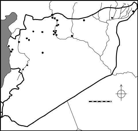
–– Cultural developments in western Syria ––
Syrian–Turkish border at Carchemish down to the confluence of the Balikh and the Euphrates just below the site of Tell Bi’a (ancient Tuttul). The remaining section of the middle Euphrates, which continues to flow in a southeasterly direction towards the Syrian/Iraqi border, includes much of the territory belonging to the kingdom of Mari and will be treated in a separate chapter of this book (Margueron, this volume). The middle Euphrates includes the deeply cut trough of the river itself and a narrow valley of the flood plain and terraces on either side. Beyond the river valley, limestone bluffs rising over 100 metres give way to the upland steppe that stretches for many kilometres in either direction. The Syrian steppe lies to the west, while to the east, the uplands comprise the Jezireh, a vast undulating plain receiving adequate levels of precipitation and bisected by the Balikh and Khabur Rivers, two of the Euphrates’ tributaries.
All of the regions of western Syria and the middle Euphrates Valley differ considerably from the environment of the Sumerian heartland of southern Mesopotamia, where the flat alluvial plains of the Tigris and Euphrates rivers and successful irrigation
|
|
|
Carchemish |
|
|
|
TURKEY |
|
|
|
|
|
|
|
|
||
|
|
|
|
|
Ahmar |
|
|
|
|
|
|
|
|
Qara Quzaq |
|
Chuera |
|
|
|
Jerablus Tahtani |
Balik |
|||||
Amuq |
|
|
|
|
Banat |
|
|
|
|
|
Umm |
Kabir |
|
h |
Jezireh |
||
|
|
|
R |
|||||
Plain |
|
|
el-MarraHadidi Sweyhat |
|
||||
Aleppo |
|
iver |
||||||
|
|
|
Munbaqa |
|
|
|||
|
O |
|
|
Habuba |
Halawa |
Bi’a |
||
|
ron |
Afis |
|
|||||
Qarqur |
|
Kabira |
|
|
|
|
||
teRs |
Ebla |
Syrian Steppe |
|
|
Euph |
|||
Ras |
|
|
|
|
||||
|
|
|
|
r |
||||
Shamra |
iver |
|
|
|
|
|
|
ates |
Sianu |
|
|
|
al-Rawda |
|
|
Rive |
|
Sukas |
|
|
|
|
|
r |
||
|
|
|
|
|
|
|
|
|
 Hama
Hama
 Mishrifeh
 Homs
Homs
 Nebi Mend
SYRIA
 Mozan
Mozan Leilan
Hamoukar
Brak
River
Khabur
IRAQ
Mari
LEBANON
0 |
100 km |
JORDAN
Figure 25.1 Map of Syria, showing the location of sites discussed in the chapter, most of which were occupied in the third millennium BC
479
–– Lisa Cooper ––
regimes elevated agro-pastoral productivity to an unprecedented scale in antiquity. In contrast, all areas of western Syria depended principally on rain-fed agriculture, and several regions, particularly the Syrian steppe lands and the southern section of the middle Euphrates River Valley, received less than adequate precipitation, frequently making dry farming precarious (Wilkinson 1994: 499–500, 2004: 41; Stein 2004: 62–63). It might be this factor, along with the fact that several regions were constrained by topographical features that prevented the cultivation of wide tracts of land, that accounts in part for the smaller growth of Syrian urban settlements when compared to the cities of Sumer. At the same time, Syria’s variety of subsistence pursuits, which combined agricultural activities with pastoralism, not to mention the continuation of small-scale hunting in some areas, gave the regions some economic flexibility, and ensured a reliable flow of sustenance in the face of environmental uncertainties (Cooper 2006: 44–45, 270–271). The activity of trade in various raw materials, especially textiles, metals and timber, conveyed up and down the Euphrates River, as well as along east–west overland routes that connected the Euphrates with trading partners to the west in the direction of Aleppo, the Idlib Plain, the Orontes Valley and the profitable ports on the Mediterranean Sea, further ensured ongoing economic success for some communities and was probably a factor that contributed to their moderate urban development during the third millennium BC.
CHRONOLOGY
Most of the discussion here focuses on developments during the third millennium BC, when many parts of western Syria and the middle Euphrates experienced urban growth and contacts with the Sumerian city-states of southern Mesopotamia (Figure 25.2). This period is the Early Bronze Age, which has been divided up into several subperiods: EB I, II, III and IV. Absolute dates for these sub-periods, obtained from radio-carbon determinations, correlations between well-formulated pottery sequences and their correspondences to reliably dated artefacts, still require considerable refinement. Moreover, the sequences of western Syria and the middle Euphrates Valley require additional work to be properly synchronised with one another. For the present, rough dates for each phase or phases are presented here. EB I is generally thought to begin c.3200–3100 BC, but its end-date is uncertain and has consequently been lumped together with EB II. The end of EB II is fixed c.2600 BC for the middle Euphrates and c. 2700 BC for Western Syria (roughly speaking Early Dynastic IIIa in Sumer). The dating has been largely influenced by the appearance of the unique RedBlack Burnished Ware (RBBW, known also as Early Transcaucasian Ware and Khirbet Kerak Ware) since it was a major diagnostic trait among the ceramic assemblages of western Syria. Although traditional arguments have tended to place the appearance of RBBW at the beginning of the Southern Levant’s EB III, around c.2700 BC, more recent studies have suggested that it may have appeared as early as the end of the fourth millennium and become widespread in the Amuq plains by 2800 BC (Philip and Millard 2000: 280; Mazzoni 2002: 71). We hesitate to push western Syria’s EB III back to an early date on the basis of this type of artefact alone, and so for the moment, we continue to assign western Syria’s EB III to around 2700 BC, until a greater understanding of chronological developments for this elusive period has been achieved.
480

–– Cultural developments in western Syria ––
EB IV, the last phase of the Early Bronze Age is generally thought to begin around 2500 BC in Western Syria and c.2450–2400 BC in the middle Euphrates, although its end-date is still contested. Pottery assemblages with traits diagnostic of the Early Bronze Age continue to appear at a few surviving middle Euphrates settlements after 2100 BC (Cooper 1998), and from this one can postulate that one or two centuries passed before the region experienced the full urban regeneration of the Middle Bronze Age (c.2000–1900 BC). The EB IV in western Syria seems to have persisted over the same length of time, with little evidence of settlement diminishment, and eventually giving way to the MB, whose beginning heralded significant changes in pottery styles, architectural planning, settlement sizes and layout (Morandi-Bonacossi 2009: 63–64; Pinnock 2009: 72–73).
THE LATE URUK AND EB I–II PERIODS
The end of the Late Uruk period and the beginnings of the Early Dynastic Period of Sumer in southern Mesopotamia coincide roughly with the earliest phases of the Early Bronze Age in western Syria and the middle Euphrates Valley (c.3100–2600 BC). The Syrian regions were affected by the ‘Uruk expansion’ of the late fourth millennium, which saw the appearance of many southern Mesopotamian material cultural attributes at a number of sites (Akkermans and Schwartz 2003: 181). Particularly prominent sites with classic Uruk assemblages include Habuba Kabira South and Jebel Aruda in the Tabqa Dam salvage zone of the middle Euphrates Valley. These sites’ evidence of central planning, southern Mesopotamian architectural materials and plans, pottery, and administrative apparatus in the form of numerical tablets, cylinder seals and clay bullae, have such a strong southern Mesopotamian orientation that scholars have
Date (BC) |
Western Syria Middle Euphrates |
Southern |
|
|
Mesopotamia |
2000– |
|
|
Ur III |
|
|
|
|
2200– |
|
Early Bronze IV |
|
|
Early Bronze IV |
Akkadian |
|
|
|
|
|
2400– |
|
|
|
|
|
Early Dynastic III |
|
|
|
|
|
|
|
Early Bronze III |
|
2600– |
|
|
|
Early Bronze III |
|
|
|
|
|
||
|
|
|
Early Dynastic II |
2800– |
|
Early Bronze I+II |
Early Dynastic I |
3000– |
Early Bronze I+II |
|
Jemdet Nasr |
3200– |
|
|
Late Uruk |
|
|
Figure 25.2 Chronology of western Syria and the middle Euphrates region, and their relation to the southern Mesopotamian cultural sequence
481
–– Lisa Cooper ––
postulated these were actually colonial enclaves, settled by peoples from southern Mesopotamia (Akkermans and Schwartz 2003: 190–196). Several other sites with evidence of the Uruk ‘intrusion’ exist in the middle Euphrates River Valley, among them Jerablus Tahtani and Tell Hadidi (Dornemann 1988: 16; Wilkinson et al. 2007: 227–229). They are marked in particular by the presence of the southern, intrusive, bevel-rimmed bowls and varying quantities of other Uruk elements. Not all of these Euphrates sites may have been Uruk colonial enclaves, but nonetheless were still strongly affected by the Uruk expansion, either through the profitable trade routes to raw materials in existence or the efficient systems of administrative control and symbols of prestige which local elite groups adopted and emulated (Frangipane 2009: 22). Further to the west, evidence for the Uruk expansion can also be detected at sites such as Hama, Qarqur and the Amuq, principally in the form of bevel-rimmed bowls (Braidwood and Braidwood 1960: 234–235; Thuesen 1988: 187; Dornemann 2003: 113). Such Uruk material, however, is totally absent at many other sites in the region. It is difficult to know for certain the impact of the Uruk expansion in the more westerly regions of Syria, but it seems unlikely that any settlements experienced full Uruk colonisation like that which took place in the middle Euphrates.
At c.3100–3000 BC, Uruk settlements and Uruk material culture in the middle Euphrates vanished, along with most traces of interaction with southern Mesopotamia (Ur 2010a: 401). What follows is a period of slow socio-economic growth, driven principally by indigenous cultural developments (Schwartz 1994: 154). This slow progression towards urbanism, which did not make any significant strides until c.2600 BC, stands in marked contrast to the situation in Sumer, where the process of urbanism, which had first gained momentum in the earlier fourth millennium, continued unabated into the third millennium and resulted in the formation of Sumer’s prosperous city-states. Nevertheless, there are signs of socio-economic complexity in Syria, and one can speak of the modest growth of small centres even in the early phases of the Early Bronze Age (Akkermans and Schwartz 2003: 211). Moreover, the structures put in place in these early periods provided the bases and the catalysts for the growth of the larger-scale urban societies which emerge in the later third millennium.
Although EB I–II settlements in the middle Euphrates Valley were quite small, averaging no more than a few hectares in size, they were often well defended. Solid lines of defence have been found circuiting the settlements of Tell Habuba Kabira and Tell Halawa B, for example, and the presence of a high mud-brick and stone-boulder citadel on the central mound at Tell es-Sweyhat underlines its defensive capabilities (Heusch 1980: 161; Orthmann 1989: 87–88; Danti and Zettler 2002: 40–41). Considerable planning, resources and labour must have been required for the successful completion and maintenance of these constructions (Cooper 2006: 73).
Evidence for well-established religions traditions come from the site of Qara Quzaq, where a religious complex within its own temenos wall was exposed on a high terrace in the central part of the tell (Olávarri and Valdés Pereiro 2001: 18–26). The complex also included a peculiar above-ground funerary structure containing human remains and a rich assortment of offerings in the form of vessels, metal pins, weapons and jewellery (Olávarri 1995: 16–17). Even more impressive is the mud-brick temple from Tell Halawa B. Set atop an elevated platform in the central part of the site, its exterior facades were adorned with niches and buttresses. The entire complex was set within a temenos enclosure and accessed via a special gatehouse (Orthmann 1989: 89–101). In
482
–– Cultural developments in western Syria ––
its elevated position and monumentality, the temple at Tell Halawa B would no doubt have played a significant role in the religious activities of the inhabitants that it was built to serve (Cooper 2006: 147).
Metal implements, used for agricultural activities, warfare, protection, personal adornment and the production of other crafts, have been found in several early EB middle and upper Euphrates contexts (Cooper 2006: 167–168). Since copper was being mined in Anatolia at this time, the abundance of copper and bronze objects in the Euphrates can be explained by that region’s relative proximity to metal sources. In addition, the discovery also of true tin–bronze alloys as opposed to the more accessible and easily obtainable arsenical copper indicates participation in exchanges over long distances, especially when one considers that tin may have come from as far away as Afghanistan (Montero Fenollós 1999: 456).
Excavations in western Syria have not penetrated extensively into levels of the EBI and II periods, with the exception of a few sites such as Hama, so our understanding of the size and complexity of settlements during this time is far from complete (Mazzoni 2002: 71). It is suspected, however, that most settlements consisted of small, non-literate farming or pastoral communities with only a low degree of economic differentiation and social stratification (Akkermans and Schwartz 2003: 226). One interesting development, as mentioned above, is the appearance in the early EB of a distinctive pottery known as Red-Black Burnished Ware. The pottery is hand-made, highly burnished and has a distinctive red/black colour that stands quite apart from the remainder of the western Syrian ceramic assemblages in terms of its production technology, surface treatment and vessel form. It first appears in small numbers at the site of Tell Judaideh in Phase G of the Amuq Plains and then increases dramatically in frequency in the subsequent Phase H (beginning as early as 2800 BC) (Braidwood and Braidwood 1960: 294, 352). It also appears at several other Syrian sites further south, such as Tell Afis and Qarqur in the early part of the third millennium or even earlier (Mazzoni 2000: 100; Dornemann 2003: 105). Because of its similarities to pottery found to the northeast in Anatolia, and even as far away as the Transcaucasian regions of Georgia, Armenia and Eastern Turkey, RBBW is seen as an exotic element in the local repertoire, and may indicate the presence of a foreign group whose origins may be traced back to these regions to the northeast. Much continues to be written about this distinctive pottery, which has now been found across a broad swathe of the Near East, extending from Iran to the southern Levant, and it remains to be determined if and why migrant populations settled in these regions. Moreover, one still needs to account for the incredible longevity of the ware, which persisted for at least 300 years and continued to be manufactured according to very specific techniques and styles that made it a visible and separate ceramic group from the other local assemblages alongside which it was found (Philip 1999; Philip and Millard 2000; Batiuk 2005; Greenberg and Goren 2009).
EB III–IV PERIODS
Around 2700–2600 BC, the regions of the middle Euphrates and western Syrian experienced increased socio-economic complexity and signs of urban growth. The process of urbanisation, however, was less dramatic than that witnessed in the Khabur Plains of northeastern Syria, where settlements such as Tell Brak, Tell Leilan, Tell
483
–– Lisa Cooper ––
Mozan and Hamoukar grew up to 120 ha and featured urban characteristics such as large-scale secular elite complexes, monumental temples, standardised and specialised craft production and centralised redistributive economies (Weiss and Courty 1993: 133–139; Akkermans and Schwartz 2003: 259–262; Stein 2004: 67; Ur 2010a: 408–409; 2010b: 150–151). In the middle Euphrates Valley, in contrast, some sites appear to have grown up to 40–56 ha only (McClellan 1999: 413), and there is no clear evidence of true settlement hierarchies akin to those observed to the east, with larger centres being served by smaller subsidiaries or tributaries.
On the other hand, other signs of social and economic complexity in the middle Euphrates are evident after 2600 BC. Excavations at Tell Banat, for example, have brought to light a large-scale building (Building 7 and its subsequent, grander manifestation, Building 6) which may have served in some association to the funerary traditions observed at the site given its location within metres of an impressively constructed and richly equipped tomb (Tomb 7) (Porter 2002a: 16). The building was a multi-chambered columned edifice, comprising interconnecting hallways and courtyards spread out over at least three terraces, some of which were paved with baked clay tiles set in bitumen mortar (Porter and McClellan 1998: 25–26; McClellan 1999: 419). Whoever occupied or operated within this structure had access to considerable resources and manpower within a society that appears to have become increasingly segmented. Tomb 7, located only a few metres to the east, was overlaid with massive roofing slabs, below which were several underground chambers accessed by connecting passageways. It was constructed with carefully dressed limestone blocks, all mortared together with bitumen in the same generous quantities observed in Buildings 7 and 6. Within the tomb were several rich burial goods, including precious objects of gold, mother-of-pearl, lapis lazuli and bronze (McClellan and Porter 1999: 109–110).
Tell Banat’s other extraordinary mortuary feature was a 20 metre high, conicalshaped, white-plastered and corrugated earth tumulus known as the White Monument (or Mortuary Monument 1), located about 200 m northeast of the Tell Banat settlement (McClellan 1998: 244–245). While no burial chambers were discovered inside of the tumulus, the funerary character of the White Monument is suggested by the deposits of human and animal remains dug into the sloping sides of it, and the fact that it stands in the centre of fields peppered with other Early Bronze burials of the same period (McClellan 1998: 246; Porter 2002b: 160–161). It has been suggested that such a monument is fitting within a pastoral tribal society, such as that which existed in the region of the middle Euphrates. Providing a central focus for the pastoral groups when they brought their flocks to the well-watered river valley during their seasonal cycle of grazing, the monument countered the centrifugal tendencies of these tribal societies, and may have helped to establish and define group identity (Porter 2002a: 26; Peltenburg 2007–2008: 221, 224).
The mortuary character of other Euphrates sites is evident at several other sites along the middle Euphrates of Syria, including Tell Ahmar, where a massive shaft and stone chamber grave (the ‘Hypogeum’) contained a rich assemblage of pottery and metalwork (Thureau-Dangin and Dunand 1936: 96 and pl. XX); Tell Hadidi, where several similar massively built stone shaft and chamber tombs have been recovered (Dornemann 1979: 118, 1980: 227); and Jerablus Tahtani with its Tomb 302, built of massive limestone blocks and enclosed by what appears to have been a large mound that would have been visible above ground, no doubt accentuating the tomb’s pre-
484
–– Cultural developments in western Syria ––
eminence at the site and the importance of the individuals buried within it (Peltenburg et al. 1995: 7–10; Peltenburg 1999: 430–431). Further down the river, at the Euphrates’ confluence with the Balikh, the site of Tell Bi’a has yielded two rows of large, richly provisioned mud-brick tombs entirely above ground (Strommenger and Kohlmeyer 1998). To the west in the Jabbul Plain, the site of Umm al-Marra has now yielded nine Early Bronze Age tombs and related funerary installations, used in a sequence over a period of some three centuries, from c.2500 to 2200 BC (Schwartz in press). Like several of the Euphrates’ monumental graves, it is conjectured that these tombs may also have been partly or completely visible above ground, and in their prominent location on a high point in the centre of the site’s acropolis, would have emphasised the preeminence of the buried deceased, who may have comprised members of the local ruling families (Schwartz 2007a: 40, 43). All these impressive burial complexes were probably the places where elaborate rituals relating to the veneration of the ancestors were carried out. The visibility and centrality of the tombs would have promoted the remembrance of the ancestors. At the same time, the presence of these prominent tombs, and the repeated funerary offerings and attendant rituals that continued to be performed in and around them, would have perpetuated and reinforced the elevated status of the living elites who claimed descent from the ancestors and were no doubt the main participants in the ongoing mortuary rites at these funerary complexes (Peltenburg
1999: 428; 2007–2008: 228; Schwartz 2007a: 45, 47).
Such well-made and richly furnished tombs indicate that by at least the middle of the third millennium BC, parts of the Euphrates River Valley and western Syria had experienced the growth of social stratification, such that some elite members of society had the wealth and resources to build and furnish for themselves rich funerary markers in the settlements over which they now had considerable influence and authority. At the same time, much of the Syrian middle Euphrates remained a pastoralist-based society, usually typified by inclusive or corporate ideals, where power was shared across different groups and sectors of society (Porter 2002b: 167–168; Peltenburg 2007–2008: 219). The continued reverence of the ancestors, a common practice among pastoral tribes with their emphasis on kin-based descent groups, may have been part of the strategy on the part of newly ascendant elites to perpetuate a tribal-based corporate ideology – effectively linking themselves to the past and the tribal ancestor traditions that defined that past – even when in reality they were exercising more exclusionary forms of behaviour (Porter 2002b: 168–170).
However we choose to interpret the symbolic meaning and import of the monumental tombs of the Euphrates Valley and Umm al-Marra, their richness cannot be denied, particularly in the form of the grave offerings found within them, which consisted of precious stones and metals in the form of gold, silver and bronze. Such imported materials reflect the far-reaching contacts that some individuals of the Euphrates region were capable of carrying out by the mid-third millennium BC. The acquisition and display of such well crafted and costly objects was a means for local elites to highlight their status and prestige within their own communities, Moreover, ownership of such luxury goods would have accentuated their status among their elite peers from other contemporary principalities, affording them membership within the larger club of elite groups, and paving the way for greater economic and social, and possibly political relationships with these outside groups (Cooper 2006: 236; Peltenburg 2007–2008: 235).
485
–– Lisa Cooper ––
Fortifications appear with increasing frequency and size within several settlements of the Euphrates Valley after c.2500 BC, and take on a variety of forms, including defensive walls (some with casemate systems), sloping ramparts, towers, and fortified city-gates (Cooper 2006: 71–86). One also finds large, spatially segregated places of worship, often revealing architectural monumentality and reflecting the presence of well-established religious traditions. Especially noteworthy is the appearance, beginning c.2500 BC, of a simple, standardised temple commonly referred to as a long-roomed temple or a temple in antis, due to its long thick walls or antae that project outward and form a shallow porch at the front. Such temples are particularly well known from the site of Tell Chuera to the east of the Euphrates Valley, where at least four temples have been well documented (Castel 2010: 125–126). Within the Euphrates Valley itself, temples in antis have been documented at the sites of Halawa Tell A, Tell Kabir, and Qara Quzaq. The temple in antis at Halawa Tell A is particularly monumental in proportions (20 x 13 m), and is well preserved, comprising not only its full ground plan and associated cultic installations and equipment within, but also the religious precinct around it, which included an encircling temenos wall, subsidiary rooms for storage, a gate-house and a possible smaller subsidiary shrine (Orthmann 1989: 63–66; Cooper 2006: 154). Much less is known about the surroundings and original contents of the temple in antis at Tell Kabir, although its preserved ground plan reveals it to have been even larger in area than the one at Halawa, measuring 22 x 13 m (286 m2) (Porter 1995: 129–130). The two temples at Qara Quzaq are significantly smaller in area (35 m2 and 112 m2 respectively) (Del Olmo Lete and Montero Fenollós 1998; Olavarri and Valdés Pereiro 2001: 27–30; Castel 2010: 129). Given our somewhat fragmentary evidence for these Early Bronze Age temples, it is difficult at this point to reconstruct precisely the nature of the religious ideologies and cult practices conducted within these sacred complexes. Nonetheless, it is interesting to document the widespread appearance of the temple in antis, which not only occurs in the Euphrates region and to the east at Tell Chuera, but which has now been documented at Ebla and Tell al-Rawda to the west (Castel 2010: 124–126). We link this development to the growth of communication and exchange networks among the settlements of these regions, and the desire, especially on the part of the settlements’ religious and secular elites, to secure their inclusion within a profitable network of exchange through the emulation of neighbouring cities’ material cultural and ideological accoutrements (Cooper 2006: 161).
Turning to western Syria, increasing socio-economic complexity does seem to be indicated between 2700 and 2500 BC during the EB III, especially if we take into account the evidence from Ebla, which hints at the emergence of a city elite stratum with considerable control over the city and its production and consumption (Mazzoni 2003: 180). Elsewhere, EB III occupation has been documented at Syrian sites on the coast (Ras Shamra, Tell Sukas and Tell Sianu) and further inland in the Orontes Valley (Qarqur, Hama, Mishrifeh/Qatna and Tell Nebi Mend), although the limited architectural data do not allow one to ascertain the true size and complexity of these sites. Regarding pottery, one sees the continuing prevalence of Red-Black Burnished Ware along with another distinctive pottery ware, known variously as Pattern-Combed Ware or Cross-Combed Ware. This hand-made, well-fired pottery, which usually takes the form of restricted necked jars with light combing decoration, are thought to be related to the production, transport and consumption of olive oil since they have been found in their greatest abundance in areas where olive trees were grown prolifically in antiq-
486
–– Cultural developments in western Syria ––
uity (Bounni and al-Maqdissi 1994: 29; Mazzoni 2002: 75). Whatever their function, petrographic analysis of the wares implies that the jars often travelled well beyond their places of production, thus reflecting the presence of a regional trade network system within what was probably an increasingly favourable economic market.
From c.2500 BC onward, western Syria reached its greatest level of urbanism and socio-economic complexity, characterised most clearly by the city of Ebla, which during this period expanded significantly, and came to be characterised by a prominent centrally located acropolis. The acropolis supported the sprawling Palace G, home of Ebla’s royal family. There is no question of Ebla’s power and influence during this period, reflected by finds that underline its tremendous wealth, and cuneiform textual records which attest to its far-ranging connections across the Near East, including Sumer. Further details about Ebla are described in another chapter of this book and so we will not repeat them here (Pinnock: this volume). Evidence obtained from excavations at other tell-sites occupied during the EB IV (e.g. Hama, Mishrifeh/Qatna, Afis, Qarqur, Nebi Mend), and the recently growing collection of surveys of areas of the Orontes River Valley, the Homs plateau to the south, and the desert margins to the east, indicate a flourishing, urban environment of cities and intensively exploited agro-pastoral hinterlands, with profitable relationships with other regions and cities facilitated through trade, political alliances and various social exchanges (Bartl and alMaqdissi 2007: 248; Cooper 2007; Philip 2007: 239). Moreover, the appearance of many new sites with EB IV occupation, along with the physical expansion of older sites, indicates a dramatic increase in population during this period. It is possible that the growth and prosperity experienced in western Syria during the EB IV was the result of tapping into the full potential of the fertility of the land as well as exploiting to the fullest various settlements’ strategic locations along profitable east–west or north–south routes of trade and communications (Cooper 2007: 49).
The proliferation of EB IV settlements in the western ‘arid’ margins of the central Syrian steppe to the north and east of Hama and Homs indicate successful attempts to harness the agricultural potential of the various micro-environments of this region, and to maintain large flocks of sheep and goats. Particularly noteworthy is the site of al-Rawda, located about 70 km to the northeast of Mishrifeh/Qatna. The 18–20 ha settlement may have been founded as early as 2500 BC and appears to have persisted for at least three centuries (Castel et al. 2008: 34; Castel: pers. comm.). Geomagnetic investigations have revealed that al-Rawda was composed of a dense array of structures linked to one another by radial and concentric streets, and surrounded by a fortified enclosure (Castel and Peltenburg 2007: 604). This urban entity, which appears to have been constructed according to a pre-conceived design, is not unlike other circular cities in Syria to the north and east such as Mari and Tell Chuera (Castel and Peltenburg 2007: 612). Moreover, many of al-Rawda’s features show associations with other parts of Syria, including one of its temples, which bears a typical ‘temple in-antis’ plan (Castel 2010: 124–125).
The advent of the Akkadian imperial power beginning c.2350 BC affected several parts of Syria. In the Khabur Plains, site abandonments, the decline of agricultural productivity and population decreases took place shortly after the Akkadian conquest of that area and its efforts to re-structure the region’s political governance (Akkermans and Schwartz 2003: 282–283; Weiss and Courty 1993: 139–141). We know from cuneiform inscriptions that Akkadian forces under kings such as Sargon and Naram-
487
–– Lisa Cooper ––
Sin also marched up the Euphrates River, destroying cities such as Mari and Tuttul (Tell Bi’a) on their way to further conquests to the northwest. Physical proof of these military activities may be reflected by the considerable augmentation to fortifications seen in the latest EB levels of most settlements in the middle Euphrates region (Cooper 2006: 73), and by the destruction of the Jebel Bazi citadel on the Euphrates at Tell Banat, which is argued to have been the result of a military encounter between the inhabitants of the settlement, which was possibly the city of Armanum, and the Akkadian forces under Naram-Sin (Otto 2006). Further to the west, many attribute the destruction by fire of the great Palace G at Ebla in the late twenty-fourth century BC to the Akkadian king Sargon, this event effectively bringing an end to Ebla’s supremacy in the west, although still others argue that Ebla’s demise may have been at the hands of Mari, the other major political power vying for control over the Euphrates and parts of western Syria during this period (Archi and Biga 2003: 35). Whatever military encounters occurred, and whoever they were orchestrated by, neither western Syria nor the Euphrates River Valley was brought to the brink of collapse. On the contrary, while there are signs of disturbances and the demise of some settlements, still other settlements continued to exist and flourish up to the end of the third millennium BC. In the middle Euphrates River Valley, one sees the abandonment of the large polity of Tell Banat/Bazi, and of smaller sites such as Jerablus Tahtani, but other urban centres such as Tell es-Sweyhat continued to thrive until at least 2100 BC (Cooper 2006: 264–265). A recent re-assessment of occupation within and around Carchemish to the north suggests that the city flourished late in the Early Bronze Age and continued to be settled, without a break, into the second millennium BC (Peltenburg 2010). In western Syria, while Ebla’s famed palace may have been brought to a fiery end, this event did not signal the demise of Ebla as a city. We know that another EB palace was re-established in the northern part of the city’s lower town, and that EB settlement continued at this site for several more centuries (Pinnock 2009: 69–71). Still other settlements in western Syria have ample evidence for continued occupation into the last centuries of the third millennium (Schwartz 2007b: 49–52).
It is difficult to account for the success of settlement in western Syria and parts of the Euphrates Valley, especially when other regions such as the Khabur Plains to the east or the southern Levant underwent several centuries of impoverishment and ruralisation in the latter part of the third millennium. We may surmise that a number of factors were involved, one at least of which was the regions’ distance from major power-centres of the Near East from which some of the most significant destabilising effects emanated, namely southern Mesopotamia and Egypt. Neither western Syria nor the middle Euphrates Valley was ever directly controlled by rulers from these lands, nor were the regions’ economies utterly dependent on their ties to these lands for their continued success and survival. Thus when Egypt experienced decline at the end of the Old Kingdom, and Mesopotamia underwent a series of regime changes at the end of the third millennium, these events and their consequences do not seem to have dramatically affected the essential livelihood of the Syrian principalities. On the contrary, the relatively peaceful centuries of EB IV in western Syria paved the way for the rapid urban renewal that took place in the succeeding Middle Bronze Age, and allowed for the continuation of occupation at most of the major western Syrian sites such as Ebla, Hama and Mishrifeh/Qatna, and Carchemish on the Euphrates (Morandi-Bonacossi 2009: 65 and 66 n. 19; Peltenburg 2010).
488
–– Cultural developments in western Syria ––
WESTERN SYRIAN/MIDDLE EUPHRATES–SUMERIAN
INTERCONNECTIONS
This overview of developments in the third millennium BC in the Euphrates River Valley and western Syria has tried to show how much of the progression towards increasing socio-economic complexity and urbanism were internally driven: that these phenomenon were the natural outgrowth of structures already in place at the start of the third millennium BC, and fuelled by the growth of local elite powers, possibly through their interactions with one another, the production and trade of various raw materials and crafted products, and the intensification of agricultural production. At the same time, it is also important to consider the strength of the effects from the outside during this period, particularly from Sumer in southern Mesopotamia.
Textual information attesting to connections between western Syria and Sumer from the early centuries of the third millennium BC is scant, although we might suggest that some form of communication and contact was made during this period, albeit in a far less systematic and intensive manner than was witnessed in the previous Late Uruk period. The second half of the third millennium, in contrast, appears to have been a period of considerable interconnections. At the end of the Early Dynastic period, the Sumerian ruler Lugalzagesi, for example, claims to have subjugated all of the lands as far as the ‘Upper Sea’, the designation for the Mediterranean Sea (Frayne 2008: 436). While his claim of dominion over such a vast area is no doubt highly exaggerated, it does show his awareness of the lands to the west, probably because of their rich resources in materials such as timber and their locations on trade routes to metal sources. The campaigns of Akkadian kings were undoubtedly motivated by southern Mesopotamia’s continuing interest in exploiting the resource-rich areas of western Syria and the areas accessible beyond it. Gudea, the Sumerian ruler at Lagash in the twentysecond century BC, claims to have received timber from the Amanus Moutains and textiles from Ebla (Klengel 1992: 35; Edzard 1997: 33). The Ur III dynasty at the end of the third millennium was in close economic contact with Syrian centres such as Tuttul (Tell Bi’a), Ebla and Urshu to the north, and it is possible that a Neo-Sumerian king, Shu-Sin, launched an expedition which took him up into Syria, reaching Ebla, among other cities, and ‘the land where the cedars are cut down’ (Klengel 1992: 36; Frayne 1997: 301).
The archaeological record from Syria provides further proof of interconnections with Sumer. Cylinder seals found in the Euphrates Valley and western Syria utilise motifs and imagery prevalent in Early Dynastic southern Mesopotamia, although it must be noted that such seals also bear local characteristics and are never slavish copies of Sumerian prototypes (Schwartz 1994: 164, 167 n. 11). Stone sculpture from the site of Tell Chuera to the east of the Euphrates, taking the form of alabaster worshipper statues, compares favourably with similarly sculpted votive figures from the Diyala region of southern Mesopotamia (Aruz 2003: 63). The evidence from Ebla, dated to the end of the Sumerian Early Dynastic period, provides some of the richest evidence for contact with Sumer. Inscribed tablets from that site, although rendered in the Northwest Semitic Eblaite language, employed the system of syllabic cuneiform writing that was directly borrowed from pre-Sargonic Mesopotamia. Moreover, the contents of several literary compositions and lexical texts from Ebla allow comparisons to be drawn with the tablets excavated at Abu Salabikh and Fara in southern Iraq
489
–– Lisa Cooper ––
(Klengel 1992: 22; Akkermans and Schwartz 2003: 239). Finely crafted art objects discovered in Ebla’s Palace G comprise many Sumerian motifs and styles (Matthiae 1981: 79–81). Most significantly, the discovery of large amounts of unworked lapis lazuli in Palace G, a valuable semi-precious stone that had been obtained from as far away as eastern Afghanistan, confirms that long-distance trade was being actively carried out. The stone was probably being conveyed to Ebla via Sumer and the Euphrates’ city of Mari, the principal gateway between southern Mesopotamia and the lands of Syria (Pinnock 1988: 110)
Such connections between Sumer and western Syria and the middle Euphrates over the many centuries of the third millennium BC almost certainly had an impact on Syria’s development, affecting its culture and society in a number of ways. Commercial exchanges with Sumer stimulated economic growth, and introduced exotic and rare materials that were used by various Syrian elite groups to set themselves apart in their own communities and enhance their prestige and high status (Schwartz 1994: 165). Also appropriated were aspects of Sumerian elite social behaviour. Noteworthy in this regard are elite drinking practices which find reflection in the growing preponderance of drinking cups that have been found in late third millennium Syrian contexts, particularly in parts of western Syria. Such goblets are tall and cylindrical, and often corrugated or decorated with horizontal and wavy bands of paint. They have been found in large quantities at Palace G at Ebla, suggesting they were part of the Ebla royal establishment’s dining ware, likely serving as drinking cups for the consumption of some liquid – possibly wine – at special banquets or ceremonies (Cooper 2007: 44). The propensity for drinking and postulated drinking celebrations are probably attempts to emulate Sumerian drinking practices, these having frequently accompanied successful harvests, the completion of temple construction projects to honour the gods, or successful military ventures (Cooper 2007: 44). Such activities are frequently represented as ‘banquet’ scenes on a number of Sumerian objects which include cylinder seals, wall plaques and the famous Royal Standard of Ur (Pollock 2003: 22). By emulating this Sumerian behaviour, western Syrian individuals, mostly elites, were endeavouring to link themselves to the cosmopolitan urban centres of southern Mesopotamia, showing themselves to be part of that civilised community, and at the same time, distinguishing themselves from the common people of their cities by engaging in these types of exclusive parties (Bunimovitz and Greenberg 2004: 27).
WESTERN SYRIA/MIDDLE EUPHRATES’ DISTINCTIVE
CULTURAL TRADITIONS AND BELIEFS
As presented above, much of the contact between Sumer and western Syria and the middle Euphrates seems to have been at the level of trade and communications with local Syrian elites who were eager to legitimate and intensify their prestige and wealth (Akkermans and Schwartz 2003: 277). It is also likely that along with these elite exchanges, general notions about what constitutes a city, with its various physical features and urban modes of behaviour, were also transmitted, along with administrative technologies such as cylinder seals (Stein 2004: 72). At the same time, it is difficult to argue that Sumerian culture and the Sumerian ‘way of doing things’ penetrated fully into Syrian society, affecting at a deeper level modes of social organisation, political structures and ideological beliefs and practices. Indeed, despite contact with
490
–– Cultural developments in western Syria ––
Sumer, the peoples of western Syria and middle Euphrates Valley continued to follow their own distinctive modes of cultural behaviour, these deriving from older, deeply seated traditions and ways of thinking. Some of the regions’ distinctive cultural traditions have already been described in the discussion above, but it may be of value to review here in detail the specific areas where western Syria/middle Euphrates culture differed from that of Sumer. Our discussion parallels some of Gil Stein’s (2004) suggested areas of divergence between northern and southern Mesopotamia, but further elaborations and evidence specific to the regions of western Syria are also presented here.
a)Syrian temples. The institution of the temple in Syria had a different place in society, when contrasted with the temples of Sumer. While temples are present in the Syrian Euphrates Valley and western Syria, they lack the same over-arching importance within the cities as in Sumer. Sumerian temples were perceived of as the dwelling places of the city-gods, and in most cases, Sumerian cities had grown up around earlier temple-centred towns extending back as early as the Ubaid period (Stein 2004: 74). Moreover, some of the earliest powerhouses, not only of religious authority, but also of socio-economic and political authority, emanated from the Sumerian house of the god, and the earliest individuals who assumed ruling status over the communities did so through their close connection to the temples and their claim to have been sanctioned by the gods. In the case of Syria, temples have been documented in many urban communities, but they rarely appear to be central to the operation of the city, and there does not appear to be any tangible link between these places of worship and local forms of political or economic authority (Stein 2004: 75). Temple complexes can have monumental features, as evidenced by some of the examples of large temples in antis at Halawa Tell A and Tall Kabir, as reviewed above, but monumentality is not the rule; indeed, many temples have modest features and dimensions. It is also common to find more than one temple in antis complex within a single settlement, as at Qara Quzaq and Tell Chuera, suggesting that these should be regarded more as neighbourhood places of worship, or serving small numbers of a local group, than constituting the principal ritual focus of an entire community (Stein 2004: 76).
b)Religious ideologies. Although the precise nature of religious beliefs and the cult in western Syria and the middle Euphrates Valley is still somewhat obscure, it is clear that they diverge from what existed in Sumer. From Syrian textual sources, we know the names of some of the deities worshipped in these regions: Dagan, Malik, Kura, Nidabal, Adda and Rashap. These deities are clearly separate from well-known Sumerian pantheon of gods (i.e. Enlil, Inanna). The god Dagan appears to have been particularly associated with the Euphrates region of Syria, with cult centres at Tuttul (Tell Bi’a) and possibly another site close to the Euphrates’ polity of Gasur, north of Emar (Feliu 2003: 23, 303). Unfortunately, the texts fail to provide any particulars concerning the ways these gods were venerated. Images from wall paintings from Halawa Tell B and Tell Munbaqa of possible divine beings, some holding tree branches, some featuring large circular eyes between tapering stalks atop tree-trunk images or human-like bodies, may hint at the ways in which the Syrian Euphrates gods were perceived, distinguishing them from their Sumerian neighbours who customarily portrayed their deities anthropomorphically or with a different suite of symbols (Orthmann 1981: 42; Cooper 2006: 92–94). On the other hand, the people of the middle Euphrates Valley were not entirely removed from the religious imagery of
491
–– Lisa Cooper ––
southern Mesopotamia, as evidenced by the fragments of a carved stele from the temple in antis at Halawa Tell A, whose layout in registers and images of animal motifs and human worshippers compares favourably with the established canon of sculptural representation from Early Dynastic Sumer (Orthmann 1985: 471). Nevertheless, subtle differences in the Syrian compositions – for example, the Halawa stele presents a female animal bearer, not a male, the standard representation in southern Mesopotamia – may indicate somewhat different beliefs about the roles and responsibilities of gods, men and women in the sphere of religion and sacred ritual (Orthmann 1985: 470–471; Cooper
2006: 154).
c)Funerary traditions and social structures. The distinctive funerary practices of the Euphrates River Valley during the Early Bronze Age reflect a somewhat divergent system of beliefs about death and the afterlife. They also refer to different modes of social organisation among the living compared to that which existed among the Sumerians of southern Mesopotamia. The striking presence of monumental shaft and chamber tombs in the Syrian Euphrates Valley and at Umm al-Marra is another notable feature not seen in Sumer, these often located in prominent intramural locations in settlements, and partially or wholly visible, drawing attention to their importance even among the living members of the community (Peltenburg 1999: 427–428). As already discussed, such funerary monuments probably served as the focal points for the veneration of ancestors, another phenomenon that has been traditionally linked to tribally organised pastoral societies, with their emphasis on kin-based descent groups (Stein 2004: 72). It is clear that such funerary traditions, which appear to reflect the persistence of more corporate, lineage-based forms of social organisation in the Euphrates Valley, stand in marked contrast to Sumerian society, which, during the Early Dynastic period, saw many individuals in society increasingly removed from their traditional family or kinship ties as they joined the workforces of the larger socioeconomic households – namely the palaces and temples – of their city-states (Pollock
1999: 117–118).
d)Kingship. The evidence for corporate forms of social organisation in western Syria and the middle Euphrates, and the dissemination of authority and decision-making across a number of groups or individuals in a community rather than being concentrated in the hands of one individual or a single authoritative group or class, leads naturally to questions about the presence and nature of kingship. The Ebla texts of the twenty-fourth century BC provide good support for the presence of city rulers and their royal lineage at that city, not to mention the physical presence of a royal complex, grandiose Palace G, which served as the dwelling place of the Ebla king and his royal household. The Ebla texts’ mention of still other cities and states in western Syria and the middle Euphrates Valley which had kings does seem to indicate that powerful individuals with some form of political authority over their territories existed, at least during part of the third millennium BC. At the same time, we must be cautious not to place too much confidence in the words of Ebla officials and scribes, who may have had a different understanding of the political and social organisation of groups distant from their own city-state (Cooper 2006: 65).
Archaeologically, the discovery of elite contexts, especially monumental, richly furnished tombs, suggests that certain individuals or families were able to amass considerable wealth and resources for themselves within their communities and that such affluence may have translated into political authority as well. On the other hand,
492
–– Cultural developments in western Syria ––
indications of ruling families outside of the evidence for rich tombs are not always easy to find. In western Syria, evidence for the storage and redistribution of large quantities of materials has been recovered from a large complex of structures on the acropolis mound during the second half of the third millennium BC at the site Mishrifeh/Qatna (Morandi Bonacossi 2007: 69). It may prove to be something on the order of a palatial structure, but elsewhere in western Syria beyond Ebla, similar palaces have not been discovered. In the middle Euphrates Valley, the absence of artefacts pointing to largescale economic or large-scale administrative activities within the few large-scale secular buildings which have been discovered cannot justify the existence of a centralised and bureaucratised royal establishment with extensive control over the rest of the settlements. Moreover, the diversity of house structures, the variability of outer city defences, and the presence of independently operated production facilities at these Euphrates sites suggest that many aspects of the cities’ operations fell outside the controlling forces of these elite complexes (Cooper 2006: 141).
The organisation of authority or kingship in western Syria and the middle Euphrates is clearly very complex, and given the varied expressions of elite status manifested in this region, it is probable that the nature of power fluctuated greatly as did the degree to which it was attained and exercised in each community. Perhaps we can envision that while some elite groups played a prominent role in socio-economic and political activities at some sites, and there may even have been local rulers with a degree of wealth or control over some facets of urban society, still other sites had a tradition in which an exclusionary or centralising authority was far more limited. This latter model would certainly fit well with what we know from contemporary or later textual sources from Syria, which speak of councils of elders in some communities, these groups either serving as an official body that decided town affairs in the absence of a local individual chief or king, or existing alongside them, serving as an independent body of decision-making for the community and off-setting the attainment of exclusionary power among any one elite group or individual (Schwartz 1994: 166; Stein 2004: 74; Fleming 2004: 190–200). Whatever the case, it seems clear from the evidence just described that the nature of kingship in western Syria differed from the well-known examples of city rulers that existed in Sumer from the same time period.
CONCLUSIONS
As the summary above has tried to emphasise, connections between Sumer and parts of western Syria were clearly present and resulted in a number of significant developments, including the intensification of long-distance trade and commercial exchanges as well as the appropriation of symbols of power, which were particularly of benefit to elite members in Syrian society desirous to showcase their wealth and prestige within their communities and among their peers from neighbouring polities. But differences between the regions, rooted in deep-seated religious traditions, social structures and concepts of decision-making and leadership, meant that western Syria and the middle Euphrates Valley followed different developmental trajectories, especially during the third millennium BC. Even though all the areas shared strides towards increasingly complex societies and urban environments, the particular nature of those phenomena, and the way they manifested themselves materially, continued to differ for the duration of the millennium. The areas’ different environmental zones were responsible for some
493
–– Lisa Cooper ––
of these differences. The unique tribal pastoral character, particularly in the middle Euphrates, may account for distinctive socio-political developments, namely the prevention or constraint of the growth of absolute kingships and highly centralised governments. As for parts of western Syria, its fertility and potential for both agricultural and pastoral productivity, coupled with the region’s location at a crossroads of trade and communication, not only with the lands of Mesopotamia but also Egypt and other polities reached via the Mediterranean Sea, gave it plenty of opportunities for economic growth and varying cultural stimuli. At the same time, distance from the principal Near Eastern centres of power, namely Sumer and Egypt, meant that the people of western Syria would never be subject to those civilisations’ rises and falls. While they never experienced the heights of success and prosperity of these neighbouring polities, they also did not have to suffer from their tumultuous demises. They continued to sustain themselves and maintain their own cultural traditions, relatively free from outside interference, right up to the end of the third millennium BC.
REFERENCES
Akkermans, P. and Schwartz, G. (2003) The Archaeology of Syria. From Complex Hunter Gatherers to Early Urban Societies (ca. 16,000–300 BC). Cambridge: Cambridge University Press.
Archi, A. and Biga, M.G. (2003) ‘A Victory over Mari and the Fall of Ebla.’ Journal of Cuneiform Studies 55: 1–44.
Aruz, J. (ed.) (2003) Art of the First Cities. The Third Millennium B.C. from the Mediterranean to the Indus. New York: Metropolitan Museum of Art.
Bartl, K. and al-Maqdissi, M. (2007) ‘Ancient Settlements in the Middle Orontes Region between arRastan and Qal’at Shayzar. First Results of Archaeological Surface Investigations 2003–2004.’ In D. Morandi Bonacossi (ed.) Urban and Natural Landscapes of an Ancient Syrian Capital: Settlement and Environment at Tell Mishrifeh/Qatna and in Central-Western Syria. Udine: Forum, pp. 243–252.
Batiuk, S.D. (2005) ‘Migration Theory and the Distribution of the Early Transcaucasian Culture.’ Unpublished Ph.D. dissertation, University of Toronto.
Bounni, A. and al-Maqdissi, M. (1994) ‘La céramique peignée à la lumière des fouilles syriennes à Tell Sianu.’ In P. Calmeyer, K. Hecker and L. Jakob-Rost (eds.) Beitrage zur Altorientalischen Archaeologie und Altertumskunde Festschrift für Barthel Hrouda zum 65. Geburstag. Wiesbaden: Harrassowitz, pp. 19–29.
Braidwood, R.J. and Braidwood, L.S. (1960) Excavations in the Plain of Antioch 1: The Earlier Assemblages, Phases A–J. Chicago: University of Chicago Press.
Bunimovitz, S. and Greenberg, R. (2004) ‘Revealed in their Cups: Syrian Drinking Customs in Intermediate Bronze Age Canaan.’ Bulletin of the American Schools of Oriental Research 334: 19–31.
Castel, C. (2010) ‘The First Temples in antis. The Sanctuary of Tell al-Rawda in the Context of Third Millennium Syria.’ In J. Becker, R. Hempelmann and E. Rehm (eds) Kulturlandschaft Syrien. Zentrum und Peripherie. Festschrift für Jan-Waalke Meyer. Münster: Ugarit Verlag, pp. 123–64.
Castel, C., and Peltenburg, E. (2007) ‘Urbanism on the Margins: Third Millenniumbcal-Rawda in the Arid Zone of Syria.’ Antiquity 81: 601–616.
Castel, C., Archambault, D., Awad, N., Barge, O., Boudier, T., Brochier, J., Cuny, A., Gondet, S., Herveux, L., Isnard, F., Martin, L., Quenet, P., Sanz, S. and Vila, E. (2008) ‘Rapport préliminaire sur les activités de la mission archéologique franco-syrienne dans la micro-région d’Al-Rawda (Shamiyeh): quatrième et cinquième campagnes (2005 et 2006).’ Akkadica 129: 5–54.
Cooper, E.N. (1998) ‘The EB-MB Transitional Period at Tell Kabir, Syria.’ In M. Fortin and O. Aurenche (eds) Espace Naturel, Espace Habité en Syrie du Nord (19e-2e millénaires av. J-C.).
Lyon: Maison de l’Orient Méditerranéen, pp. 271–280.
494
–– Cultural developments in western Syria ––
Cooper, L. (2006) Early Urbanism on the Syrian Euphrates. London: Routledge.
—— (2007) ‘Exploring the Heartland of the Early Bronze Age ‘Caliciform’ Culture.’ Journal of the Canadian Society for Mesopotamian Studies 2: 43–50.
Danti, M. and Zettler, R. (2002) ‘Excavating an Enigma. The latest discoveries from Tell es-Sweyhat.’
Expedition 44: 36–45.
Del Olmo Lete, G. and Montero Fenollós, J. (1998) ‘Du temple à l’entrepôt. Un exemple de transformation de l’espace urbain à Tell Qara Quzaq en Syrie du nord.’ In M. Fortin and O. Aurenche (eds) Espace Naturel, Espace Habité en Syrie du Nord (19e-2e millénaires av. J-C.). Lyon: Maison de l’Orient Méditerranéen, pp. 295–304.
Dornemann, R. (1979) ‘Tell Hadidi: A Millennium of Bronze Age City Occupation.’ In D.N. Freedman (ed.) Archaeological Projects from the Tabqa Dam Project – Euphrates Valley, Syria, (AASOR 44). Cambridge, MA: American Schools of Oriental Research, pp. 113–151.
——(1980) ‘Tell Hadidi: An Important Center of the Mitannian Period and Earlier.’ In J.-C. Margueron (ed.) Le Moyen Euphrate. Leiden: E.J. Brill, pp. 218–234.
——(1988) ‘Tell Hadidi: One Bronze Age Site among Many in the Tabqa Dam Salvage Area.’
Bulletin of the American Schools of Oriental Research 270: 13–42.
——(2003) ‘Seven Seasons of ASOR Excavations at Tell Qarqur, Syria, 1993–1999.’ In N. Lapp (ed.)
Preliminary Excavations Reports and Other Archaeological Investigations. The Annual of the American Schools of Oriental Research 56. Boston: ASOR, pp. 1–141.
Edzard, D.O. (1997) Gudea and His Dynasty, Royal Inscriptions of Mesopotamia, Early Periods 3/1. Toronto: University of Toronto Press.
Feliu, L. (2003) The God Dagan in Bronze Age Syria. Leiden: Brill.
Fleming, D. (2004) Democracy’s Ancient Ancestors. Mari and Early Collective Governance. Cambridge: Cambridge University Press.
Frangipane, M. (2009) ‘Rise and Collapse of the Late Uruk Centres in Upper Mesopotamia and Eastern Anatolia.’ Scienze dell’Antichità 15: 15–31.
Frayne, D. (1997) Ur III Period (2112–2004 BC), Royal Inscriptions of Mesopotamia, Early Periods 3/2. Toronto: University of Toronto Press.
—— (2008) Presargonic Period (2700–2350 BC), Royal Inscriptions of Mesopotamia, Early Periods 1. Toronto: University of Toronto Press.
Greenberg, R. and Goren, Y. (2009) ‘Migrating Technologies at the Cusp of the Early Bronze III.’
Tel Aviv 36: 129–134.
Heusch, J.-C. (1980) ‘Tall Habuba Kabira im 3. und 2. Jahrtausend: Die Entwicklung der Baustruktur.’ In J.-C. Margueron (ed.) Le Moyen Euphrate. Leiden: E.J. Brill, pp. 159–178.
Klengel, H. (1992) Syria, 3000–300 B.C. Berlin: Akademie Verlag.
Matthiae, P. (1981) Ebla, An Empire Rediscovered. Garden City, NY: Doubleday.
Mazzoni, S. (2000) ‘From the Late Chalcolithic to Early Bronze I in North-West Syria: Anatolian Contact and Region Perspective.’ In C. Marro and H. Hauptmann (eds.) Chronologies des pays du Caucase et de l’Euphrate aux IVe-IIIe millénaires. Paris: de Boccard, pp. 97–114.
——(2002) ‘The Ancient Bronze Age Pottery Tradition in Northwestern Central Syria.’ In M. al-Maqdissi, V. Matoïan and C. Nicolle (eds) Céramique de l’âge du Bronze en Syrie. I: La Syrie du sud et la vallée de l’Oronte. Beyrouth: IFAPO, pp. 69–96.
——(2003) ‘Ebla: Crafts and Power in an Emergent State of the Third Millennium BC Syria.’
Journal of Mediterranean Archaeology 16: 173–191.
McClellan, T.L. (1998) ‘Tell Banat North: The White Monument.’ In M. Lebeau (ed.) About Subartu. Studies devoted to Upper Mesopotamia. Vol. 1: Landscape, Archaeology, Settlement, (Subartu
4). Turnout: Brepols, pp. 243–269.
—— (1999) ‘Urbanism on the Upper Syrian Euphrates.’ In G. Del Olmo Lete and J.-L. Montero Fenollós (eds) Archaeology of the Upper Syrian Euphrates. The Tishrin Dam Area. Proceedings of the International Symposium Held at Barcelona, Jan. 28th-30th, 1998. Barcelona: Editorial Ausa, pp. 413–424.
495
–– Lisa Cooper ––
McClellan, T.L. and Porter, A. (1999) ‘Survey of Excavations at Tell Banat: Funerary Practices.’ In G. Del Olmo Lete and J.-L. Montero Fenollós (eds) Archaeology of the Upper Syrian Euphrates. The Tishrin Dam Area. Proceedings of the International Symposium Held at Barcelona, Jan. 28th-
30th, 1998. Barcelona: Editorial Ausa, pp. 107–116.
Montero Fenollós, J.-L. (1999) ‘Metallurgy in the Valley of the Syrian Upper Euphrates during the Early and Middle Bronze Ages.’ In G. Del Olmo Lete and J.-L. Montero Fenollós (eds)
Archaeology of the Upper Syrian Euphrates. The Tishrin Dam Area. Proceedings of the International Symposium Held at Barcelona, Jan. 28th-30th, 1998. Barcelona: Editorial Ausa, pp. 443–469.
Morandi Bonacossi, D. (2007) ‘Qatna and its Hinterland during the Bronze and Iron Ages. A Preliminary Reconstruction of Urbanism and Settlement in the Mishrifeh Region.’ In D. Morandi Bonacossi (ed.) Urban and Natural Landscapes of an Ancient Syrian Capital: Settlement and Environment at Tell Mishrifeh/Qatna and in Central-Western Syria. Udine: Forum,
pp. 65–90.
——(2009) ‘Tell Mishrifeh and its Region During the EBA IV and the EBA-MBA Transition. A First Assessment.’ In P. Parr (ed.) The Levant in Transition. Proceedings of a Conference held at the British Museum on 20–21 April 2004. Leeds: Maney, pp. 56–68.
Olávarri, E. (1995) ‘Dos tumbas del Bronce Antiguo de Qara Quzaq.’ Aula Orientalis 13: 15–23. Olávarri, E. and Valdés Pereiro, C. (2001) ‘Excavaciones en Tell Qara Quzaq: Campañas IV-VI
(1992–1994).’ In G. del Olmo Lete, J.-L. Montero Fenollós and C. Valdés Pereiro (eds) Tell Qara Quzaq II. Campañas IV-VI (1992–1994). Barcelona: Editorial Ausa, pp. 13–76.
Orthmann, W. (1981) Halawa 1977–1979. Bonn: Dr. Rudolf Habelt.
——(1985) ‘Art of the Akkade Period in Northern Syria and Mari.’ MARI 4: 469–474.
——(1989) Halawa 1980–1986. Bonn: Dr. Rudolf Habelt.
Otto, A. (2006) ‘Archaeological Perspectives on the Localization of Naram-Sin’s Armanum.’ Journal of Cuneiform Studies 58: 1–26.
Peltenburg, E. (1999) ‘The Living and the Ancestors: Early Bronze Age Mortuary Practices at Jerablus Tahtani.’ In G. Del Olmo Lete and J.-L. Montero Fenollós (eds) Archaeology of the Upper Syrian Euphrates. The Tishrin Dam Area. Proceedings of the International Symposium Held at Barcelona, Jan. 28th-30th, 1998. Barcelona: Editorial Ausa, pp. 427–442.
——(2007–2008) ‘Enclosing the Ancestors and the Growth of Socio-Political Complexity in Early Bronze Age Syria.’ Scienze dellÀntichità 14: 215–247.
——(2010) ‘The Emergence of Carchemish as a Major Polity: Contributions from the Land of Carchemish Project (Syria), 2006.’ In P. Matthiae, F. Pinnock, L. Nigro and N. Marchetti (eds) Proceedings of the 6th International Congress on the Archaeology of the Ancient Near East. Wiesbaden: Harrassowitz, pp. 539–552.
Peltenburg, E., Campbell, S., Croft, P., Lunt, D., Murray M.A. and Watt, M.E. (1995) ‘JerablusTahtani, Syria, 1992–4: Preliminary Report.’ Levant 27: 1–28.
Philip, G. (1999) ‘Complexity and Diversity in the Southern Levant during the Third Millennium BC: The Evidence of Khirbet Kerak Ware.’ Journal of Mediterranean Archaeology 12: 26–57.
—— (2007) ‘Natural and Cultural Aspects of the Development of the Marl Landscape East of Lake Qatina during the Bronze and Iron Ages.’ In D. Morandi Bonacossi (ed.) Urban and Natural Landscapes of an ancient Syrian Capital: Settlement and Environment at Tell Mishrifeh/Qatna and in Central-Western Syria. Udine: Forum, pp. 233–242.
Philip, G. and Millard, R. (2000) ‘Khirbet Kerak Ware in the Levant: The Implications of Radiocarbon Chronology and Spatial Distribution.’ In C. Marro and H. Hauptmann (eds) Chronologies des pays du Caucase et de l’Euphrate aux IVe-IIIe millénaires. Paris: de Boccard, pp. 279–296.
Pinnock, F. (1988) ‘Observations on the Trade of Lapis Lazuli in the IIIrd Millennium B.C.’ In H. Waetzoldt and H. Hauptmann (eds) Wirtschaft und Gesellschaft von Ebla. Heidelberg: Heidelberg Orientverlag, pp. 107–110.
—— (2009) ‘EBIVB-MBI in Northern Syria: Crisis and Change of a Mature Urban Civilization.’ In P. Parr (ed.) The Levant in Transition. Proceedings of a Conference held at the British Museum on 20–21 April 2004. Leeds: Maney, pp. 69–79.
496
–– Cultural developments in western Syria ––
Pollock, S. (1999) Ancient Mesopotamia. Cambridge: Cambridge University Press.
—— (2003) ‘Feasts, Funerals and Fast Food in Early Mesopotamian States.’ In T. Bray (ed.) The Archaeology and Politics of Food and Feasting in Early States and Empires. New York: Kluwer Academic, pp. 17–38.
Porter, A. (1995) ‘The Third Millennium Settlement Complex at Tell Banat: Tell Kabir.’ Damaszener Mitteilungen 8: 125–163.
——(2002a) ‘The Dynamics of Death: Ancestors, Pastoralism, and the Origins of a ThirdMillennium City in Syria.’ Bulletin of the American Schools of Oriental Research 325: 1–36.
——(2002b) ‘Communities in Conflict. Death and the Contest for Social Order in the Euphrates River Valley.’ Near Eastern Archaeology 65: 156–173.
Porter, A. and McClellan, T. (1998) ‘The Third Millennium Settlement Complex at Tell Banat: Results of the 1994 Excavations.’ Damaszener Mitteilungen 10: 11–63.
Schwartz, G.M. (1994) ‘Before Ebla: Models of Pre-State Political Organization in Syria and Northern Mesopotamia.’ In G. Stein and M. Rothman (eds) Chiefdoms and Early States in the Near East: The Organizational Dynamics of Complexity. Madison: Prehistory Press, pp. 153–169.
——(2007a) ‘Status, Ideology and Memory in Third-Millennium Syria: ‘Royal’ Tombs at Umm el-Marra.’ In N. Laneri (ed.) Performing Death. Social Analyses of Funerary Traditions in the ancient Near East and Mediterrranean. Chicago: University of Chicago Press, pp. 39–68.
——(2007b) ‘Taking the Long View on Collapse: A Syrian Perspective.’ In C. Kuzucuoglu and C. Marro (eds) Sociétés humaines et changement climatiques à la fin du IIIe millénaire. Une crise al-t-elle eu lieu en Haute Mésopotamia? Paris: de Boccard, pp. 45–67.
——(in press) ‘Era of the Living Dead: Funerary Praxis and Symbol in Third Millennium BC Syria.’ In H. Niehr, E. Pernicka and P. Pfälzner (eds) (Re-)Constructing Funerary Rituals in the Ancient Near East. Wiesbaden.
Stein, G. (2004) ‘Structural Parameters and Sociocultural Factors in the Economic Organization of North Mesopotamian Urbanism in the Third Millennium BC.’ In G. Feinman and L. Nicholas (eds) Archaeological Perspectives on Political Economies. Salt Lake City: University of Utah Press, pp. 62–63.
Strommenger, E. and Kohlmeyer, K. (1998) Tell Bi’a/Tuttul – 1: Die Altorientalischen Bestattungen. Saarbrücken: Saarbrücker Druckerei und Verlag.
Thuesen, I. (1988) Hama. Fouilles et Recherches 1931–1938. I: The Preand Protohistoric Periods.
Copenhagen: Nationalmuseet.
Thureau-Dangin, F. and Dunand, M. (1936) Til-Barsib. Paris: Librairie Orientaliste Paul Geuthner. Ur, J. (2010a) ‘Cycles of Civilization in Northern Mesopotamia, 4400–2000 BC.’ Journal of
Archaeological Research 18: 387–431.
—— (2010b) Urbanism and Cultural Landscapes in Northeastern Syria: The Tell Hamoukar Survey,
1999–2001. Chicago: Oriental Institute.
Weiss, H. and Courty, M.-A. (1993) ‘The Genesis and Collapse of the Akkadian Empire: The Accidental Refraction of Historical Law.’ In M. Liverani (ed.) Akkad, the First World Empire. Padua: Sargon, pp. 131–155.
Wilkinson, T.J. (1994) ‘The Structure and Dynamics of Dry-Farming States in Upper Mesopotamia.’
Current Anthropology 35: 483–520.
—— (2004) On the Margin of the Euphrates: Settlement and Land Use at Tell es-Sweyhat and in the Upper Lake Assad Area, Syria. Chicago: Oriental Institute of the University of Chicago.
Wilkinson, T.J., Peltenburg, E., McCarthy, A., Wilkinson, E.B., and Brown, M. (2007) ‘Archaeology and the Land of Carchemish: landscape surveys in the area of Jerablus Tahtani 2006.’ Levant
39: 213–247.
497