

BURMA |
49 |
|
General |
49 |
Buoyage System |
49 |
Currency |
49 |
Government |
50 |
Holidays |
50 |
Industries |
50 |
Languages |
50 |
Navigational Information |
50 |
Search and Rescue |
50 |
Signals |
50 |
Time Zone |
50 |
U.S. Embassy |
50 |
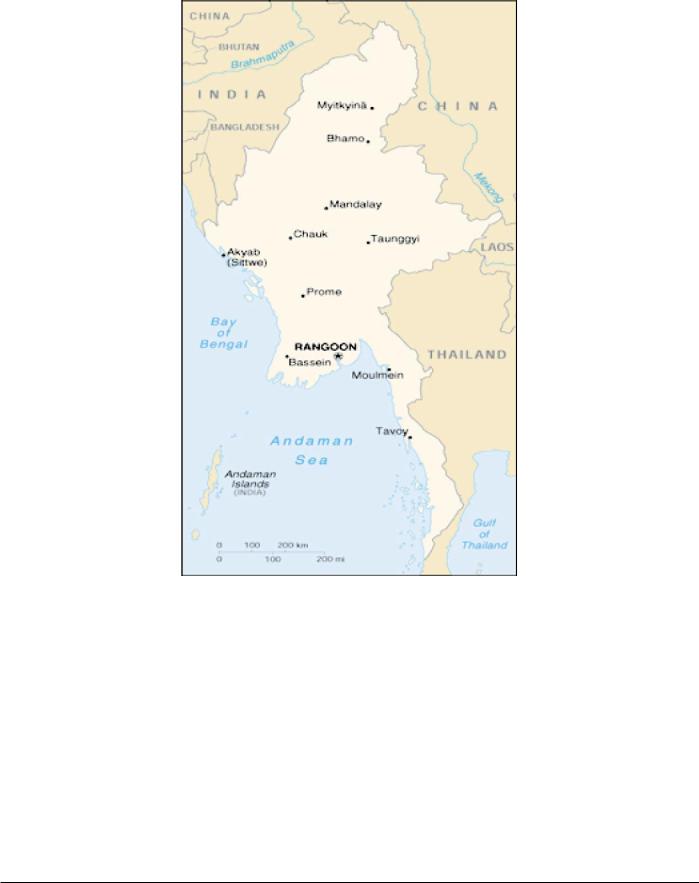
bounded on the W by Bangladesh and India, on the N by China, and on the E by Laos and Thailand.
The terrain consists of a central lowland ringed by steep, rugged highlands.
The climate is mostly tropical monsoon. The summer is rainy, hot, and humid during the Southwest Monsoon (June to September). The winter is mild, with lower humidity during the Northeast Monsoon (December to April).
Buoyage System
The IALA Buoyage System (Region A) is in effect. See Chart No. 1 for further IALA Buoyage System information.
General
Burma, also known as Myanmar, is located in Southeast Asia and borders the Andaman Sea and the Bay of Bengal. It is
Currency
The official unit of currency is the kyat, consisting of 100 pyas.
Pub. 160
50 |
Burma |
Government |
Other industries include wood processing, textiles, footwear, |
|
mining, cement, petroleum refining, pharmaceuticals, fertilizer, |
|
fishing, livestock raising, and tourism. |
Flag of Burma
Burma, also known as Myanmar, is a military regime. The country is divided into seven states and seven administrative divisions.
Burma is governed by Chairman of the State Peace and Development Council. The People’s Assembly was to have consisted of 485 directly-elected members serving 4-year terms; however, the last election was conducted in 1990 and the People’s Assembly was never allowed to convene by the military regime.
The legal system is based on remnants of the British era, but there is no guarantee of fair trials, as the judiciary is not independent of the military regime.
The capital is Rangoon (referred to by the regime as Yangon).
Languages
Burmese is the official language. The use of English is permitted in commerce and education.
Navigational Information
The maritime territorial claims of Burma are, as follows:
Territorial Sea * |
12 miles. |
Contiguous Zone ** |
24 miles. |
Fisheries or Economic |
200 miles. |
Zone |
|
Continental Shelf |
200 miles or the |
|
Continental Margin. |
*Requires advance permission or notification for innocent passage of warships in the territorial sea. Claims the following as internal waters:
1.All waters inside a 223 mile baseline closing the Gulf of Martaban.
2.All waters inside straight baselines connecting coastal islands.
**Also considered a Security Zone.
Holidays
The following holidays are observed:
January 4 |
Independence Day |
February 12 |
Union Day |
March 2 |
Peasants’ Day |
March 27 |
Armed Forces Day |
May 1 |
May Day |
July 19 |
Martyrs Day |
December 25 |
Christmas Day |
Other holidays, which are subject to the appearance of the moon, are Full Moon of Tabaung, Thingyan (Burmese Water Festival), Burmese New Year's Day, Full Moon of Kason (Beginning of Buddhist Lent), Full Moon of Waso, Full Moon of Thadingyut (End of Buddhist Lent), Tazaungdaing, National Day, Karen New Year, Idul Athwaha, and Dewali.
Search and Rescue
Search and rescue operations are coordinated between the Myanmar air force, the Myanmar navy, the Department of Civil Aviation, and the Department of Marine Administration. A Maritime Rescue Coordination Center is located in Rangoon (Yangon). Rangoon (Yangon) Coast Radio Station maintains a continuous listening watch on international distress frequencies.
Signals
Storm Signals
The General System, the Brief System, or the Extended System of storm signals may be used in Burmese ports. For further information, see India—Signals—Storm Signals.
Time Zone
The observed Standard Time is 6 hours 30 minutes fast of UT(GMT). Daylight Savings Time is not observed.
Industries
The principal industry is agriculture. The major crops include rice, sugarcane, groundnuts, oilseed, corn, jute, cotton, and opium.
U.S. Embassy
The U.S. Embassy is situated at 581 Merchant Street, Rangoon (GPO 521).
The mailing address is Box B, APO AP 96546.
Pub. 160
CAMEROON |
51 |
|
General |
51 |
Buoyage System |
51 |
Currency |
51 |
Government |
51 |
Holidays |
52 |
Industries |
52 |
Languages |
52 |
Navigational Information |
52 |
Search and Rescue |
52 |
Time Zone |
52 |
U.S. Embassy |
52 |
General
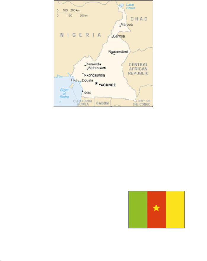
Cameroon, located on the SW coast of Africa, is bounded on the NW by Nigeria; on the E by Chad and the Central African Republic; and on the S by the Republic of Congo, Gabon, and Equatorial Guinea.
The country may be divided into four distinct physical regions, as follows:
1.The S region consists of a coastal plain covered by dense rain forests.
2.The central region consists of the Adamawa Plateau, which is 1,370m high.
3.The N region is a transitional area, with forests giving way to savanna country. In the far N part of this region, the savanna gradually slopes into marshland surrounding Lake Chad.
4.The W region consists of forested mountains up to 4,090m high.
Numerous rivers are located along the coast but are generally
encumbered with rapids.
The climate is equatorial, with high temperatures and plentiful rainfall occurring during all seasons. The heaviest rain falls from March to June and from September to November.
Buoyage System
The IALA Buoyage System (Region A) is in effect. See Chart No. 1 for further IALA Buoyage System information.
Currency
The official unit of currency is the French African Community franc, consisting of 100 centimes.
Government
Flag of Cameroon
Cameroon is a republic. The country is divided into ten provinces.
Pub. 160

52 |
Cameroon |
Cameroon is governed by a directly-elected President serving a 7-year term. The Prime Minister and the Council of Ministers are appointed by the President. The National Assembly consists of 180 directly-elected members serving 5-year terms; the President may shorten or lengthen the term. The constitution provides for the formation of an upper chamber, called the Senate, but this has not been created.
The legal system is based on French civil law and English common law.
The capital is Yaounde.
Holidays
The following holidays are observed:
January 1 |
New Year’s Day/Indepen- |
|
dence Day |
February 11 |
Youth Day |
Feast of the |
Variable |
Lamb |
|
Good Friday |
Variable |
Holy Saturday |
Variable |
Easter Sunday |
Variable |
Easter Monday |
Variable |
May 1 |
Labor Day |
May 1 |
Ascension Day |
May 20 |
National Day |
August 15 |
Assumption of the Blessed |
|
Virgin Mary |
December 25 |
Christmas Day |
Islamic holidays, which are subject to the appearance of the moon, include Eid Al-Fitr (End of Ramadan) and Eid Al-Adha (End of Pilgrimage).
In addition, two or more local holidays are usually celebrated in each region. Autonomous provinces may celebrate certain local holidays instead of some of the general holidays.
Industries
The main industries are the production of crude oil, hardwoods, textiles, aluminum, food, and beverages. Other industries include metals, chemicals, cement, timber, fishing, livestock raising, and tourism. Crops include cassava, sorghum, millet, maize, plantains, yams, groundnuts, bananas, palm kernels, cocoa, coffee, rubber, and cotton.
Languages
English and French are the official languages; however, 24 major African dialects are also spoken.
Navigational Information
The only maritime claim of Cameroon is a territorial sea of 12 miles.
Search and Rescue
Douala Coast Radio Station maintain a continuous listening watch for distress calls on 2182 kHz.
Time Zone
The Time Zone description is ALFA (-1). Daylight Savings Time is not observed.
U.S. Embassy
The U.S. Embassy is situated at Rue Nachtigal, Yaounde. The mailing addresses are, as follows:
1.Cameroon address— P.O. Box 817 Yaounde
2.U.S. address—
American Embassy Yaounde
Department of State
Washington DC 20521-2520
U. S. Embassy Cameroon Home Page
http://yaounde.usembassy.gov
Pub. 160