

DJIBOUTI |
61 |
|
General |
61 |
Buoyage System |
61 |
Cautions |
61 |
Currency |
61 |
Government |
61 |
Holidays |
62 |
Industries |
62 |
Languages |
62 |
Navigational Information |
62 |
Search and Rescue |
62 |
Time Zone |
62 |
U.S. Embassy |
62 |
Cautions
Special Warning 121 (Issued 20 March 2003)
Information on Special Warning 121 can be found in Iraq— Cautions.
Special Warning 115 (Issued 5 March 2001)
Information on Special Warning 115 can be found in Iraq— Cautions.
General
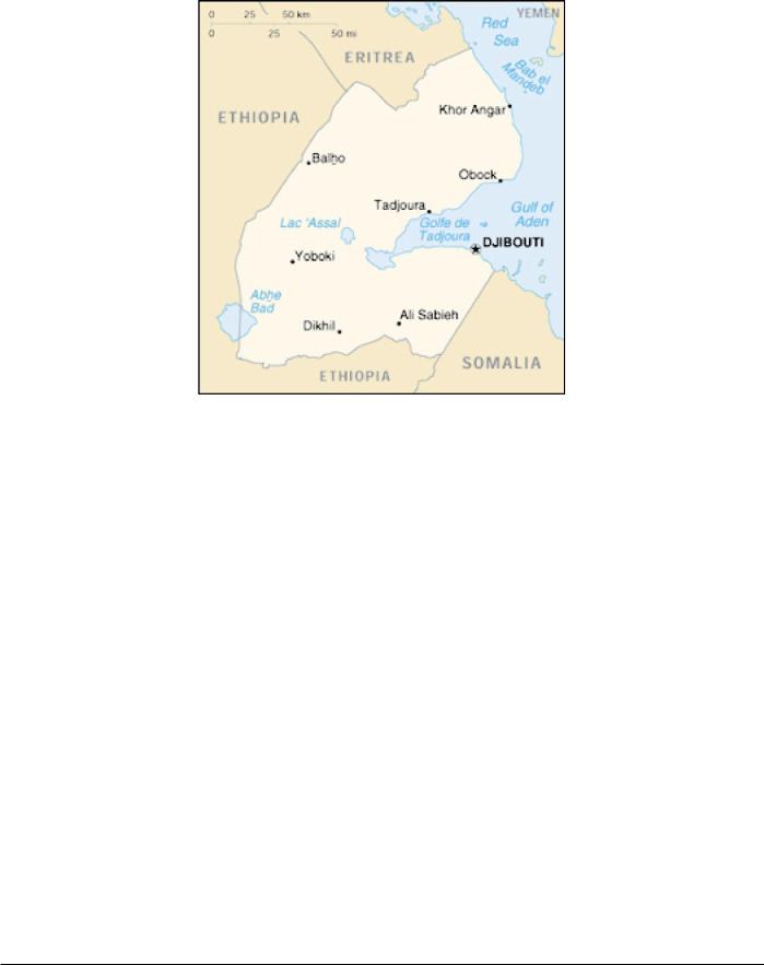
Djibouti, located in the NE part of Africa, has a coast, about 195 miles long, and extends for about 48 miles inland. It is bordered on the NW by Eritrea, on the W by Ethiopia, on the SE by Somalia, and on the E by the Gulf of Aden.
The country has a coastal plain and a plateau, separated by central mountains.
The climate is dry, with high temperatures and sparse rainfall.
Buoyage System
The IALA Buoyage System (Region A) is in effect. See Chart No. 1 for further IALA Buoyage System information.
Currency
The official unit of currency is the Djibouti franc, consisting of 100 centimes.
Government
Djibouti is a republic. The country is divided into five provinces.
Djiboiti is governed by a directly-elected President serving a 6-year term. The unicameral Parliament consists of a 65-mem- ber directly-elected Chamber of Deputies serving 5-year terms.
The legal system is based on French civil law, Islamic law, and traditional practices.
The capital is Djibouti.
Pub. 160

62 |
Djibouti |
Flag of Djibouti
Holidays
The following holidays are observed:
January 1 |
New Year’s Day |
May 1 |
Labor Day |
June 27 |
Independence Day (2 days) |
December 25 |
Christmas Day |
Islamic holidays, which are subject to the appearance of the moon, include Eid-il-Fitr (End of Ramadan), Eid-il-Adha (End of Pilgrimage), Hijrah (Islamic New Year), Ashoora, and the Prophet’s Birthday.
Industries
The country provides services as both a transit port for the region (free trade zone) and an international transshipment and refueling center. It has few natural resources and little industry.
Scanty rainfall limits crop production. The principal exports are hides, cattle, and coffee (in transit).
Languages
French and Arabic are the official languages. Several Somali and Afar dialects are also widely used.
Navigational Information
The maritime territorial claims of Djibouti are, as follows:
Territorial Sea * |
12 miles. |
Contiguous Zone |
24 miles. |
Fisheries or Economic |
200 miles. |
Zone |
|
* Nuclear-powered vessels and vessels transporting nuclear materials or other radioactive substances are required to give notice prior to entering the territorial sea.
Search and Rescue
Djibouti Coast Radio Station maintains a continuous listening watch for distress calls on VHF channel 16.
Time Zone
The Time Zone description is CHARLIE (-3). Daylight Savings Time is not observed.
U.S. Embassy
The U.S. Embassy is situated at Plateau du Serpent, Boulevard Marechal Joffre, Djibouti.
The mailing address is B.P. 185, Djibouti.
Pub. 160

EGYPT |
63 |
|
General |
63 |
Buoyage System |
63 |
Cautions |
63 |
Currency |
63 |
Government |
63 |
Holidays |
64 |
Industries |
64 |
Languages |
64 |
Mined Areas |
64 |
Navigational Information |
64 |
Regulations |
64 |
Routes |
64 |
Search and Rescue |
65 |
Signals |
65 |
Time Zone |
65 |
U.S. Embassy |
65 |
General
Egypt is located in the N part of Africa. It is bordered on the N by the Mediterranean Sea; on the W side by Libya; on the E side by the Gaza Strip, Israel, the Gulf of Aqaba, and the Red Sea; and on the S by Sudan. The Sinai Peninsula, which forms the E part of the country, is bordered on its W by the Gulf of Suez and the Suez Canal and on its E by the Gulf of Aqaba.
A number of Egyptian islands lie within the Gulf of Suez and the Red Sea. These include Jazirat Jubal, Jazirat Shakir, Jazair Jiftun, and Jazirat Zabarjad (St. Johns Island).
The Nile River, in the 960 miles of its course through Egypt, does not receive a single tributary. The First Cataract is near Aswan (24˚05'N., 32˚52'E.), above which has been constructed the High Dam. Most of the country is an arid desert. Only the Nile valley, the Nile delta, and some oases are cultivated. Sev-
eral mountain ranges intersect the desert between the Nile River and the Red Sea. The climate is arid with hot, dry summers and moderate winters.
Buoyage System
The IALA Buoyage System (Region A) is in effect. See Chart No. 1 for further IALA Buoyage System information.
Cautions
Special Warning 121 (Issued 20 March 2003)
Information on Special Warning 121 can be found in Iraq— Cautions.
Special Warning 115 (Issued 5 March 2001)
Information on Special Warning 115 can be found in Iraq— Cautions.
Currency
The official unit of currency is the Egyptian pound, consisting of 100 piastres.
Government
Egypt is a republic. The country is divided into 26 governorates.
Egypt is governed by a President, nominated by the People’s Assembly to serve a 6-year term, and confirmed in a national referendum. The unicameral 454-member People's Assembly, which is the principal legislative body, consists of 444 directlyelected members and ten appointed members, all serving 5-
Pub. 160

64 |
Egypt |
Flag of Egypt
year terms. There is also a 264-member Advisory Council, which functions only in a consultive capacity; it is composed of 176 directly-elected members and 88 appointed members.
The legal system is based on English common law, Islamic law, and the Napoleonic code.
The capital is Cairo.
Holidays
The following holidays are observed:
January 7 |
Coptic Christmas |
April 25 |
Sinai Liberation Day |
Easter Monday |
Variable |
May 1 |
Labor Day |
June 18 |
Evacuation Day |
July 23 |
Revolution Day |
October 6 |
Armed Forces Day |
October 24 |
Suez Victory Day |
December 23 |
Victory Day |
Islamic holidays, which are subject to the appearance of the moon, include Eid Al-Fitr (End of Ramadan), Eid Al-Adha (End of Pilgrimage), Hijrah (Islamic New Year), Sham El Nessim (Spring Holiday), and the Prophet’s Birthday.
Industries
Agriculture is the chief industry, with cotton being the most important crop. Other crops include rice, onions, beans, wheat, corn, and barley. Other industries include textiles, chemicals, petroleum products, cement, tourism, and shipping (via the Suez Canal).
Languages
Arabic is the official language. English and French are widely understood by the educated classes.
Mined Areas
Due to dangerous mines, navigation is prohibited within an area on the W side of the Red Sea in an area bounded by the following positions:
a.28˚38.5'N, 32˚51'E.
b.28˚38.5'N, 32˚53'E.
c.28˚35.0'N, 32˚56'E.
d.28˚33.5'N, 32˚55'E.
Navigational Information
The maritime territorial claims of Egypt are, as follows:
Territorial Sea * |
12 miles. |
Contiguous Zone ** |
24 miles. |
Fisheries or Economic |
200 miles. |
Zone |
|
Continental Shelf |
Depth of 200m or the Limit |
|
of Exploitation. |
*Requires advance permission or notification for innocent passage of warships in the territorial sea.
**Also considered a Security Zone. Egypt claims the right to prior permission for entry of nuclear-powered vessels, vessels carrying nuclear materials, and foreign vessels carrying hazardous or other wastes.
Regulations
Navigation
Navigation may be prohibited in certain areas within 20 miles of the Egyptian coast.
Vessels bound for Egyptian ports or navigating off the Egyptian coast are advised to obtain the latest information from their agents.
All vessels should send an ETA at least 24 hours in advance to the port authorities indicating their last port of call, position, course, and speed. Vessels navigating within 24 miles of the Egyptian coast should contact the port authorities for entry instructions.
Vessels bound for Egyptian ports in the Red Sea should request permission to enter Egyptian waters from the port authorities, through their agents, at least 48 hours before crossing the parallel of 23˚N.
Vessels in the Gulf of Suez (Khalij as Suways) should maintain a listening watch on VHF channel 16.
Routes
Traffic Separation Scheme
An extensive IMO-adopted Traffic Separation Scheme (TSS) exists within the Gulf of Suez.
The following TSS-associated rules for vessels navigating in the Gulf of Suez have been approved by the IMO:
1.1 Ships should take into account that crossing traffic may be encountered in the traffic junction eastward of Ain Sukhna and in the precautionary area off Ras Shukheir,
Pub. 160

Egypt |
65 |
and should be in a high state of readiness to maneuver in these areas.
1.2Exceptional care is needed, when overtaking another ship within a lane, not to enter the separation zone or force the overtaken ship to do so.
1.3Ships navigating in the Gulf of Suez are requested to keep a continuous listening watch on the Suez Gulf Traffic Information Broadcasts and report any aids to navigation which are malfunctioning or are out of position and that are not already included in the broadcasts.
2.1All oceangoing ships should have their radar in effective use by day and at night throughout the passage between Shaker Island and Suez Port as an aid to achieving maximum feasible lane conformity and avoiding risk of collision. Particular care is required for strict adherence to the confines of relevant traffic lanes.
2.2Ships proceeding S from Suez should be alert for tankers heading for the SUMED Oil Terminal, situated off Ain Sukhna.
2.3Northbound tankers heading for the SUMED Oil Terminal should report their intention of using the traffic junction off Ain Sukhna on the appropriate frequencies.
2.4All ships, northbound and southbound, when navigating through the precautionary area off Ras Shukheir or in the vicinity of the July Oil Field should avoid overtaking within the traffic lanes in these areas.
2.5All ships, including service and supply craft serving the July, Ramadan, and Morgan Oil Fields, proceeding in and out of the Ras Shukheir Oil Terminal should only cross the southbound and northbound traffic flow through the precautionary area. Within this precautionary area, local rules relating to crossing traffic apply.
2.6Tankers leaving the Ras Shukheir Oil Terminal and intending to join the northbound traffic lane should only do so when no through southbound traffic is in the vicinity and should always report their movements to other ships beforehand on VHF.
2.7Ships anchored in the designated waiting area for Ras Shukheir should ensure that they are never less than
0.25mile from the edge of the southbound traffic lane and should pay special regard to their correct light signals for ships at anchor. They should also show their deck lights.
Suez Canal
The Suez Canal, a sea-level waterway, connects Port Said (Bur Said) on the Mediterranean Sea with Suez (As Suways) on the Red Sea. It has a total length of 193.5km (including approaches); it has been reported (2003) that the Suez Canal has been dredged to a depth of 18.9m, with further plans to dredge the canal to a depth of 20.1m by 2006. The canal was originally opened for traffic on November 17, 1869 and nationalized in 1956. It was closed in June 1967 due to military conflict and reopened in June 1975. Regulations, restrictions, and other operational details concerning transit of the Suez Canal are fully described in Pub. 172, Sailing Directions (Enroute) Red Sea and the Persian Gulf.
Search and Rescue
The Middle East Search and Rescue Center at the Joint Rescue Coordination Center (JRCC) Cairo is responsible for coordinating search and rescue operations and can be contacted by e-mail, as follows:
jrcc136@afmic.gov.eg
A network of coast radio stations maintains a continuous listening watch on international distress frequencies.
Signals
Visual storm warning signals used in Egypt are given in the accompanying table.
Egypt—Storm Signals
Day |
Night |
|
Meaning |
|
|
|
|
One black triangle, |
— |
|
Gale from NW |
point up |
|
quadrant |
|
|
|
||
|
|
|
|
One black triangle, |
— |
|
Gale from SW |
point down |
|
quadrant |
|
|
|
||
|
|
|
|
Two black triangle, |
|
|
Gale from NE |
points up, |
— |
|
|
|
quadrant |
||
vertically disposed |
|
|
|
|
|
|
|
|
|
|
|
Two black |
|
|
|
triangles, points |
— |
|
Gale from SE |
down, vertically |
|
quadrant |
|
|
|
||
disposed |
|
|
|
|
|
|
|
Two black triangle, |
|
|
|
bases together, ver- |
— |
|
Storm |
tically disposed |
|
|
|
|
|
|
|
White flag with |
Four red lights, |
|
Sea too rough. |
vertically dis- |
|
Pilots cannot |
|
yellow anchors |
|
||
posed |
|
go out. |
|
|
|
||
|
|
|
|
Time Zone
The Time Zone description is BRAVO (-2). Daylight Savings Time (CHARLIE (-3)) is maintained from the end of April through the end of September; the exact changeover dates should be obtained from local authorities.
U.S. Embassy
The U.S. Embassy is situated at 5 Latin America Street, Garden City, Cairo.
The mailing address is Unit 64900, Box 15, APO AE 098394900.
U.S. Embassy Egypt Home Page http://cairo.usembassy.gov
Pub. 160