Добавил:
Опубликованный материал нарушает ваши авторские права? Сообщите нам.
Вуз: Предмет: Файл:

ppl_04_e2

.pdf
Скачиваний:
4454
Добавлен:
26.01.2018
Размер:
12.8 Mб
Скачать

ID: 3658

Customer: Oleg Ostapenko E-mail: ostapenko2002@yahoo.com Customer: Oleg Ostapenko E-mail: ostapenko2002@yahoo.com

C H A P T ER 2 3 : T H E

THIS IS LONDON VOLMET MAIN

AMSTERDAM AT 1125.

WIND 160 DEGREES 16 KNOTS.

VARIABLE BETWEEN 130 AND 190 DEGREES. VISIBILITY 7 KILOMETRES.

LIGHT RAIN SHOWERS.

CLOUD FEW 2 THOUSAND FEET. FEW CUMULONIMBUS 2 THOUSAND 5 HUNDRED FEET.

BROKEN 4 THOUSAND FEET. TEMPERATURE 14. DEWPOINT 9 QNH 1004

BECOMING

VISIBILITY 10 KILOMETRES OR MORE. NIL SIGNIFICANT WEATHER.

BRUSSELS AT 1120

WIND 190 DEGREES 14 KNOTS MAXIMUM 24 KNOTS.

VISIBILITY 10 KILOMETRES OR MORE. LIGHT RAIN SHOWERS.

CLOUD SCATTERED 2 THOUSAND 3 HUNDRED FEET.

SCATTERED 5 THOUSAND FEET. BROKEN 10 THOUSAND FEET. TEMPERATURE13. DEWPOINT 10. QNH 1006.

NOSIG.

GLASGOW AT 1120.

WIND 070 DEGREES 5 KNOTS.

VARIABLE BETWEEN 030 AND 110 DEGREES. VISIBILITY 10 KILOMETRES OR MORE. CLOUD FEW 1 THOUSAND 8 HUNDRED FEET SCATTERED 4 THOUSAND 5 HUNDRED FEET. TEMPERATURE 14. DEWPOINT 8.

QNH 997.

DUBLIN AT 1130.

WIND 260 DEGREES 6 KNOTS.

VARIABLE BETWEEN 240 AND 300 DEGREES. VISIBILITY 10 KILOMETRES OR MORE. CLOUD SCATTERED 2 THOUSAND 4 HUNDRED FEET.

TEMPERATURE 13. DEWPOINT 6. QNH 997.

NOSIG.

The

information on VOLMET

broadcasts is

updated every 30 minutes.

LONDON/GATWICK AT 1120. WIND 190 DEGREES 10 KNOTS.

VARIABLE BETWEEN 150 AND 220 DEGREES. VISIBILITY 10 KILOMETRES OR MORE. SHOWERS IN VICINITY.

CLOUD FEW CUMULONIMBUS 2 THOUSAND 4 HUNDRED

SCATTERED 4 THOUSAND FEET.

TEMPERATURE 11. DEWPOINT 9. QNH 999.

LONDON/HEATHROW AT 1120.

WIND 220 DEGREES 12 KNOTS.

VARIABLE BETWEEN 190 AND 250 DEGREES. VISIBILITY 10 KILOMETRES OR MORE. LIGHT RAIN SHOWERS.

CLOUD FEW 2 THOUSAND FEET. BROKEN 11 THOUSAND FEET. TEMPERATURE 11. DEWPOINT 8. QNH 997.

TEMPO

VISIBILITY 4 THOUSAND 5 HUNDRED METRES.

RAIN SHOWERS.

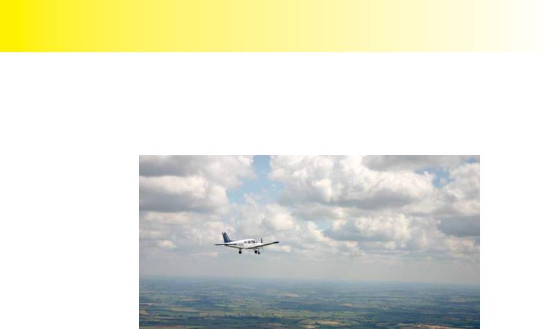
Figure 23.2 Example VOLMET broadcasts from LONDON VOLMET MAIN.

287

Order: 6026

Customer: Oleg Ostapenko E-mail: ostapenko2002@yahoo.com

Customer: Oleg Ostapenko E-mail: ostapenko2002@yahoo.com

C H A P T ER 2 3 : V O L M ET

VOLMET BROADCASTS IN THE HIGH FREQUENCY BAND.

The VOLMET broadcasts that we have spoken of, so far, are transmitted in the VHF band. However, VOLMETS are also broadcast, all over the world, in the High Frequency (HF) band, typically between 3 to 20 MHz. A selection of HF VOLMET is depicted in Figure 23.3.

ATIS


Automatic Terminal Information Service


VOLMET

Routine Broadcast of Meteorological Information for Aircraft In Flight


(INTL)


VOLMET

Routine Broadcast of Meteorological Information for Aircraft In Flight


(NATL)


WX


Weather Broadcast


Inactive or Planned Service


EUR-MET Europe


Freq

Type

BCH +

Call

State

Station Name


Latitude

Longitude

Remarks

(Mhz)


Sign


(N)

(E/W)


2.998


VOLMET


unassigned


3.413


VOLMET

00,30

EIP

IRL

Shannon


52 34 N

09 12 W

1800-0530Z

4.540


WX

15,45

MLD

GBR

Architect


57 39 N

03 34 W


(Kinloss)


4.645


ATIS

Cont

ES..

EST

Tallinn


59 25 N

24 50 E

ex-RPH 6


4.742


WX

00,30

MLP

GBR

Architect (Brize


51 45 N

01 35W


Norton)


VOLMET

.., 35

GFG

GIB

Gibraltar


36 09 N

05 21 W


VOLMET

15, ..

GFW

CYP

Cyprus


34 35 N

32 58 E

Mo-Fr 0215-


(Akrotiri)


1815Z

5.450


VOLMET

00, 30

MPL

GBR

West Drayton


“RAF”


2


(London)


5.505


VOLMET

00, 30

EIP

IRL

Shannon


52 34 N

09 12 W


5.714


WX

00, 30

MLP

GBR

Architect (Brize


51 45 N

01 35 W


Norton)


6.580


VOLMET


unassigned


Figure 23.3 International HF VOLMET Broadcasts.

The Shannon VOLMET, shown in Figure 23.3, is a vital source of weather information for North Atlantic flight routes.

The types of VOLMETs listed in Figure 23.3 contain the same information as the VOLMETs for mainland United Kingdom, although they are more likely also to contain additional weather forecast details, such as SIGMETS for en-route weather.

VOLMET transmissions are designed to be simple and easily understood, so that fast, efficient weather briefing can be obtained by pilots in flight.

During pre-flight planning, note down the VOLMET frequencies for the areas that you will be flying in, so that, en-route, you can listen to broadcasts for aerodromes in the vicinity of your destination, as well as for alternate aerodromes.

Access to VOLMET broadcasts enables the pilot to confirm that weather conditions at his destination airfield are favourable. If a diversion becomes necessary, the current suitability of the planned diversion airfield can also be rapidly determined.

288

ID: 3658

Customer: Oleg Ostapenko E-mail: ostapenko2002@yahoo.com

Customer: Oleg Ostapenko E-mail: ostapenko2002@yahoo.com

C H A P T ER 2 3 : T H E V O L M

R e p r e s e n t a t i v e P P L - t y p e q u e s t i o n s t o t k n o w l e d g e o f T h e V O L M ET .

1.An aerodrome VOLMET report for 0450 UTC during the autumn in the United Kingdom is given as follows:

Surface wind

150/05 kts

Visibility

2000 m

Weather

Nil

Temperature

9º C

Dew point

8º C

QNH

1029 mb

Trend

NOSIG

From the information above, what type of pressure system, do you deduce, is dominating the region?

a.An anti-cyclone

b.A cyclone

c.A low pressure

d.A trough

2.A VOLMET is defined as:

a.A radio broadcast of selected aerodrome forecasts

b.A continuous telephone message of selected aerodrome METARs

c.A continuous radio broadcast of selected aerodrome actual weather observations and forecasts

d.A teleprinter message of selected aerodrome TAFs and METARs

3.VOLMETs are updated:

a.Every hour

b.4 times a day

c.2 times a day

d.Every half hour

4.VOLMETs are:

a.Air to ground radio transmissions in the HF and VHF bands

b.Air to ground radio transmissions in the HF and SVHF bands

c.Ground to air radio transmissions in the LF and VHF bands

d.Ground to air radio transmissions in the HF and VHF bands

289

Order: 6026

Customer: Oleg Ostapenko E-mail: ostapenko2002@yahoo.com

Customer: Oleg Ostapenko E-mail: ostapenko2002@yahoo.com

C H A P T ER 2 3 : T H E V O L M ET Q U ES T IO NS

5.An aerodrome VOLMET report for 0450 UTC during the autumn in the United Kingdom is given as:

Surface wind

150/05 kts

Visibility

2000 m

Weather

Nil

Temperature

9º C

Dew point

8º C

QNH

1029 mb

Trend

NOSIG

Given that sunrise is at 0600 UTC, what might you expect during the 2 hours following this report?

a.CAVOK

b.Radiation Fog

c.Low Stratus

d.Advection Fog

Question

1

2

3

4

5


Answer


T h e a n s w e r s t o t h e s e q u e s t i o n s c a n b e

290

Customer: Oleg Ostapenko E-mail: ostapenko2002@yahoo.com

CHAPTER 24

THE AUTOMATIC TERMINAL INFORMATION SERVICE

291

Order: 6026

Customer: Oleg Ostapenko E-mail: ostapenko2002@yahoo.com

Customer: Oleg Ostapenko E-mail: ostapenko2002@yahoo.com

C H A P T ER 2 4 : T H E A U T O M A T IC T ER M INA L INF O R M A

292

ID: 3658

Customer: Oleg Ostapenko E-mail: ostapenko2002@yahoo.com

Customer: Oleg Ostapenko E-mail: ostapenko2002@yahoo.com

C H A P T ER 2 4 : T H E A U T O M A T IC T ER M INA

INTRODUCTION.

The Automatic Terminal Information Service (ATIS) is a continuous broadcast of current aerodrome weather and other aerodrome information.

The purpose of theATIS is to improve controller effectiveness and to reduce congestion on busy ground, tower and approach frequencies by automatically transmitting on a discrete VHF radio frequency.

Pilots departing from or arriving at aerodromes which offer ATIS are encouraged to listen to the ATIS broadcast and to notify air traffic control, on initial contact, that they have received the ATIS broadcast, by passing the phonetic alphabet code letter by which all ATIS broadcasts are identified.

At some aerodromes there will be separate ATIS broadcasts for departure and arrival.

In order to free up air traffic VHF communication frequencies, some aerodromes transmit the ATIS information on the voice channel of a VOR beacon located at the aerodrome.

Figure 24.1a, below, is an extract from the Aerodrome section of the United Kingdom Aeronautical Information Publication (UK AIP) illustrating that both an arrival and departure ATIS is available, on different frequencies, at Manchester Airport.

The Automatic

Terminal Information

Service (ATIS)

is a continuous broadcast of current aerodrome weather and other aerodrome information.

Pilots are encouraged to

listen to ATIS broadcasts

before initial contact with Air Traffic Control, either on

departure from or arrival at an aerodrome.

ATIS is

generally broadcast

on VHF

communication frequencies but there are several airports where the ATIS is broadcast on the VOR frequency.

Figure 24.1a Manchester Airport has separate ATIS frequencies for arrival and departure.

The purpose


of ATIS is


to improve


controller


effectiveness and to reduce


congestion on busy ATC


frequencies.


293

Order: 6026

Customer: Oleg Ostapenko E-mail: ostapenko2002@yahoo.com

Customer: Oleg Ostapenko E-mail: ostapenko2002@yahoo.com

C H A P T ER 2 4 : T H E A U T O M A T IC T ER M INA L INF O R M A

Figure 24.1b is another extract from the UK AIP. This extract shows that, at Southampton Airport, the ATIS broadcast is made on the Southampton VOR frequency.

An ATIS broadcast

is up-dated as soon as

there is any change in the weather or airfield information. Each broadcast has a distinct identifying code letter.

Figure 24.1b Southampton Airport is an example of an airfield at which the ATIS is broadcast on the VOR frequency.

The surface wind

information given in the ATIS broadcast is referenced

to Magnetic North.

ATIS OPERATION.

If the current aerodrome weather conditions change, or if there is any change in other pertinent aerodrome information, the ATIS broadcast is immediately updated to reflect these changes. The updated ATIS broadcast is then given a new, sequential alphabetical code. For example, ATIS broadcast BRAVO will have replaced the previous ATIS broadcast ALPHA.

On initial contact withAirTraffic Control (ATC), a pilot is required to state the identifying letter code of the ATIS information last received, in order that ATC may know that the pilot has the most recent information.

ATIS will be broadcast in plain language and will contain some or all of the following information, if applicable.

Aerodrome name.

ATIS sequence designator or information code.

Time of observation.

Runway in use and status.

Surface wind in knots and referenced to magnetic north.

Visibility and Runway Visual Range (RVR).

Present weather.

294

ID: 3658

Customer: Oleg Ostapenko E-mail: ostapenko2002@yahoo.com

Customer: Oleg Ostapenko E-mail: ostapenko2002@yahoo.com

C H A P T ER 2 4 : T H E A U T O M A T IC T ER M INA

Significant cloud.

Temperature and dew point.

Altimeter setting.

Transition Level.

Type of approach expected.

Any essential aerodrome information pertinent to flight operations.

USE OF ATIS.

On departure from an aerodrome, ATIS information should be obtained by the pilot before initial contact with Air Traffic Control. When initial contact is made with Air Traffic Control, the pilot must mention the identifying letter of the ATIS broadcast obtained, in order to confirm to the controller that the latest airfield information has been received.

Figure 24.2 On depature, ATIS information should be obtained by a pilot before initial contact is made with Air Traffic Control.

295

Order: 6026

Customer: Oleg Ostapenko E-mail: ostapenko2002@yahoo.com

Customer: Oleg Ostapenko E-mail: ostapenko2002@yahoo.com

C H A P T ER 2 4 : T H E A U T O M A T IC T ER M INA L INF O R M A

A pilot arriving at an aerodrome should also listen to the ATIS broadcast before transmitting on the aerodrome’s initial contact frequency. On hearing that a pilot has the latest ATIS information, an approach controller may omit, in his reply to the pilot, certain details contained in the ATIS broadcast. Normally, however, the aerodrome

QNH will always be confirmed by the controller.

Figure 24.3 On arriving at an aerodrome, a pilot should obtain the latest ATIS information before making initial contact with Approach.

If a pilot does not acknowledge receipt of the latest ATIS broadcast on initial contact with an aerodrome controller, the controller will pass the essential aerodrome information to the pilot.

Obtaining the latest ATIS information helps ensure that radio transmissions between

Air Traffic Control and the pilot are kept to a minimum. This is especially important in busy airspace where radio transmissions must be kept short to allow for effective communication between controllers and all the aircraft to which they are giving a service.

296

Соседние файлы в предмете [НЕСОРТИРОВАННОЕ]