

Careers in the mining indastry
..pdf7.Прочитайте определения элементов бурильной установки и выпишите глаголы, характеризующие операции и действия, которые они выполняют.
8.Подготовьте и задайте вашим партнерам различные вопросы по элементам бурильной установки.
6.4. Drilling operations
The crew sets up the rig and starts the drilling
operations. First, from the starter hole, they drill a surface
hole down to a pre-set depth, which is somewhere above
where they think the oil trap is located.
There are five basic steps in drilling the surface hole:
Place the drill bit, collar and drill pipe in the hole.
Attach the kelly and turntable and begin drilling.
As drilling progresses, circulate mud through the pipe and out of the bit to float the rock cuttings out of the hole.
Add new sections (joints) of drill pipes as the hole gets deeper.
Remove the drill pipe, collar and bit when the preset depth (anywhere from a few hundred to a couple-thousand feet) is reached.
Phillips Petroleum Co.
Rotary workers trip drill pipe
After the hole is drilled, sections of steel tubing known as casing to provide
an annular for cementing is placed in the hole. The casing provides structural integrity to the newly drilled wellbore in addition to isolating potentially
dangerous high pressure zones from each other and from the surface.
With these zones safely isolated and the formation protected by the casing,
the well can be drilled deeper with a smaller bit, and also cased with a smaller size
casing. Modern wells often have 2-5 sets of subsequently smaller hole sizes
drilled inside one another, each cemented with casing.
After drilling and casing the well, it must be 'completed'. Completion is the
process in which the well is enabled to produce oil or gas. In a cased-hole
71
completion, small holes called perforations are made in the portion of the casing to provide a path for the oil to flow from the surrounding rock into the production tubing.
After a flow path is made, acids or fracturing fluids containing proppants are pumped into the well. The pressure from this fluid allows oil to flow into the well.
Finally, the area above the reservoir section of the well is packed off inside the casing, and connected to the surface via a smaller diameter pipe called tubing. This arrangement provides a redundant barrier to leaks of hydrocarbons as well as allowing damaged sections to be replaced.
When the well no longer produces or produces so poorly that it is a liability, it is abandoned. In this process, tubing is removed from the well and sections of well bore are filled with cement to isolate the flow path between gas and water zones from each other, as well as the surface. Completely filling the well bore with cement is costly and unnecessary. The surface around the wellhead is then excavated, and the wellhead and casing are cut off, a cap is welded in place and then buried.
Activities
1.Прочитайте текст и выделите ключевые слова, передающие основную информацию о процессе бурения скважины.
2.Прочитайте текст и озаглавьте каждый абзац.
3.Прочитайте текст и выпишите глаголы, характеризующие бурение направляющей части скважины.
4.Прочитайте текст и назовите языковые средства, реализующие связь между абзацами.
5.Ответьте на вопросы вашего партнера:
1.What do the crew start drilling operations with?
2.What is casing used for?
72
3.Why is a diameter of a hole changed while drilling?
4.How many holes do the drillers usually make in the well?
5.What are casings perforations made for?
6.Why are proppants pumped into the well?
7.What is tubing used for?
8.What terms cause the well abandonment?
9.Why is the well bore filled with cement?
10.What is the final step of a well abandonment?
6. |
Расположите следующие этапы бурения скважины в порядке |
|||
следования: casing, drilling, completion, planning, abandonment, production. |
||||
|
|
|
|
|
|
1 |
|
4 |
|
|
|
|
|
|
|
2 |
|
5 |
|
|
|
|
|
|
|
3 |
|
6 |
|
|
|
|
|
|
7.Коммуникативное задание. Ознакомьтесь с задачами,
описанными в двух ситуациях.
Ситуация 1. Вы работаете в кадровом агентстве. Международная компания разместила вакансию инженера-буровика. Изучите текст вакансии, позвоните заинтересованному лицу и сообщите о выдвинутых требованиях и должностных обязанностях, которые необходимо выполнять в случае трудоустройства.
Ситуация 2. Работайте в парах. Вы ищете работу. Позвоните в отдел кадров международной компании и задайте все интересующие вас вопросы (уровень образования, условия работы, размер зарплаты,
перспективы карьерного роста, наличие соц.пакета и т.д.) относительно размещенной вакансии инженера-буровика.
73

Job Opportunity for a Drilling Engineer
Company
Description:
Position Description:
Qualifications/
Experience:
Leading energy company within the broader Asia Pacific region participating in gas and oil exploration and production, distribution and retail.
Responsibilities: Under Head of Engineering control:
Sets up the Engineering concepts and techniques, with which the wells have to be drilled to meet the targets set up by of Geology and Reservoir departments.
Proposes optimization of drilling techniques and procedures.
Evaluates specific / new drilling equipment. Issues proposals for their application to TEPR operations. Follow up actual applications and reports performance.
Assists the Drilling and/or Well Operations Superintendent in
routine drilling and/or well operations engineering activities (well’s trajectory, hydraulics, BHA’s selection, completion’s mechanical behavior, etc.).
Prepares and/or Coordinates and Issues the Drilling Proposals, Technical Drilling Programs, Well intervention programs and Operations Reports including end of well reports.
Issues specifications for drilling equipment.
The following skills, qualifications and experience are required:
Formal Engineering qualifications,
Good English,
Not less than 2 years of experience in drilling activities (operations and engineering),
Spend time at remote sites and can work independently.
74
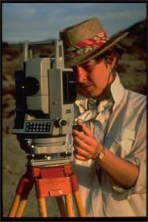
UNIT 7
Geodesy
and
Geodesist’s Position
Description
75
7.1. History of Geodesy
Since ancient times man has made measurements in an attempt to determine the exact size and shape of the earth. Throughout history, the shape of the Earth has been debated by scientists and philosophers. Early ideas about the figure of the Earth held the Earth to be flat and the heavens a physical dome spanning over it. Two early arguments for a spherical earth were that lunar eclipses were seen as circular shadows which could only be caused by a spherical Earth, and that Polaris is seen lower in the sky as one travels South.
The history of geodesy includes much more than can be covered in summary, but certain highlights are notable:
Pythagoras (born 582 B.C.) declared the earth to be a globe.
Aristotle (384-322 B.C.) concluded the earth must be spherical.
Eratosthenes, an Alexandrine scientist, (276-195 B.C.) is given credit for first measuring earth's size. His results were about 16% too big.
Poseidonius (135-50 B.C.) also determined earth's size using arc measurements
between Rhodes and Alexandria. Results still 11% too large.
Arabian efforts about 827 A.D. near Baghdad by the caliph Abdullah al Mamun gave an answer only about 3.6% too large.
Little is recorded in western literature about geodesy until after the Middle Ages. However with invention of the telescope in the early 1600's, publication of 14 place logarithms and use of triangulation for arc measurement, many advancements were made. Later developments also included the theory of gravity, differential & integral calculus, standardization of length and introduction of least squares adjustment.
In 1615 a Dutchman, Willebrord Snellius, measured an arc more than 80 miles long with a series of 33 triangles. His computation of the earth's circumference was too small by about 3.4 per cent.
In 1669-70 a Frenchman, Jean Picard, measured an arc on the meridian through Paris and obtained results too large by only 0.7 percent. An interesting
76
note here is that Newton needed and used Picard's measurements in development of his theory of universal gravitation which he published in 1687. Newton also concluded the earth is flattened at the poles due to earth's rotation.
Picard's work was extended north to Dunkirk and south to Collioure by the
Cassini brothers about 1700. The total arc was about 8°20' but the arc was computed in two segments - the parts north and south of Paris. The radius of the earth determined from the northern portion was shorter than that computed from the southern portion. Hence the Cassini's concluded, in fact insisted, the earth is elongated at the poles.
In 1735 – 1736 two geodetic surveying expeditions were sent by the French Academy of Science to Peru (Bouguer) and Lapland (Maupertuis) to make precise measurements to settle the dispute. Results showed quite conclusively the earth is flattened at the poles.
During the last 100 years, geodesy and its applications have advanced tremendously. The 20th century brought space-based technology, making geodetic measurements extremely precise. Today, NAVSTAR Global Positioning System satellites allow scientists to measure changes in the Earth's surface to the centimeter.
Activities
1.Прочитайте текст и выпишите к слову The Earth все поясняющие его определения.
2.Прочитайте текст и скажите, что является его темой. Какую роль играет заголовок для раскрытия темы?
3.Прочитайте текст и выпишите слова, характеризующие основные этапы развития геодезии как науки.
4.Прочитайте текст и скажите, какое открытие, на ваш взгляд,
стало поворотным моментом в истории развития геодезии. Обоснуйте
свою точку зрения.
77
5. Найдите в тексте соответствующие английские выражения:
точный размер и форма, на протяжении истории, круглая тень, изобретение телескопа, тригонометрическая съемка, интегральное исчисление,
уравнивание по методу наименьших квадратов, разрешить спор, глобальная система спутниковой связи, поверхность земли.
6. Попросите партнера ответить на ваши вопросы:
1.What was the original idea about the Earth shape?
2.What arguments were made for the spherical Earth?
3.What scientists made the first measurements of the Earth?
4.What inventions stimulated the advancements in geodesy in the Middle Ages?
5.What developments in geodesy did Newton use in his theory of universal gravitation?
6.How did Newton explain the flattened form of the Earth?
7.When was the flattened shape of the Earth finally proved?
8.What technology can be used to measure the Earth changes extremely precise?
7. Прочитайте текст и кратко зафиксируйте в таблице основные
этапы развития науки геодезии.
Discovery |
Author |
Period of time |
What? |
Who? |
When? |
|
|
|
determination of the Earth size and shape |
philosophers |
ancient times |
….…………………………………………. |
……………………… |
……………… |
…….………………………………………. |
……………………… |
……………… |
……..……………………………………… |
……………………… |
……………… |
………..…………………………………… |
……………………… |
……………… |
……………………………………………. |
……………………… |
……………… |
|
|
|
8. Используя записи таблицы, выступите с кратким сообщением об |
||
основных этапах развития геодезии. |
|
|
78
7.2. Geodesy Overview
Geodesy is the science of determining the size and shape of the Earth including its temporal variation using measurements primarily of distance, time, and gravity.
Building roads and bridges, conducting land surveys, and making maps are some of the important activities that depend on a spatial reference system. For example, if you build a bridge, you need to know where to start on both sides of the river. If you don't, your bridge may not meet in the middle.
As positioning and navigation have become fundamental to the functions of society, geodesy has become increasingly important.
Geodesy helps the transportation industry ensure safety and reliability, while reducing costs. Without geodesy, planes might land next to - rather than at - airports, and ships could crash onto land. Geodesy also helps shipping companies save time and money by shortening their ships' and airplanes' routes and reducing fuel consumption.
Geologists, oceanographers, meteorologists, and even paleontologists use geodesy to understand physical processes on, above, and within the Earth. Because geodesy makes extremely accurate measurements to the centimeter level, scientists can use its results to determine exactly how much the Earth's surface has changed over very short and very long periods of time.
The Earth's surface changes for many reasons. For instance, its surface rises and falls about 30 centimeters (about 1 foot) every day due to the gravitational influences of the moon and the sun. The Earth's outermost layer, the crust, is made up of a dozen or more «plates» that ride atop a sea of molten rock, called magma, which flows beneath the surface of the Earth. Plate tectonics is the scientific discipline that looks at how these plates shift and interact, especially in relation to earthquakes and volcanoes. Although these phenomena are violent and usually affect large areas of land, even smaller events, such as erosion and storms, have an impact on shaping the Earth's surface. Geodesy helps us determine exactly where and how much the Earth's surface is changing.
79
Being one of the oldest sciences, with a history of more than two thousand years, the traditional measurements were mostly associated with land surveying dealing with distance and direction measurements of landmarks and celestial objects and gravity observations determining the geoid, as reference surface for heights, and the plumb direction.
The age of satellites, radio science, and computer technology have completely transformed these methods and enabled geodesy to branch into many of the Earth sciences where the exquisite measurement precision has enabled the determination of ocean level variations, crustal deformation, tectonic plate motions, ice sheet heights, Earth rotation variation, and other geodynamical phenomena with unprecedented detail and accuracy.
Contemporary geodesy utilizes the latest in mathematical modeling, physics research, astrometry, computer science, and statistical analysis to aid in the understanding of ocean currents, sea level rise, the world's hydrological cycles, atmospheric conditions, global climate change, post-glacial rebound, and other crustal deformation, particularly as it relates to natural hazards, such as earthquakes, volcanoes, and flooding.
In these Earth science applications, accurate coordinate reference frames, high-resolution global gravity models, and precise time keeping are of paramount and fundamental importance.
Geodesy, of course, continues the tradition of forming the backbone for all national and international data and reference systems needed to establish threedimensional positional control of regional and global networks of terrestrial points. Several geodetic principles and techniques also have found application in studies of the Moon and other planets.
Activities
1. Прочитайте текст и выпишите все слова, характеризующие науку геодезию.
80