

A Dictionary of Archaeology
.pdfinto association with the skeleton as a result of natural POST-DEPOSITIONAL activity such as soil movement or animal burrowing (Turner and Hannon 1988). Another of the bodies – Shanidar 1
– appears to have survived as a crippled old man for several years before his death, which may perhaps indicate that the Neanderthals looked after the older, less able members of their groups. The published pottery from later strata makes it clear that the cave had a long later history of use, including habitation in the Uruk period and late Islamic period. The nearby site of
SHANIDAR was occupied both in the Epipalaeolithic period and the Sasanian period.
R. Solecki: Shanidar – the first flower people (New York, 1971); E. Trinkaus: The Shanidar Neandertals (New York, 1983); C. Turner and G.E. Hannon: ‘Vegetational influence for late Quaternary climatic changes in southwest Europe in relation to the influence of the North Atlantic Ocean’, Philosophical Transactions of the Royal Society of London B/318 (1988), 451–85; O. Bar-Yosef: ‘Geochronology of the Levantine Middle Palaeolithic’, The human revolution, ed. P. Mellars and C. Stringer (Edinburgh, 1989), 589–610.
IS
Shaqadud KHARTOUM NEOLITHIC site in
Sudan, which was excavated by Anthony Marks over the course of several seasons in the 1960s. This large occupation site, covering some 2 ha, includes 3 m deep stratigraphy dating from the 4th millennium to the late 2nd millennium BC.
K.H. Otto: ‘Shaqadud: a new Khartoum Neolithic site outside the Nile Valley’, Kush 11 (1963), 108–15; A.E. Marks et al.: ‘The prehistory of the Central Nile Valley as seen from its eastern hinterlands: excavations at Shaqadud, Sudan’, JFA 12 (1985), 261–78.
IS
Sheba see ARABIA, PRE-ISLAMIC
shell midden see KITCHEN MIDDEN, SHELL
MIDDEN
Shemshara, Tell see TELL HASSUNA
shifting cultivation see LINEARBANDKERAMIK
Shih-chai-shan (Shizhaishan) Cemetery site situated 50 km west of Chin-ning-hsien, in the Chinese province of Yun-nan; first excavated in 1955, it has shed light on the ancient Tien (Dian) culture of southwest China, which flourished
SHIZAISHAN 525
between the 4th and 2nd centuries BC. The large quantity of bronze, gold and iron artefacts unearthed is significant from several viewpoints. On the one hand, the bas-relief scenes on many of the bronze drums and other vessels vividly portray the daily life of the time, including the buildings, dress, personal ornaments, domesticated animals, agriculture, ceremonial activities, implements and weapons employed. Particularly remarkable are the group scenes of small detailed figurines on cowriecontainers. On the other hand, technological study of the metallurgical attainments of these peoples throws valuable light on the appearance of such alien approaches as metal-working (e.g. the engraving of the metal surface, repoussé, pierced-work and splitting, wire-drawing, mechanical shaping, etc.), cire-perdue, and possibly gold amalgam applications.
M. Pirazzoli-t’Serstevens: La civilization du royaume de Dian à l’époque Han (Paris, 1974); Anon.: The Chinese bronzes of Yünnan, ed. J. Rawson (London, 1983); N. Barnard: ‘Bronze casting technology in the peripheral ‘barbarian’ regions’, BMM 12 (1987), 3–37; ––––: ‘The entry of cire-perdue investment casting, and certain other metallurgical techniques (mainly metalworking) into South China and their progress northwards’, Ancient Chinese and Southeast Asian bronze cultures I, ed. D. Bulbeck (Taipei, 1996), 1–94; ––––: ‘Bronze vessels with copper inlaid décor and pseudo-copper inlay of Ch’unch’iu and Chan-kuo times II’, Ancient Chinese and Southeast Asian bronze cultures I, ed. D. Bulbeck (Taipei, 1996), 176–272.
NB
Shih-huang-ti (Shihuangdi) See CH’IN
Shinto Literally ‘the way of the gods’, Shinto is the native religion of Japan, which took its traditional form after the introduction of rice cultivation. The core of beliefs is that spirits reside in numerous natural phenomena such as the sun, water, fire and mountains and that it is important to attain ritual purity from pollution through offerings and participation in festivals and rituals. Shrines share architectural details with the buildings represented on Yayoi-period bronze bells and by Kofun-period haniwa (unglazed pottery funerary sculptures).
I. Oba: Shinto kokogaku koza [A course in Shinto archaeology] (Tokyo, 1981).
SK
Shizaishan see SHIH-CHAI-SHAN
526 SHU
Shu see PA-SHU
Shum Laka Rockshelter 14 km southwest of Bamenda, western Cameroon, with a distinctive Late Stone Age sequence, which was excavated by Pierre de Maret in 1978–80, by Raymond Asombang in 1982, and then again by de Maret and his colleagues in 1991–4. De Maret’s 1991–4 excavations were extensive (49 m2 in the upper part and 34 m2 in the lower), and have revealed a stratigraphy which is up to 3.3 m thick. This stratigraphy comprises three phases:
(1)An exclusively microlithic quartz industry in rockfall, sand and loam, at the base (which it is thought may go back some 30,000 years)
(2)an orange layer (dating from 8705 to 6070 uncal BP) in which macrolithic artefacts in basalt are also prominent. These include bifacially worked, waisted and partially polished axes or hoes, as well as some Levallois flakes, points, and cores.
(3)The same type of industry (radiocarbon dated to 3810 ± 60 and 3140 ± 80 uncal BP) is accompanied by some pottery in a grey ashy deposit at the top.
A total of 15 human skeletons have been found at the site. The mammalian fauna recovered during the earlier excavations were exclusively wild, mainly giant forest hog (Hylochoerus meinertzhageni), forest buffalo (Syncerus caffer nanus), and cane rat (Thryonomys swinderianus). This suggested that the landscape in the upper layers was forested, and that the western Cameroon grasslands took on their present form subsequently due to human action, but there are now preliminary indications that a savanna environment may also have been characteristic of the basal deposits. Detailed analyses of the data gathered ‘should provide us with the first evidence of the transition from the Pleistocene to the Holocene, as well as the change from Later Stone Age to food producing communities in West Central Africa’ (de Maret et al. 1995: 3).
P. de Maret, B. Clist and W. van Neer: ‘Résultats des premières fouilles dans les abris de Shum Laka et d’Abeke au Nord-ouest du Cameroun’, L’Anthropologie 91 (1987), 559–84; R. Asombang: ‘Age de la pierre récent: Cameroun’, Aux origines de l’Afrique Centrale, ed. R. Lanfranchi and B. Clist (Paris, 1991), 99–101; P. de Maret: ‘Pits, pots and far west streams’, paper presented to the conference on The growth of farming communities in Africa from the equator southwards, British Institute in East Africa and African Studies Centre (Cambridge, 1994);
––––, R. Asombang, E. Cornelissen, P. Lavachery and J. Moeyersons: ‘Continuing research at Shum Laka rock
shelter, Cameroon (1993–1994 field season)’, NA 43 (1995), 2–3.
PA-J
Shuruppak see FARA, TELL
Sialk, Tepe Pair of settlement mounds (and associated cemeteries), collectively dating to the 6th–1st millennia BC, located on an ancient east–west trade route at the edge of the central Iranian desert, about 200 km to the south of modern Tehran. In 1933–7 Roman Ghirshman defined six major phases at the site, the earliest of which (Sialk I) was a small village, consisting initially of reed huts and later of pisé and mud-brick structures. The Sialk I occupation was found only on the northern mound and roughly corresponded to the HASSUNA and SAMARRA phases of Mesopotamia (c.5800–5000 BC). The Sialk II phase, comprising some seven metres of stratigraphy, includes buildings made of hand-made bricks bearing thumb-prints, closely resembling those of the early UBAID temple at ERIDU. This suggests that there was an Ubaidrelated material culture in Iran during the 5th millennium BC, although the hand-made ceramics appear to be quite different to those of the Ubaid culture.
In assessing the material culture at Sialk, Max Mallowan (1970: 455) stresses the balance between local characteristics and external influences: ‘The rich material . . . demonstrates a long and steady internal development of native styles which were never altogether out of touch with technological advances in Elburz, in Susiana, in Assyria, and, to a lesser extent perhaps, in Babylonia’. At the end of the 4th millennium BC the site appears to have been abandoned. The two final phases, Sialk V and VI, consist simply of a pair of Iron Age cemeteries at the edge of the site, dating to the late 2nd and early 1st millennia BC respectively and perhaps indicating the arrival of Indo-Europeans on the Iranian plateau.
R. Ghirshman: Fouilles de Tepe Siyalk, près de Kashan, 2 vols (Paris, 1938–9); M.E.L. Mallowan: ‘The development of cities from al-ðUbaid to the end of Uruk 5’, Cambridge Ancient History 1/1, ed. I.E.S. Edwards et al., 3rd edn (Cambridge, 1970), 327–462 [447–56].
IS
sickle sheen Polish or ‘sheen’ that develops on the blade of stone (especially flint) implements as they are used to cut grain, grasses etc. When there is no botanical evidence for cultivated cereals at a site, sickle sheen is often taken as strong evidence
that a group had started to harvest wild cereals – and is sometimes cited as circumstantial evidence of ‘incipient agriculture’ by gathering and hunting groups. However, the presence of sickle sheen does not prove that wild cereals formed part of the diet; ethnographic accounts indicate that hunter and gatherer groups may also collect grasses regularly for building purposes.
RJA
Sidi Abderrahman see AFRICA 1
sign and symbol In common parlance, a sign is taken to be something which communicates a particular meaning to an observer. However, the Genevan linguist Ferdinand de Saussure (1857–1913), who identified the sign as the most fundamental unit of communication, gave the term a more precise meaning: a sign is the relationship between the signifier, the signified and the particular context in which the sign is used. For example, in the written language, ‘trowel’ signifies a useful archaeological tool within a quite particular context. In this case, the relationship between the signifier (the written word ‘trowel’) and the signified (the concept of an archaeological trowel) is based on convention – any signifier could have been used. Furthermore, the same signifier (the written word ‘trowel’) may signify something else again in a different context (in the minutes of a Masonic meeting, for example). Thus the idea of the sign as a relationship between signifier, signified and context is of great importance.
Signs can be divided up into three main types, depending upon the nature of this relationship: index, icon and symbol. Writers in different fields concerned with semiotics (particularly linguistics and anthropology) have not always defined these different types of sign in the same way. However, usually an index is a sign that has an existential or natural relationship with the signified – for example, in most contexts the sound of thunder signifies (is an index for) lightning. An icon is a signifier that has a representational relationship with the signified. For example, in prehistoric art a wave-like pattern is often taken to be an icon of water. A sign such as a downward gesture has an iconic relationship to the signified action (‘sit down’). Although icons are relatively unimportant in linguistic analysis, their interpretation is a prominent feature in discussions of ancient art and material culture.
By contrast to the index and the icon, the symbol is usually defined as a signifier that is entirely arbi-
SIGNIFICANCE 527
trary in its connection to the signified – that is, the connection is formed by social convention (usage) only. However, in anthropology and archaeology many writers concentrate on symbols that have special emotional or cultural meanings. Confusingly, some anthropologists have argued that the word ‘symbol’ should be reserved for signs that have some special link to emotional meanings or some resonance from the physical or natural world – and which are therefore, in a sense, nonarbitrary (see SYMBOLIC ARCHAEOLOGY for further discussion).
Symbolic anthropology is a particularly rich field and has had great, if indirect, influence on archaeological interpretations of symbols in prehistoric material culture. It has also affected interpretations of religious and ‘ritual’ sites, and the analysis of prehistoric IDEOLOGY. Numerous strands can be traced in symbolic anthropology, but some of the most directly influential in archaeological writing are the works of Claude Lévi-Strauss, Victor Turner’s writings on the relationship between ritual, symbol and social structure, and Mary Douglas’ seminal work on the symbolism of purity and pollution and how this affects material culture, decoration amd ritual behaviour.
The study of the ways in which signs and symbols are organized is described in the entry on STRUCTURALISM. The symbolism of material culture, and the ‘archaeology of the mind’, are described respectively in SYMBOLIC ARCHAE-
OLOGY and COGNITIVE ARCHAEOLOGY, while the
complications for the archaeologist arising from an active use of symbolic meaning are explored in
CONTEXTUAL ARCHAEOLOGY.
M. Douglas: Purity and danger (London, 1966); V. Turner: The forest of symbols (London, 1967); ––––: The ritual process (London, 1969); M. Douglas: Natural symbols (London, 1970); D. Sperber: Rethinking symbolism (Cambridge, 1974); I. Hodder: Symbols in action (Cambridge, 1982); ––––, ed.: Symbolic and structural archaeology (Cambridge, 1982); ––––: The present past (London, 1982); ––––, ed.: The archaeology of contextual meanings (Cambridge, 1987).
RJA
significance In the analysis of archaeological DATA, the ‘significance level’ of a HYPOTHESIS TEST is the PROBABILITY of rejecting a null hypothesis, given that it is actually true. The level should be specified in advance of the test, taking into account the strength with which the null hypothesis is held, and the consequences of rejecting it. Significance testing says nothing about the chances of accepting or rejecting a false null hypothesis, and
528 SIGNIFICANCE
to that extent is a limited concept. The value of 5% is conventionally used but has no intrinsic validity; it means that there is a 1 in 20 chance of rejecting the null hypothesis when it is true.
J.E. Doran and F.R. Hodson: Mathematics and computers in archaeology (Edinburgh, 1975), 52–8; S. Shennan: Quantifying archaeology (Edinburgh, 1988), 53–63; M. Fletcher and G.R. Lock: Digging numbers (Oxford, 1991), 60–2.
CO
Silsilian see SEBILIAN
Silver Leaves Iron Age settlement near Tzaneen, South Africa, where road construction exposed a village horizon with storage pits containing metal slag and pottery decorated with flutes and bevels. Radiocarbon dates of the 3rd–4th centuries AD show that this pottery forms the first phase of the Early Iron Age in the eastern half of southern Africa. Some call the ceramic facies Silver Leaves while others name this cultural tradition after Matola, a site in Maputo, Mozambique. The style is clearly related to Kwale (see EARLY IRON AGE) further north, and belongs to David Phillipson’s ‘lowland facies of Eastern Stream’. Although preservation in Silver Leaves/ Matola sites is not good, Silver Leaves itself yielded pottery with seed impressions of domesticated millet (Pennisetum sp.), and another site in the northern Transvaal contained the bones of domestic small stock.
M. Klapwijk: ‘A preliminary report on pottery from the northeastern Transvaal, South Africa’, SAAB 29 (1974), 19–23; T. Maggs: ‘Mzonjani and the beginning of the Iron Age in Natal’, Annals of the Natal Museum 24 (1980), 71–96; J. Morais: The early farming communities of southern Mocambique (Maputo, 1988).
TH
similarity see CLUSTER ANALYSIS
simulation The imitation of the behaviour of one or more VARIABLES, in order to explore their
STATISTICAL DISTRIBUTION or the overall pattern
of their behaviour. Archaeological simulation ranges from the plotting of the distribution of a single variable, e.g. in order to carry out a HYPOTHESIS TEST (known as the ‘monte carlo’ approach), to the operation of a large complex model, e.g. of foraging or subsistence systems (see FORAGING THEORY). Predictably, small exercises have tended to have more success than large. The model is run with different values of its PARAMETERS, using a computer to repeat each ‘run’
several times (at least 100) with a randomly-selected starting point. Much depends on the reliability of the random number generator. There are often so many possible combinations of the different values of the parameters that the main result is a very large pile of computer print-out. A task not to be undertaken lightly, and, some would argue, only as a last resort.
J.E. Doran and F.R. Hodson: Mathematics and computers in archaeology (Edinburgh, 1975), 298–306; I.R. Hodder and C.R. Orton: Spatial analysis in archaeology
(Cambridge, 1976), 126–54; ––––, ed.: Simulation studies in archaeology (Cambridge, 1978); P. Freeman: ‘How to simulate if you must’, Computer and quantitative methods in archaeology 1987, ed. C.L.N. Ruggles and S.P.Q. Rahtz (Oxford, 1988), 139–46.
CO
Sinagua Prehistoric culture (c.AD 700–1450) of the American Southwest, located in the Arizona mountains from Flagstaff south along the Verde River Valley and its northeastern tributaries. Sinagua cultural development was punctuated by the eruption of Sunset Crater volcano, 25 km north of Flagstaff in AD 1064. Prior to this time, the material culture of the Sinagua resembled that of the mountain-adapted MOGOLLON with pithouses and brown pottery. After the eruption, the Flagstaff area exhibits a cultural picture which may be interpreted by three models with different causal emphases. Harold S. Colton, the founder of the Museum of Northern Arizona, who defined the Sinagua, proposed that the greatly improved agricultural productivity of the land after the eruption encouraged immigration by ANASAZI, Mogollon, HOHOKAM and Cohonina people. The second model interprets the admixture as the result of extensive trade managed by the Sinagua. The third model takes an ideological perspective, proposing that the Flagstaff region – with an active volcano and in the shadow of the historically sacred San Francisco peaks – came to have powerful religious significance to different people of the Southwest. The Sinagua are generally thought to be among the people ancestral to the HOPI. The major Sinagua sites are Chavez Pass, Ridge, Tuzigoot, Winona and Wupatki, all in Arizona.
H.S. Colton: The Sinagua (Flagstaff, 1946).
JJR
Sinai see SERABIT EL-KHADIM
Sintiou-Bara Site in the middle valley of the River Senegal, which was excavated by Guy
SIPÁN 529
|
|
|
|
brass |
|
|
||
|
|
|
|
copper silver tin |
||||
metalwork |
|
|
|
cowries |
|
|||
|
|
|
enamelled pottery |
|||||
|
|
|
|
|||||
PODOR |
|
|
|
|
|
|
|
|
marine shells |
|
|
|
|
|
|
|
metalwork |
|
|
|
|
|
|
|
|
|
|
S |
|
|
|
|
|
|
|
|
I |
|
|
|
|
|
|
|
|
N |
|
|
|
|
|
|
|
|
T |
|
|
|
|
|
|
|
|
I |
|
S-B |
|
|
|
|
|
|
O |
|
|
|
|
|
||
|
|
|
|
|
|
|
|
|
|
U |
|
OGO |
|
|
|
||
|
|
- |
|
|
|
|
||
|
|
B |
|
|
|
|
|
|
|
|
|
A |
|
|
|
|
|
|
|
|
|
R |
|
|
|
|
|
|
|
|
A |
C |
|
|
|
|
|
|
|
|
U |
|
|
|
|
|
|
|
|
|
L |
|
|
|
|
|
|
|
|
|
T |
|
|
|
|
|
|
|
|
|
U |
|
|
|
|
|
|
|
|
RE |
DAKAR
stone beads
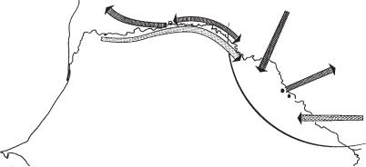
Figure 48 Sintiou-Bara Long-distance trade contacts indicated by finds at Sintiou-Bara and the extent of the ‘culture area’ (drawn by Philip Allsworth-Jones).
Thilmans and Annie Ravisé in 1973–8. These excavations yielded eight radiocarbon dates in the range AD 400–1050, and in Thilmans’ view formed the centre of a ‘culture area’ defined largely on the basis of its distinctive pottery, slipped and burnished ware with channelled decoration, including geometric designs, which Susan and Roderick McIntosh consider to be comparable with similar motifs found on North African glass goblets at Tegdaoust. Long-distance trade contacts are indicated by several of the objects found at the site: cowries, glass beads, non-ferrous metals, and enamelled pottery of a type which may ultimately be traced back to Spain. Metalworking of a very high standard was carried out in situ, as demonstrated by the presence of numerous furnaces and at least 140 finished artefacts (not counting 7600 small brass ‘collars’ which probably served a decorative purpose). The majority of the larger artefacts, such as bells and discs, are interpreted as horse trappings, although no actual remains of horses have been found at the site. Other objects, such as rings and pendants, had a decorative function, and a conical ‘mitre’ of brass recalls the description given by alBakri in AD 1068 of headware used by the kings of Ghana. Traces of seven wattle and daub structures (two of which are interpreted as having had religious significance) and six burials were found over an excavated area of 153 m2. This constitutes a relatively small part of the 67 ha settlement, which, according to Thilmans, probably corresponds to the
historical city or state of Silla and its first Dia-ogo dynasty.
G. Thilmans and A. Ravisé: Sintiou-Bara et les sites du fleuve (Dakar, 1980).
PA-J
Sinú Style of gold work manufactured in northern Colombia for long-distance trade in the 7th to 12th centuries AD. Investigations along the Río San Jorge have placed this metal in a cultural context of large communities who created the most extensive system of drained fields known in South America. The earliest construction dates to a period of severe drought between 800 and 100 BC, and until the 9th century AD there was a gradual evolution of peoples making elaborate pottery, living in linear settlements along the waterways on artificial platforms, and burying their dead in tumuli associated with the settlements. Then strong fluctuations in flood levels apparently led to the gradual abandonment of the flood plains.
A. Legast: La fauna en la orfebreria sinú (Bogotá, 1980); C. Plazas et al.: La sociedad hidraulica Zenu: estudio arqueológico de 2000 años de historia en las llanuras del Caribe Colombiano (Bogotá, 1993).
KB
Sion see LE PETIT-CHASSEUR
Sipán Site of a series of burials dating to the Early Intermediate Period (c.400 BC–AD 500) in the
530 SIPÁN
Lambayeque Valley of northern Peru. These were the first set of unlooted royal/elite Moche burials to be excavated by archaeologists. They show the wealth of the Moche elite as well as the artistry of their finest craftsmen in metal, ceramics and lapidary work. The Sipán burials, with those of neighbouring San José de Morro, show that people and scenes represented in Moche ceramics existed in reality.
W. Alva: ‘Discovering the New World’s richest unlooted tomb’, NGM 174/4 (1988), 510–48; ––––: ‘The Moche of ancient Peru: new tomb of royal splendor’ NGM 177/6 (1990), 2–15; C.B. Donnan and L.J. Castillo: ‘Finding the tomb of a Moche priestess’, Archaeology 45/6 (1992), 38–42; S. Kirkpatrick: Lords of Sipán: a tale of pre-Inca tombs, archaeology, and crime (New York, 1992).
KB
Sippar (Abu Habba and Tell ed-Der; Biblical Sepharvaim) Site in southern Iraq about 30 km southwest of Baghdad, adjacent to an ancient canal linking the Tigris and Euphrates. Sippar was one of the major cities of the Early Dynastic period (c.2900–2350 BC). When Hormuzd Rassam excavated the temple of the sun-god Shamash in 1880–2, he discovered the marble tablet of Nabu- apla-idinna (c.870 BC) decorated with a relief of the god in his shrine. During the same 18-month season he uncovered an archive of some 50,000 cuneiform cylinders and tablets from the rooms surrounding the ziggurat. One of these cylinders bears a text describing the excavations beneath the temple floor undertaken by Nabonidus (555–539 BC) which resulted in his discovery of the foundation stone laid by the Akkadian ruler Naram-Sin (2254–2218 BC) almost two millennia earlier. Despite the comparative fragility of the unbaked clay tablets from Sippar, a great deal of information has been obtained regarding the administration and liturgy of neo-Babylonian temples. The main settlement mound (Abu Habba) was also excavated by Scheil in 1894 and Andrae and Jordan in 1927, and the library was re-examined by Iraqi archaeologists in the 1980s. In the late 1960s and 1970s a team of Belgians worked on the neighbouring fortified town-site of Tell ed-Der (see de Meyer 1976).
V.Scheil: Une saison de fouilles à Sippar (Paris, 1902);
W.Andrae and J. Jordan: ‘Abu Habbah-Sippar’, Iraq 1 (1934), 51–9; L. de Meyer: ‘La sixième campagne de fouilles à Tell ed-Deir, 1974’, Sumer 32 (1976), 161–5.
IS
Siraf Port on the southern coast of Iran, 200 km south of Shiraz, which was an important centre for
international maritime commerce during the 9th and 10th centuries AD, with the origins of goods ranging from East Africa to China and Southeast Asia. It went through its great period of expansion between the SASANIAN period (c.AD 224–651) and its destruction by earthquake in AD 977; by the 13th century it had faded away.
The excavations directed by David Whitehouse between 1966 and 1973 are among the most important to have been undertaken on a major early site of the eastern Islamic territories in the late 20th century. The approach was comprehensive, investigating not only the main buildings and houses but also the subsistence economy of the town, addressing the geomorphology, the water supply and traces of land-use as well as retrieving seeds and other material as a part of the environmental study. At an Islamic site this approach was revolutionary, even if standard procedure in the archaeology of other periods. One of the most unusual and instructive studies involved excavation of a funerary site, rare information in Islamic archaeology. The results were remarkable, seeming to indicate the persistence of pre-Islamic burial practices into the Islamic period.
D. Whitehouse: ‘Excavations at Siraf’, Iran 6–11 (1968–74) [six interim reports]; ––––: ‘Siraf: a Sassanian port’, Antiquity 45 (1971), 262–7; ––––: Siraf III: the Congregational Mosque (Leiden, 1980); V.F. Piacentini:
Merchants – merchandise and military power in the Persian Gulf (Sûriânj/Shahriyâj–Sîrâf) (Rome, 1992).
GK
Sirikwa holes Artificial depressions associated with the semi-legendary Sirikwa people, widely found in the western highlands of Kenya and the elevated stretch of the adjacent Eastern Rift Valley at sites such as Chemagel (see figure 11) and HYRAX HILL. Dating to the 13th–18th centuries AD, the Sirikwa holes comprise a range of regional and chronological variants.
Occurring in groups of between five and a hundred either on hillsides or around streams and springs, each ‘hole’ is a saucer-shaped hollow, usually about 10 m across, with signs of an entrance facing downhill and an earthen mound or pair of mounds below it. In rocky terrain, drystone walling was sometimes used to line the entrance and revet the interior of the hollow. Excavations in the 1960s and 1980s (Sutton 1973, 1987) showed that they were unroofed but stoutly protected by stockades and defensive gateways. They have been interpreted as stock-pens, particularly for cattle (but also for goats and sheep), and the external mounds are thought to have resulted
from the dumps of mud and dung removed daily. Houses were not built inside the hollows, but were attached outside, either beside the gate – in order to guard the pen, as with the small houses at Hyrax Hill – or around the perimeter. These would have catered for the herdsmen. With later Sirikwa holes in the west, where cultivation was combined with the pastoral economy, more substantial round thatched houses were built for whole families.
Sirikwa pottery, often called ‘Lanet ware’ after a site near Hyrax Hill excavated by Posnansky in 1957, is a very distinctive pastoral ware of the late Iron Age, with bands of twisted-cord rouletted decoration and shapes imitating milk-gourds. The semi-legendary Sirikwa themselves, now vindicated archaeologically, are believed to have been linguistically ancestral to the Kalenjin population of this region. The Sirikwa way of life was phased out in the 17th–18th centuries AD, as its methods of grassland exploitation, herding and stock protection proved too vulnerable to large-scale raiding in the Maasai era. It is argued however that the recent success of the pastoral sections of the Maasai owes much to the Sirikwa experience and their pioneering of advanced pastoral strategies in these fine high equatorial grasslands.
J.E.G. Sutton: The archaeology of the Western Highlands of Kenya (Nairobi, 1973); ––––: ‘Hyrax Hill and the Sirikwa’, Azania 22 (1987), 1–36.
JS
Sirkap see TAXILA
Sirsukh see TAXILA
Sisupalgarh Fortified Iron Age urban site (c.400 BC–AD 400) near Bhuvenshwar in Orissa, India, which was excavated by Braj Basi Lal in 1948–9. The walled core of the site is square in plan (1.2 × 1.2 km), with two gateways in each side, each gate being linked with the others by paved roads lined with structures and wells. Several monolithic columns stand in the centre of Sisupalgarh, perhaps marking the location of an elite residence. Ceramics dominate the artefact assemblage from the site and include BLACK AND RED WARE and red slipped wares in early levels, while red and ochre slipped wares dominate in later levels; other artefacts that span the entire occupation include ceramic ear ornaments, iron implements and gemstone beads. Copper, ceramic and gold coins appeared near the end of the occupation.
SITE CATCHMENT ANALYSIS 531
B.B. Lal: ‘Sisupalgarh’, AI 5 (1948), 62–105; ––––:
‘Sisupalgarh: some reflections on its layout’, Archaeology and art II, ed. C.R.P. Sinha (Delhi, 1990), 589–96.
CS
Sitagroi Tell site on the Drama plain of northeastern Greece, occupied primarily from the Middle Neolithic to the Early Bronze Age (c.5500–2200 BC). The excavation of Sitagroi (1968–70) by Colin Renfrew and others greatly elucidated the relationship between the early metalusing cultures of the northern Aegean and their counterparts in the Balkans. Traditional DIFFUSIONIST explanations of cultural and technological change in the Balkans depended upon the notion that the significant innovations were all derived from the east (specifically, Anatolia). Renfrew knew that these explanations would be invalidated if it could be shown that early copperusing cultures in the Balkans (exemplified by the Vincˇa and Gumelnit¸a complexes) were older than their supposed progenitors in the Aegean (exemplified by Troy I etc.). At Sitagroi, Renfrew recovered material related to the Gumelnit¸a culture (Sitagroi phase III) at a markedly lower level than material which formed part of the Aegean Early Bronze Age (Sitagroi phase V). Thus the stratigraphic evidence at Sitagroi, confirmed by calibrated radiocarbon dates, strongly suggested the autonomy of metallurgical innovations in Central Europe.
C. Renfrew et al., eds: Excavations at Sitagroi: a prehistoric village in northeast Greece, vol. 1 (Los Angeles, 1986).
RJA
site catchment analysis Quantitative and qualitative evaluation of the natural resources within an easily exploitable distance of a given settlement or archaeological site. Although the approach was implicit in many traditional analyses of sites, Eric Higgs coined the term and explicitly employed the techniques of site catchment analysis. In the 1970s, formal site catchment analysis became a standard technique in the economic analysis of prehistoric sites, and seemed to complement the move toward a more quantitative approach to site description.
The catchment area can be defined according to various criteria, but it is often taken to be the resources within a day’s walk of the site. This means that when a catchment area in a region of rugged relief is plotted onto a map, it is often far from circular. At its simplest, the approach gives only the roughest indication of the type of resources available to early communities – notably the percentage
532 SITE CATCHMENT ANALYSIS
of land fit for certain types of cereal farming or animal husbandry. It does not in itself provide any proof that these resources were used, or even that they could have been used (given the limited technology available).
In order to increase the usefulness of the analysis it is therefore necessary to take into account economic variables such as technology (e.g. tool and seed types), climate change and seasonal effects, farming traditions and size of settlement; cultural variables such as taboos about land use, political factors, land distribution; land-sharing and resource-allocation relationships with neighbouring communities; the effect of any settlement hierarchy or regional trade and redistribution; and whether the settlement may have been located where it is for reasons that have little to do with land use (e.g. religious, historical or defensive reasons).
C. Vita-Finzi and E.S. Higgs: ‘Prehistoric economy in the Mount Carmel area of Palestine: site catchment analysis’, PPS 36 (1970), 1–37; F.J. Findlow and J.E. Ericsson, eds:
Catchment analysis: essays on prehistoric resource space (Los Angeles, 1980).
IS
site formation processes Term used to describe the various natural and cultural processes which combine to create an archaeological site. The interpretation of any set of archaeological remains must involve some assessment of the ways in which they have been modified by such processes. See
BEHAVIORAL ARCHAEOLOGY, C-TRANSFORMS,
N-TRANSFORMS, POST-DEPOSITIONAL THEORY,
REFUSE DEPOSITION and TAPHONOMY.
Si Thep Moated centre containing temples dedicated to Hindu and Buddhist deities, located in the upper Pasak Valley between the central Plain of Thailand and the Khorat Plateau. An inscription raised there by a certain Bhavavarman in the 6th or 7th century AD records that he established a temple to Siva on his accession (the ruins of which still survive). A man called Bhavavarman was overlord of a ZHENLA-CULTURE polity in Cambodia, and he might have exercized hegemony over this area. There is also evidence of Buddhism in the form of images carved on the walls of a nearby cavern on Thomarat Hill, while Hinduism is further evidenced by the discovery, in a nearby modern temple, of an image of Visnu that may possibly derive from the site. As with MUANG FA DAET and MUANG SIMA, Si Thep is an example of a small polity contemporary with those of the DVARAVATI
CULTURE.
H.G. Quaritch-Wales: Dvaravati: the earliest kingdom of Siam (London, 1969), 81–5.
CH
Sitio Conte Ceremonial site of the COCLÉ culture of Panama, situated inland off the northwestern Gulf of Panama, roughly in the centre of the country. Sitio Conte is well-known for its extraordinarily rich funerary complex dating to c.AD 300–900. Excavation of a series of graves with multiple burials yielded tools and weapons, textiles, cast gold and TUMBAGA ornaments, jewellery (such as necklaces, bracelets, rings, headbands, helmets and whistles) and gemstones. The pottery includes a variety of forms such as spouted effigy vessels, plates and dishes.
S.K. Lothrop: Coclé, an archaeological study of central Panama: Part I, Memoirs of the Peabody Museum, Harvard University 7 (Cambridge, MA, 1937).
PRI
situla (pl. situlae) Bronze, and occasionally ceramic, ‘pail-shaped’ vessels that were produced in prehistoric Europe from the late 2nd millennium BC onwards, and which seems to have been employed in drinking ceremonies. The name is used particularly for the decorated situlae produced in the sub-Alpine region, especially in north Italy around ESTE, from about 600 BC on (see SITULA ART).
RJA
situla art Style of art produced in north Italy and Slovenia in the later 1st millennium BC (especially the 5th and 4th centuries BC, and manifested largely on bronze or occasionally earthenware situlae and related bronzework such as belts and mirrors. The situlae are usually made from a single sheet of bronze that was beaten from the inside, and then chased on the outside to provide fine detail, before being rivetted and seamed together to form a vessel. The decoration consists of a series of horizontal ornamental bands and figurative friezes (shown in profile), for example, an assortment of animals, a feasting ceremony, or a military or religious procession. Specific scenes in situla art include men (women are usually shown only as attendants) sitting on thrones in hats with wide brims, men with musical instruments, men boxing, animals being led to slaughter and in processions, men with mixing and drinking vessels etc.
– all perhaps relating to the same feasting ritual. The scenes seem to illustrate the life of the elite of the region, rather than depicting mythologies or
simply copying more sophisticated Etruscan or Greek work, although key elements of the style (e.g. the use of figurative human and animal friezes), and many of the details, betray the direct influence of the former region at least. A minority of the animals are mythological, including gryphons and sphinxes, and reveal the indirect influence of the civilizations of the ancient Near East. The origin of the situla style seems to have been in northern Italy, especially around ESTE, where a tradition of beaten bronzework using largely animal motifs evolved from the 7th century BC; however, most of the situlae were manufactured in the 5th and 4th centuries in the wider southeast Alpine region of north Italy and Slovenia.
W. Lucke and O.H. Frey: Die Situla in Providence, Rhode Island (Berlin, 1962); O.H Frey: Die Entstehung der Situlenkunst (Berlin, 1969); N. Sandars: Prehistoric art in Europe (London, 1985), 337–40.
RJA
Siwa Oasis (anc. Sekhet-imit; Ammonium) Natural depression in the Libyan Desert about 560 km west of Cairo, where the earliest remains date to the Egyptian 26th dynasty (664–525 BC). The site includes the cemetery of Gebel el-Mawta, dating from the 26th dynasty to the Roman period, and two temples dedicated to the god Amun, dating to the reigns of Amasis (570–526 BC) and Nectanebo II (360–343 BC) respectively; in 331 BC the famous oracle of Amun is said to have been visited by Alexander the Great soon after his conquest of Egypt. The caravan route from northwest Africa passed through Siwa in medieval times.
A. Fakhry: The oases of Egypt I: Siwa Oasis (Cairo, 1973); K.P. Kuhlmann: Das Ammoneion: Archäologie, Geschichte und Kultpraxis des Orakels von Siwa (Mainz, 1988).
IS
Skara Brae One of the best-preserved Neolithic villages in Europe, this small collection of drystone houses was preserved under sand-dunes on the coast of mainland Orkney. Discovered in the mid-19th century after storms disturbed the dunes, the village was excavated principally by Gordon Childe in the 1930s and D.V. Clarke in the 1970s. The houses, only about half a dozen of which were in use at any one time, were joined by passages and contain furniture built of drystone and slabs including a ‘dresser’, stone ‘beds’, storage alcoves and tanks and benches around hearths. As well as GROOVED WARE pottery, a number of ‘prestige’ items, such as a finely carved ground stone ball and
SOAN 533
decorated bone and ivory pins and pendants, have been recovered from the site (see Clarke et al. 1985).
V.G. Childe: Skara Brae (London, 1931); D.V. Clarke: ‘Excavations at Skara Brae: a summary account’,
Settlement and economy in the third and second millennia BC, BAR BS 33 (Oxford, 1976), 233–50; –––– et al.: Symbols of power at the time of Stonehenge (Edinburgh, 1985), 245–6.
RJA
Skhul see MOUNT CARMEL
slash and burn agriculture see SWIDDEN
AGRICULTURE
SMA (Stone to Metal Age) see AFRICA 5.3
small tool tradition see AUSTRALIAN SMALL
TOOL TRADITION
Snaketown see HOHOKAM
Snettisham Site in Norfolk, England, which in 1948–50 yielded a remarkable group of hoards of Iron Age metalwork; metal-detecting and excavation revealed a further six deposits in 1990. In total the hoards contained 75 complete and c.100 incomplete torcs, over 100 ingot rings/bracelets, and 170 coins; the metals used were electrum, gold, silver and bronze. An electrum torc from Hoard E, the terminals of which are intricately decorated with raised circular motifs filled in with a basketry pattern, is often quoted as one of the finest examples of insular (i.e. British) Celtic art. To judge from the numismatic evidence, the hoards date from the first half of the 1st century BC. They were almost certainly deposited for the purpose of safe-keeping: the excavation proved that the site is not part of a settlement, and Stead (1991) points out that there is no evidence that torcs were ever ritually deposited in the Iron Age.
R.R. Clarke: ‘The Early Iron Age treasure from Snettisham, Norfolk’, PPS 20 (1954), 27–86; I.M. Stead: ‘The Snettisham Treasure: excavations in 1990’, Antiquity 65 (1991), 447–65.
RJA
snowmarks see AERIAL ARCHAEOLOGY;
FROSTMARKS
Soan Palaeolithic sequence of the Potwar Plateau region of northern Pakistan, defined by Helmut de
534 SOAN
Terra and Thomas T. Paterson (1939). Their work was significant in locating several South Asian Palaeolithic sites, but was flawed by a lack of understanding of the geological complexity of the region and exclusive dependence on surface finds, with no in situ remains. As a result, the archaeological sequence that they defined (pre-, early and late Soan flake tools) is no longer widely accepted (Allchin and Dennell 1989: 2; Dennell and Hurcomber 1992: 71). A reexamination of the region was initiated by the British Archaeological Mission in 1980. Through a program of systematic geological, paleontological, and archaeological documentation, coupled with the use of THERMO-
LUMINESCENCE and PALEOMAGNETISM dating
techniques, this research is reappraising the sequence of early human settlement in South Asia. Artefacts from dated contexts include flaked tools that may date as early as 2 million years ago (Allchin and Dennell 1989: 12) as well as lithic and structural remains from a c.45,000 year old lithic procurement or hide processing site near
RIWAT.
H. de Terra and T.T. Paterson: Studies on the Ice Age of India (Washington, D.C., 1939); R.W. Dennell: ‘The importance of the Potwar Plateau, Pakistan, to studies of early man’, South Asian archaeology, 1981, ed. B. Allchin (Cambridge, 1984), 10–19; H. Rendell: ‘The Pleistocene sequence in the Soan Valley, northern Pakistan’, South Asian archaeology, 1981, ed. B. Allchin (Cambridge, 1984), 3–9; B. Allchin and R.W. Dennell: ‘Palaeolithic survey in Potwar Region – 1980: History and Result’, PA (1989), 1–19; R.W. Dennell and L. Hurcombe: ‘Paterson, the British Clactonian, and the Soan flake industry: a reevaluation of the early Palaeolithic of Northern Pakistan’, South Asian archaeology, 1989, ed. C. Jarrige (Madison, 1992), 69–72.
CS
Soba Early medieval settlement site covering an area of about a square mile on the east bank of the Nile in central Sudan, 22 km from Khartoum. It was the capital city of the Christian Nubian state of Alwa (c.AD 550-1500). Peter Shinnie’s excavations at Soba in the early 1950s, involved the pioneering use of ETHNOARCHAEOLOGY, including the documentation of local pottery manufacture and the analysis of mud-brick buildings, as well as the first published stratigraphic drawings from a Nile Valley site (Shinnie 1955). Shinnie recovered large quantities of imported glass of the 6th–12th centuries AD, which helped to establish the site’s chronology, now confirmed by radiocarbon dates obtained during the excavations of the 1980s (Welsby and Daniels 1991).
P. Shinnie: Excavations at Soba (Khartoum, 1955); D.A. Welsby and C.M. Daniels: Soba: archaeological research at a medieval capital on the Blue Nile (London, 1991).
IS
social Darwinism Just as Darwinism is the theory of biological evolution by means of natural selection, social Darwinism is the belief that a similar principle helps to explain the success and evolutionary trajectory of social groups and societies. A few years before the publication of Darwin’s Origin of species by means of natural selection in 1859, the journalist and thinker Herbert Spencer had invented the phrase ‘survival of the fittest’ to describe competition for resources among societies. Spencer believed that if this competition were given free rein, it would lead to the optimal form of society. His ideas, and those of related social thinkers, later drew metaphorical power from the much more rigorously formulated and observed Darwinian theory of natural selection.
Social Darwinism offered social theorists of the later 19th century a powerful template to explain the way in which societies interact and social history unfolds. Unlike Darwinism, social Darwinism developed a strong prescriptive flavour: it became associated both with the political arguments for economic libertarianism and, from the early 20th century, with the arguments by the Eugenic Society for artificially manipulating biological reproduction to improve the gene pool. As a simple concept – the survival of the fittest social group – it could be argued that social Darwinism lies behind many modern explanations of the dominance of particular cultures in the archaeological record. However, the confusing political and eugenic connotations mean that the phrase ‘social Darwinism’ needs to be carefully defined if used outside its particular historical context.
H. Spencer: On social evolution, ed. J. Peel (Chicago, 1972).
RJA
social status analysis Technique devised by Roy Hodson (1977) to analyse the Iron Age cemetery of HALLSTATT, later used on cemeteries of other periods, such as the early Saxon cemetery at Sleaford (Brenan 1985). Starting from a table of the presence or absence of each functional type of artefact in each grave, it assigns a score to each type according to the average number of other types with which it is found. The graves are then ordered according to the total score of the types found in each (alternatively, the score of the highest-scoring