

Galichian R., Historic Maps of Armenia the Cartographic Heritage
.pdfFig. 105/105a
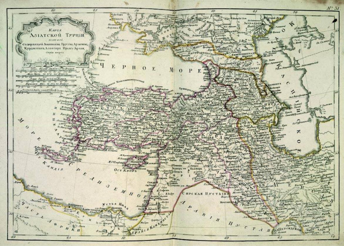
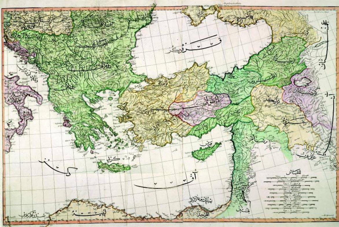
This map of ‘Asiatic Turkey including Anatolia, Turkey, Armenia, Kurdistan, Aljezira, Iraq- |
105a |
Arabi’,inRussian,datesfrom1793.ItwasprintedinNew Atlas, or Collection of Charts of All Parts of the Terrestrial Globe,printedinSaintPetersburg.
The atlas was based on the French atlas of the same title printed in Paris in 1762 with some revisions to the maps.
The map shows Armenia divided between Turkey and Russia. The shape of the Caspian Sea is shownrelativelycorrectly.ThelakesshownareAchtamar (Van),Gokcha (GeghamaorSevan)and Ormia (Urmia).ManyimportantArmeniantownsareshown,includingErevan, Arabkir, Kars, Van,
Bitlis,Baiburt,Akhlat,Vostanandothers.
For the area of Armenia see detail map 105a. Size app. 44x33cm
British Library – London, Maps C.27.f.3
190
105
191
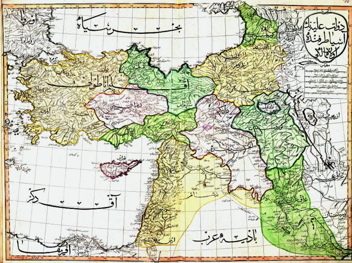
Fig. 106
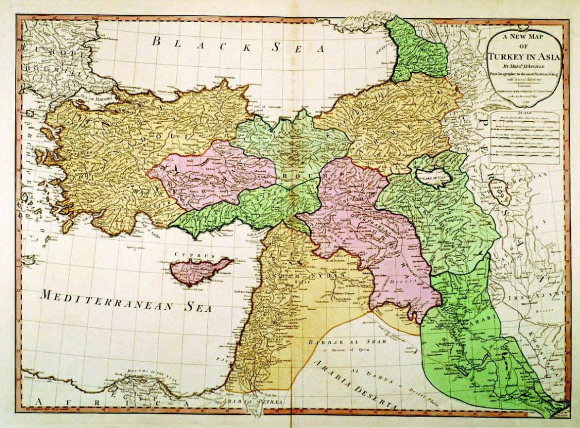
‘A new map of Turkey in Asia’ is from Atlas Generale, printed in London by Jean Baptiste d’Anville (1697–1782) in 1794. The map also appears in William Faden’s General Atlas of 1797.
ItshowsArmeniadividedbetweenthePersianandtheOttomanEmpires,andbearstheArmenian names of some of her provinces. Yerevan and Mount Ararat are shown under Persian domination, while Lake Sevan is calledBlue Water. The shape of Lakes Van and Urmia is incorrect. Aderbigian (Azerbaijan)isshowntothesouthoftheRiver Aras (Arax).ItisinterestingthattheMonasteryof St Thadeus is also mentioned in the county of Artaz, within Persian Armenia. The map includes many other details of the area.
Size 71x52cm
Private collection – London, Ref. RG39 |
106 > |
192
193
107a
Fig.107/107a
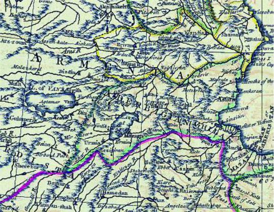
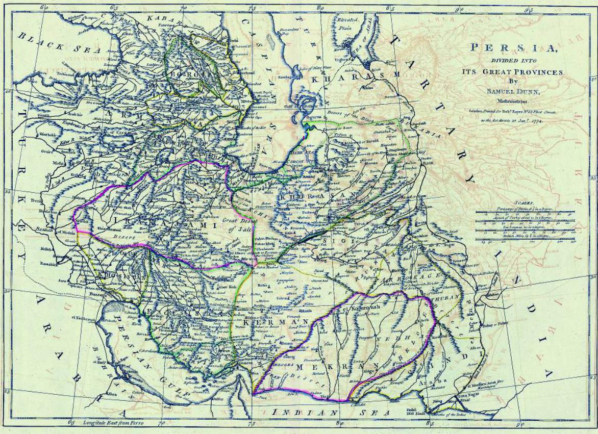
This map of ‘Persia divided into its Great Provinces’, published in London in 1774, is the work of cartographer Robert Dunn (d. 1794).
The map is from his atlas entitled The New Atlas of the Mundane System. It shows Eastern Armenia asaprovinceofPersiaandWesternArmeniawithintheOttomanEmpire.Aderbigan (Azerbaijan), outlinedingreen,isoneofthePersianprovincesandislocatedsouthoftheRiverArax.Thenortheastern territory of Arax is calledChirvan (Shirvan).
In the enlarged part of the map of Armenia (Fig. 107a) much detail is visible, such as the Monastery of St Stepanos Protomartyr on the southern shore of the Aras (Arax) River opposite Nalsivan (Nakhijevan), the islands of Akhtamar and Lun (Lim) within Lake Van, and the town of Argish (Arjesh) near its northern shore.
Size 44x31cm
Private collection – London, Ref. RG47
194
107
195
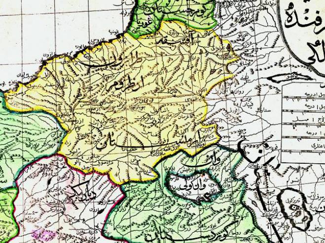
Fig.108/108a
This map of ‘Turkey in Asia’ is from the Ottoman World Atlas, printed in Üsküdar (one of the districts of Istanbul) in 1803–4, which in itself is the translation of William Faden’s (1750–1836) General Atlas publishedinLondonin1797.ThetranslatorisMahmudRaif.Insteadofthe52maps of the English atlas, the Ottoman work contains 24 maps only, which are in large format, carefully prepared and coloured.
The first 78 pages of the atlas are dedicated to geography, giving descriptions of various features of the earth, the sun and the moon, as well as various races of people, followed by descriptions of various countries, with names of important towns and other data. It bears the date AH 1218.
The map shows the Asiatic parts of Turkey. Here Armenia is shown divided between Ajamestan (Persia) and the Ottoman Empire, and some of its provinces are given their Armenian names. Yerevan, here called  – Revan, and Mount Ararat –
  – are shown under Persian domination, while the regions of Van –
 – and Erzerum –
 – are called
 , i.e. Armenia. The shape of Lakes of Van and Urmia is incorrect. In this map, too, Azerbaijan is shown south of the River Arax. The map is based on d’Anville’s map of Fig. 106.
The region of Armenia is shown in the detail 108a. Size72x54cm
British Library, OIOC 14999.h.2(2), f.18
108a
108 >
196
197
109a
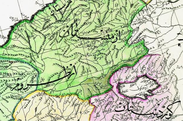
Fig. 109/109a
This ‘Map of the Mediterranean’ is also from the Ottoman World Atlas of Fig. 106, printed in Üsküdar,in1803–4,initselfthetranslationofWilliamFaden’s(1750–1836)General Atlas published in London in 1797. The translator is Mahmud Raif. For further information about the atlas see the description of Fig. 108.
This map covers the European part of the Ottoman Empire including the eastern Mediterranean, where it was the dominant power. As in the previous map, it also includes Armenia divided between Ajamestan (Persia) and the Ottoman Empire, and gives the Armenian names of some of itsprovinces.
Yerevan, here called  – Revan, and Mount Ararat –
 – are shown under Persian rule, while the regions of Van –
  – and Erzerum –
  – are called
  , i.e. Armenia. Lakes Van and Urmia are shown almost touching, while in reality they are some 150 kilometres apart. Azerbaijan is shown to the south of the River Arax.
TheregionofArmeniaisshowninthedetailFig.109a,withawealthoftopographicalinformation. Size80x58cm
British Library, OIOC 14999.h.2(2), f 5
198
109
199