

Closer to the Fire?
If you live in the Northern Hemisphere, as we do in the United States, Earth is actually closest to the sun during winter. The Earth's orbit isn't a perfect circle. The planet reaches perihelion -- the closest point to the sun -- in early January, and aphelion -- the farthest point -- in July. We receive about 3 percent more solar radiation in January.
So why is it so cold? You've probably noticed that the sun is lower in the sky at noon in winter. Therefore, the sun's rays must pass through our atmosphere at a greater angle before striking the ground. The heat and energy are somewhat diluted along the way. (See Tying Down the Wind, pages 131-132.) In places where the sun's rays are more direct, such as at the equator, sunlight is much more intense.
It all comes back to the tilt of Earth's axis. Here's one way to visualize it: Try pointing a flashlight at a wall. If you hold the flashlight close to the wall, you'll get a small, intense circle of light. Now tilt the flashlight at an angle. The light covers a greater area, but it's weaker. The greater the angle, the weaker the light.
Twists and Turns
Think of wind as a river. Water in a river flows from high elevations to low elevations. Likewise, wind wants to flow from a region with high atmospheric pressure to a region with low atmospheric pressure.
High pressure indicates fair weather: It inhibits the formation of clouds and storms, leaving mostly sunny skies, possibly a few popcorn-shaped cumulus clouds in the afternoon, and clear nights. At the center of a high pressure system, air is sinking. Surface-level winds spiral away from the high in a clockwise direction (in the Northern Hemisphere; the direction is reversed in the Southern Hemisphere).
Low pressure means cloudy or stormy weather. Wind spirals inward toward the center of the low in a counterclockwise direction. There's a convergence of air at ground level. Air rises, cooling to its dew point aloft and condensing to form clouds.
29.92 inches: the average atmospheric pressure at sea level
32.01 inches: the highest pressure ever recorded, during a cold snap in Siberia in 1968
25.63 inches: the lowest air pressure measured at sea level, during a typhoon that struck the Philippines in 1979
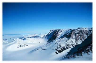
Figure 2-1: High pressure indicates fair weather: It inhibits the formation of clouds and storms, leaving mostly sunny skies, possibly a few popcorn-shaped cumulus clouds in the afternoon, and clear nights. (Photo courtesy of NOAA/Department of Commerce; http://www.photolib.noaa.gov; photo taken by Michael Van Woert, NOAA NESDIS, ORA
The Pressure's On
Evangelista Torricelli, one of Galileo's students, invented the barometer in 1644. A barometer measures atmospheric pressure. It's a quick and easy forecasting tool. When the barometer reports high (or rising) pressure, expect improving or mostly sunny weather. If the barometer reading is low (or falling), you better bring along an umbrella. Low pressure means stormy weather. The faster and lower the pressure falls, the more severe the storm's likely to be.
Twists and Turns
Why does wind spiral clockwise around a high and counterclockwise around a low? Shouldn't it just flow from one to the other in a straight line? The Coriolis effect is the answer to this riddle.
The Coriolis effect is named after French mathematician Gaspard Coriolis, who observed and explained this process in around 1835. The Coriolis effect is an apparent deflection in the motion of wind or water currents (or anything else that moves), caused by the Earth's rotation. Wind appears to curve to the right in the Northern Hemisphere and to the left in the Southern Hemisphere. For more about the Coriolis effect, read Tying Down the Wind, pages 29 to 32