

Экзамен зачет учебный год 2023 / Zevenbergen, Land Registration
.pdf148 |
SYSTEMS OF LAND REGISTRATION |
looking for land makes an offer to those holding rights, who –theoretically– can accept it, or turn it down. When a governmental agency is involved, a Land Clearance Committee will advise upon it. In practice the right holders are pressured to accept the offers, even if they do not want to part from the land or the compensation is unrealistically low. (de Haas-Engel 1993: 146-151) Those persons and communities having unregistered (Adat) rights are treated even less favorable. They might be considered mere users and only get a bonus instead of full compensation, and communal rights (especially in forest areas) are regularly ignored and the land is just ‘grabbed’ (World Bank 1994: 28). In such cases social conflict arises with the traditional, Adat land tenure systems (Soni Harsono 1995: 3).
In an increasing amount of areas, especially in the urban fringes or other development areas, the close-knit societal structures are gone and there is no longer a homogenous Adat community. The traditional land rights seem to be inadequate and a lack of security is felt when the 'modern' land registration is missing (also Sherer 1985: 7). The lack of a 'modern' land registration is of course felt much more, when there is no form of written evidence at all, than when the village office keeps a rudimentary land register of some sort. In the former case it is also very hard to get (still unregistered) land rights converted into registered BAL-rights without written evidence. To overcome this, the draft for the revision of Gov. Reg. No. 10/1961 proposes to make it possible to replace written evidence with holding the land for 20 years in good faith with the consent of the local Adat community. But this provision runs the risk of abuse, especially when the Adat community is not really functional any more. In such areas the value of land has risen very much, because of the expected possibilities for high economic value development (this might include speculation). Because buyer and seller usually will not know each other in these situations, and certainly will not belong to the same coherent community, an informal land transfer will much easier be subject to fraud and false statements (compare § 1.2.3).
Regardless of these problems many areas exist in which development (especially of offices and houses) takes place at a high rate. And many of the land transfers necessary for this take place without registration. Even in the Jakarta business district big office buildings are built on unregistered land.
Because of the lack of registered land, and the troublesome procedures for registering a mortgage on registered land before enactment of the Mortgage Law No. 4/1996, the use of land as collateral for (bank) loans did not encourage banks to give loans, especially not against low interest rates75, as is the case in societies with an efficient and secure land market. Whether the new mortgage law, which only allows a mortgage on unregistered land if an application for registration is filed at the same time, will improve this situation will become clear in the near future.
can the present land registration activities solve these problems?
From the above it becomes clear that the lack of a 'modern' land registration causes problems in Indonesia. The extent of the problems differs between traditional, rural and modern, urban communities, and is especially prominent in areas where developments (both rural and urban) are being undertaken. But can the present land registration activities solve these problems?
75Soni Harsono (1995: 14) indicates that it is noted that due to general uncertainty in rights in Indonesia, interest rates are higher than in surrounding countries.

CASE STUDY RESULTS |
149 |
Again the answer is not a simple yes or no, but we have to look at the background with regard to land tenure and land registration, as can be found in the land policies and the basic legislation, and the implementation of it in daily practice, as can be seen in the lower regulations, the actual operations of the government staff involved and the appreciation of it by the people.
The Basic Agrarian Law No. 5/1960 can be seen as a policy statement as much as as a law. Its policies emit the spirit of the time, and it leaves much room for uncertainty. This causes complex problems in the day-to-day operations. Questions can be asked with regard to the results of a national Seminar in 1992 in which it was concluded that the BAL itself is still suitable for the present, fastly developing society, and does not need to be revised (Djoko 1993: 16). The BAL is only a basic law, and it needs many additional regulations. Some of them even at the high levels of law and of government regulations. Of both types several important ones are still missing or need to be revised.
A serious problem on this level can be seen in the lack of coordination between the BAL and the Basic Forestry Law. Especially regarding the recognition of traditional group rights the attitude of both laws differs. Furthermore the laws are not clear as to how to determine which one of them is applicable in a certain area.
There also can be many problems identified with the implementation of policy regarding land tenure and land registration as laid down in the BAL. BAL aims for a land law that should be written and supported by an efficient and effective land registration system. Whereas the elucidation to the BAL states that land registration that is not mandatory is totally useless (BAL 1960: 16), the informal transfers have continued. The government staff is not willing or not able to stop it, and the people are not convinced of the advantages of doing it in the formal way (at least in relation to extra time and money that it would take). And although the BAL recognizes that it will take time to register the whole of the country, the progress until recently has been extremely slow. The people apparently are not convinced of the advantages of applying for registration, and the government has not given a high priority to starting registration projects in the past. The fact that, although in name based on Adat, the BAL focuses much more on unified and individualized land rights, than on the local varieties of mainly communal Adat rights.
The BAL clearly rejects the domain principle76 from the colonial era, but replaces it with the concept of land managed by the State, which in practice does not differ much from it. The idea that all land which has no other owner –with written proof of his or her ownership–is land owned by the state can be recognized in many (land registration) activities in practice. One example being the treatment of traditional group rights in general and in forest areas in particular (the last also caused by the different approach of this in the 1967 Basic Forestry Law). Another example is the deviation from the BAL on the issue of existing land rights which are not supported by written evidence. When one wants to have such land registered, the existing land right will not be recognized (and when necessary converted), but the government will grant the land to the person who thought he or she already owned it. This will cost this person more money, take longer and not strengthen the believe of this person in the justice of the land policy and its implementation. When such land is wanted
76Under the domain principle (domeinbeginsel) it is assumed that all land to which no other rights can be proven, are in the domain of the state. This principle was announced in 1870 as part of a major revision of the colonial Agrarian Law.
150 |
SYSTEMS OF LAND REGISTRATION |
for some ‘development’ project, the person stands very weak in the process of land clearance, and might feel that the land is grabbed from him, her or their community.
Whereas land surveying and mapping of parcel boundaries, which is relatively expensive, is meant to enlarge the security of the land right one holds in such a parcel, the practice in sporadic registration has not accomplished this. Because of the lack of (local) reference networks, the lack of large scale base maps or photo-maps and the fact that often no connections were made to hard topographic features in the area (only when they were on or directly in the vicinity of the parcel), the parcel-maps produced during sporadic registration cannot prevent the later issuance of a title certificate for a parcel that (partly) overlaps with this one.
Whereas the BAL aims at making the greater security of land rights readily available to all Indonesians, in practice a procedure for registration has evolved that is complicated, time consuming and expensive (with formal and informal fees). So for many people the possible disadvantages of having unregistered land and participating in informal land transfers as they perceive them, do not outweigh the direct disadvantages of having the land registered. Each person makes his own 'cost-benefit analysis' is this regard, whereby the benefits will be underestimated in general because of the lack of awareness of the land policy and role of land registration within it. A comparison could be made with the possibility introduced in 1872 (sic!) to convert traditional Hak milik to the colonial right of agrarische eigendom, with written rules, registration in the land registry and possibility of mortgaging it. "The conversion procedure was sufficiently complex so that few took advantage of the opportunity." (Gautama and Hornick 1983: 75).
The system of land registration in itself seems quite decent. The legal base provides a satisfactory start, but the practice should adopt an unambiguous obligation of registration of every transfer. Apparently there is a discrepancy between the benefits for most people of having their transfers registered, and the hassle of doing this. The legal base could also be improved by introducing the principle that the de facto situation after a certain time will be acknowledged de jure. Rules like a statute of limitations on making claims against the registered situation and the introduction of prescription rights can be useful in this regard, but only if the administrative system is strong enough to support this.
The organizational frame can be regarded as satisfactory, since all registration related tasks (keeping the records, cadastral surveying and issuing title certificates) are fulfilled by the same organization (BPN), although co-operation between the divisions of BPN could be improved. The division of tasks between BPN and the PPAT's, and their cooperation seems adequate. A problem, however, is that for a large part of the population both PPAT and the Land Office are not close by. There are 301 Land Offices and thousands of PPAT's, but they are rather concentrated in the cities and main towns. Further distribution of Land Offices would be difficult, because even now it is hard to get good staff for the small offices.
In the field of technology very traditional methods are used. They are time consuming, and since the lack of staff, more efficient methods would be highly desirable. The biggest problem in this regard is the lack of (qualified) staff at BPN, being willing and able to undertake the sensitive task of land registration in such a way, that it is effective, efficient and the public will trust it. Right now the work methods and integrity of the staff involved can not guarantee that the procedures will lead in practice to the effect one would expect when knowing the theory of the system.

CASE STUDY RESULTS |
151 |
So, apart from only covering a minority of the parcels in the country, the land registration has not been responsive to the needs of the public (too much time needed to process title deeds77); made it difficult to obtain legally reliable information and has lacked legal provisions for the protection of Adat rights, especially regarding locally accepted, but undocumented occupation and group rights. This has led to social conflicts, inhibited land transactions and discouraged private investments (World Bank 1994: 3).
final remarks
Although the system of land registration in Indonesia looks quite decent at first sight, the practice is very different. In a growing number of places throughout the country the lack of registered land causes problems, but in general the people do not see the present land registration activities as a useful means to solve these problems.
The most serious problem is the mentality and the knowledge of the staff presently involved in land registration. Also the procedures for first registration and the registration of subsequent transfers are complicated, including all kinds of permissions which only partly deal with land registration as such. Long process periods, high costs (due to informal fees several times the formal fees) and a lack of real benefits from the result in their minds (partly because of unawareness and partly because of lack of mandatory registration in practice and the weak administrative processes) will keep many people from applying for land registration.
The government of Indonesia is aware of these problems and has started –with aid from the World Bank and the Australians– the Land Administration Project as the first five year phase of a twenty-five year program. In this project a lot of attention is given to strengthening the staff, raising public awareness, studying the impact in non-urban areas and starting systematic registration of the whole country at a high speed.
A short look at the situation with regard to the technical, legal, and organizational aspects gives the following picture.
The technical aspects are inadequate. The methods used are very traditional and not very efficient, which is a problem since there is a lack of staff and much work to be done. Especially the surveying and mapping of 'floating' parcel-maps in sporadic registrations is ineffective, and should thus be seen a mistake.
The legal aspects are mediocre at best. The policy framework of the BAL is lacking much needed clear and coordinated regulations. The acceptance of informal transfers without any regulation of them has to be altered if an effective and efficient system of land registration will ever emerge.
The organizational aspects are inadequate. Although all land registration functions are combined within BPN, numerous circumstances have made it impossible for BPN to let the land registration function in an effective and efficient way. The daily practice is in many ways not in concurrence with the land policy as laid down in the BAL. The present state of the knowledge and mentality of the staff has led to a mediocre administrative system, that is not seen by the people as the solver of their land tenure problems.
The Indonesian government has started the Land Administration Project to improve the organizational, legal and technical aspects by training and awareness campaigns, the revision of key regulations and the acquiring of new equipment.
77A proposal to allow 45 days after registration of the deed for BPN to issue the title certificate in the revised Gov. Reg. on Land registration was turned down by BPN.

152 |
SYSTEMS OF LAND REGISTRATION |
6.3Austria (1996)78
6.3.1 Functional Description
overview
Virtually all land has been brought under the present system of land registration. This system consists of two (partly overlapping) sets of information collections. The first one consists of the parcel-based property register (‘land book’), supported by the archive of deeds and an index map (‘registry map’, which is a copy of the cadastral map). This is kept and maintained at the local courts. The second one consists of a parcel based land register (‘cadastral register’), an index map (‘cadastral map’) and the archives of survey documents. This is kept and maintained by the regional survey departments.
procedures
The transfer of property rights requires a notarized deed which has to be registered in the land book. The deed can be drawn up by the parties themselves, but usually the assistance of a notary or other lawyer is used. The obligatory notarization is limited to verification of the signatures by a notary. In many cases the transfer deed has to be accompanied by several other documents (mostly governmental approvals) before a successful application can be lodged for registration. The registrar (‘land book judge’) will check the deed and the other documents before he or she will make his or her decision. In case of a positive decision he or she will make the appropriate entries in the land book. The survey department will be informed of the changes.
identifiers
Each property is required to be identified by a property number, and is made up of one or more parcels. These parcels are identified by a unique parcel number, which refers to the cadastral map. Most of the boundary surveys are undertaken by licensed surveyors, who have to offer their survey documents to the survey department for approval and –if necessary– issuance of parcel numbers. The information is used to update the cadastral map and registers. The land book court is informed of the changes. Boundaries have to be monumented with boundary stones or other markers.
The cadastral map finds its origins in land taxation, and has the appropriate specifications. To improve the map, the Austrians introduced in 1969 the ‘boundary cadastre’. The state guarantees the boundaries of a parcel entered into the boundary cadastre, and these boundaries are no longer subject to prescription. To enter a parcel one needs written consent of all neighboring owners, and a precise survey of the whole parcel. So far about 8% of the parcels have been converted into the boundary cadastre. Parcels of both types of cadastre are depicted on the same cadastral map.
use of ICT
Already in the early 1980s the digital ‘land parcel database’ was set up, which contains both the information from the land book and the cadastral register. The information which used to be duplicated in both, is now kept only once. The database has completely replaced the
78For a full description see the ‘Report on the case Austria’, Delft/Vienna/Innsbruck, May 1997/February 2002. The draft case report was also used as an important base for the report on Austria by Prof.Dr. Theo Bogaerts as part of the Review of Planning Options, Cadastral System in Poland, Comparative Analysis of Cadastral Systems in Selected Countries, dated December 1997.

CASE STUDY RESULTS |
153 |
analogue registers. Each land book court and survey department inputs the changes within its jurisdiction into the database, which is kept centrally at the Federal Computer Centre in Vienna. All land book courts, survey departments, notaries and licensed surveyors and many others have on-line access to the database. The digitizing of the cadastral map is combined with an upgrade of its quality, and thus taking some time. In 1996 some 60% of the country had been finished. With financial assistance from local authorities and technical assistance from the licensed surveyors the aim is to complete the whole country by the year 2000.
participants
The Austrian system of land registration is a joint effort of the land book courts, the Federal Office of Metrology and Surveying, the licensed surveyors and the notaries (and other lawyers). In 1996 there were 187 land book courts, which are part of the lowest level of the judiciary system, whereas the Federal Office of Metrology and Surveying had 68 regional offices (survey departments). There are approximately 260 licensed surveyors, organized in a professional body. Since 1994 their fees are no longer controlled by a legally binding ordinance. The number of notaries and their fees are set by government, and their quality is controlled by a professional body as well.
type of system
In the traditional classifications the Austrian system is ‘title registration’. The registered owner has ‘public faith’ of being owner. The title registration is operated in close cooperation with a cadastre in the Napoleonic sense. Parcels are mainly defined with ‘fixed boundaries’, monumented or marked and recorded in national coordinates and depicted on the cadastral maps (numeric cadastre). Each boundary survey is documented in a title plan (a ‘certified survey document’). The owner receives a copy of the transfer deed and the relevant decision of the land book judge, which resemble a title certificate.
practice
The Austrian system looks very consistent and works well in practice. It is supporting an active land market, with a high level of legal security. The author takes the opinion that the system is more bureaucratic than necessary. It could be operated more efficiently if the Austrians accepted a more ‘risk management’ oriented approach, instead of the present aim for 100% solutions79. It also seems to be over-decentralized, with some land book courts only handling a few hundred transfers each year. However, the introduction of a combined database of the land book courts and the survey departments, has been a brilliant move.
6.3.2 Aspect Based Description
technical aspects
The national geodetic framework is well established and maintained. The cadastral surveys are done in relation to this, and already 40% of the boundary point coordinates are of ‘numeric cadastre’ quality. Parcels with such coordinates could be moved to the ‘boundary cadastre’ if all adjacent owners sign off on their correctness. About 8% of the parcels has been entered into this ‘boundary cadastre’. Boundary points have to be monumented. The requirements for accuracy is +/- 15 cm, for the worst case where both base points deviate
79It seems to be a good example of an existing system that has been so perfected that its legal security level seems to be a 100-120% (Kaufmann/Steudler 1998: 26-27).
154 |
SYSTEMS OF LAND REGISTRATION |
from the allowed maximum of +/- 7 cm in opposite directions. The survey work is performed with modern equipment, although little GPS was used for this in 1996. Most subdivision surveys are performed by licensed surveyors, who pass their data on to the survey departments for approval and updating of the cadastral map. In 1996 60% of the cadastral maps had been digitized. In addition to the land parcel database, there is also a boundary point database. Both can be accessed on-line. Local and national authorities are using GIS more and more, and the cadastral data is one of the data sets that is shared between different authorities.
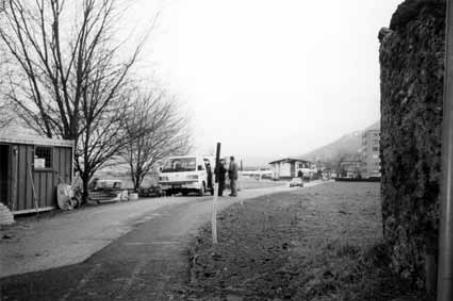
Figure 6.4; Survey of subdivision caused by road improvement just East of Innsbruck
legal aspects
The legal base for most of the system of land tenure is the General Civil Lawbook (1811). The real rights listed in it are possession, ownership (both single and joint), easements (both personal and real types) and lease (which can be registered and then gets real right characteristics). It includes also the mortgage and preemption rights. Other legislation allows for long lease (Baurecht) and condominium (Wohnungseigentum).
The legal base for the system of land registration is made up of several laws. For the land book there is a law on its creation (1929), a law on its keeping (1955) and a law on its migration to the computer (1980). For the cadastre there is the Subdivision Law (1929) and the Survey Law (1968). Transfer of a real right consists of two phases. The first phase deals with the transaction as such (‘title’), the second phase with the publicly visible activity (‘means of acquiring’). The latter includes the application for registration of a notarized deed at the land book court. When the land book judge has approved the application, the land book will be updated and the legal transfer takes place retrospectively to the moment the application was filed. The ‘booking principle’ (see § 2.3.1) plays an important role in the Austrian system.
Transactions in which a parcel has to be changed or formed, have to be processed in the cadastre first, before the land book can be updated. The subdivision will usually be carried out by a licensed surveyor, and entered (provisionally) into the cadastre (map and register) by the survey department. After this the application can be made at the land book court, and if the transactions is accepted there, all data will be updated and final.
CASE STUDY RESULTS |
155 |
The causal doctrine is applied in Austria, which means that problems in the ‘title’ are not repaired by the entry in the land book, although bona fide third parties can rely on the land book.
The legislation on privacy does not apply to the system of land registration. Although all information in it is public, the search by name is not generally available (this was introduced with the computerization).
organizational aspects
In the case of 1996 Austria land registration involves the land book courts, the survey departments, notaries (and other lawyers) and licensed surveyors. The Federal Computer Centre plays an important supportive role.
The land book courts keep and maintain the land registry, including controlling the deeds offered. Legally the notary’s role is limited to certifying the signatures on the deeds, but often he or she or another lawyer will assist in drafting it as well. The survey departments keep and maintain the cadastral map and register. Cadastral surveys, mainly subdivisions, are mostly done by licensed surveyors (some by governmental surveyors). Both the land book and the cadastral register are computerized and kept in one database, which is connected to all relevant offices. This network and the database are supported by the (recently privatized) Federal Computer Centre.
The separation between registrar and cadastre is very strict in a legal and organizational sense (different laws and ministerial responsibilities). In practice they cooperate very well, and in a technical and administrative sense it can be seen as an integrated system of land registration.
The daily practice seems to be much in tune with the ‘law in books’. Even when one considers some provisions quite bureaucratic, the benefits of using the system surely outweigh the time and money involved in most cases. An occasional exception have been reported for unregistered leases of rural land in some areas, and the use of the notregistered right to have a (temporary) construction on someone’s land (called Superädifikate) instead of the complex real right of long lease (Baurecht). All in all a near perfect system for a well organized society where there is good cooperation between different parts of the administration.
6.3.3 Developments
Just after the case study in 1996, the Federal Office of Metrology and Surveying was reorganized and the number of survey departments reduced by 35%. In 1997 changes were made in the legislation to allow for improved on-line access to the land parcel database (including abolishment of subscription fee and a motivated reason for getting access).
156 SYSTEMS OF LAND REGISTRATION
6.3.4 Task Table
|
done |
who |
mandatory |
legal effect |
consequence |
indemnified |
|
|
|
|
|
of mistake |
|
|
|
|
|
|
|
|
nego- |
yes |
s,p, (r) |
yes |
legal base for |
no transfer, but |
usually |
tiating |
|
|
|
transfer |
3rd parties |
|
|
|
|
|
|
protected |
|
advis- |
usua |
lawyer, |
no |
liability for |
no transfer, but |
yes |
ing |
lly |
notary |
|
expert |
3rd parties |
|
|
|
|
|
|
protected |
|
legal- |
yes |
notary |
yes |
prerequisite |
no transfer, but |
yes |
izing |
|
|
|
for registration |
3rd parties |
|
|
|
|
|
|
protected |
|
surve- |
yes |
Licensed |
before |
prerequisite |
no transfer, but |
yes |
ying |
|
Surveyor |
subdivision |
for registration |
3rd parties |
|
|
|
|
|
|
protected |
|
map- |
yes |
Licensed |
before |
prerequisite |
no transfer, but |
yes |
ping |
|
Surveyor |
subdivision |
for registration |
3rd parties |
|
|
|
|
|
|
protected |
|
index- |
yes |
Survey |
yes |
prerequisite |
no transfer, but |
yes |
ing |
|
Departm |
|
for registration |
3rd parties |
|
|
|
ent |
|
|
protected |
|
map- |
yes |
Survey |
yes,esp for |
liability for |
boundary |
yes |
ping |
|
Departm |
boundary |
state for |
cadastre is |
|
|
|
ent |
cadastre |
bound. cad. |
guaranteed |
|
check- |
yes |
Land |
yes |
transfer on |
still transferred, |
yes |
ing |
|
Book |
|
moment of |
but 3rd parties |
|
|
|
Court |
|
acceptance |
protected |
|
stor- |
yes |
Land |
yes |
no direct effect |
no direct effect |
yes |
ing |
|
Book |
|
|
|
|
|
|
Court |
|
|
|
|
index- |
yes |
Survey |
yes, but for |
no direct effect |
no direct effect |
yes |
ing |
|
Departm |
mainly for |
|
|
|
|
|
ent |
taxes |
|
|
|
regis- |
yes |
Land |
yes |
introduces |
still transferred, |
yes |
tering |
|
Book |
|
‘public faith’ |
but 3rd parties |
|
|
|
Court |
|
|
protected |
|
issu- |
yes |
Land |
yes, copy |
no direct effect |
no direct effect |
yes |
ing |
|
Book |
of decision |
|
|
|
|
|
Court |
|
|
|
|
Figure 6.5; Tasks and questions of the Austrian system of land registration

CASE STUDY RESULTS |
157 |
6.3.5 Concluding Summary
It can be said that in Austria an effective land market has operated for a long time. This land market is supported by a well run, but elaborate system of land registration. There is a large group of players, including the land registry courts, the survey department, notaries and attorneys and licensed surveyors. In the more recent history these players have been able to supplement each other without many problems. New technology has been implemented energetically80 by both the land registry courts and the survey departments. A very good step was set by combining all land related data from those two organizations in one database, which is accessible by all players. Before this, much of the information was kept in duplicate at both organizations and in the 1970s complaints about the chaos at the land registries was heard. (Hofmeister/Auer 1992: 98). The use of information technology in the field of land related data has offered Austria an appropriate solution in a timely fashion (BEV 1993: 50).
Without any doubt the system is supplying good security of title to land (real estate) to the Austrian society. But the ‘price’ they have to pay for this seems quite high (similar Hofmeister/Auer 1992: 79-80).
The high registration fee (1 - 1.1%) is usually supplemented by the fees of the private practitioners (notary, attorney, surveyor), and a stamp duty has to be paid for any form sent towards a governmental agency.
In addition to the money that has to be paid, the system also appears to be bureaucratic and not quick. To be able to make an application to have a transfer registered, one needs four to six documents. Each of which needs some input from a governmental organization (at national and/or provincial level). It takes a lot of time to get all these documents, and stamp duties and/or fees have to be paid. And depending on the workload of the staff within the local land registry court, the time between application and actual registration can vary between a few days and several months.
It is not desirable that such differences exist between regions. This is only one example of the effect of the large number of offices throughout the country. Although Austria is larger in size and traveling is much more difficult because of the topography, the difference in the number of offices as compared to for instance the 15 offices found in the Netherlands is astonishing. There were 68 survey departments in 1996, whereas there were 187 land registry courts, following the organization of the district courts. Most of the offices have a limited work load and a small staff. This makes them very vulnerable for absenteeism of staff (illness and holidays) and sudden peaks in the workload. In addition, it is less efficient to introduce all kinds of computer applications in smaller offices. The system seems to be over-decentralized! It was reported that there are land registries with only 100 entries a year.
The combination of many offices, high transfer costs and long processing times is likely to hinder the land market of growing to its full potential, even though the system supplies a high level of security with regard to the transactions that do occur.
Such a system will create evasive action by some parties in the land market. An example of this, in a legal way, can be seen with the Superädifikate, which are used in almost all cases of constructing a building on the land of someone else. This construction is only meant for buildings which are erected with the intention to be there only for a (relatively) short period of time. For ‘everlasting’ buildings one should use the Baurecht, which is
80 In 1993 the responsible minister called this ‘a notable innovation thrust’ (BEV 1993: 5).